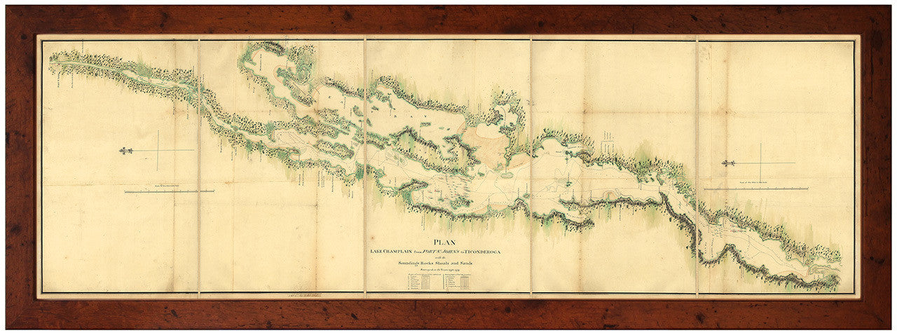
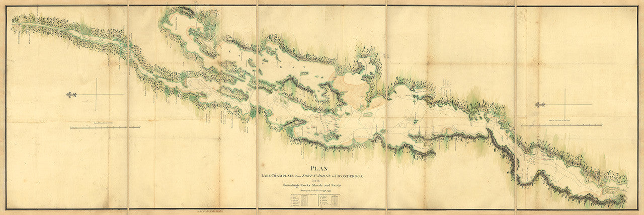
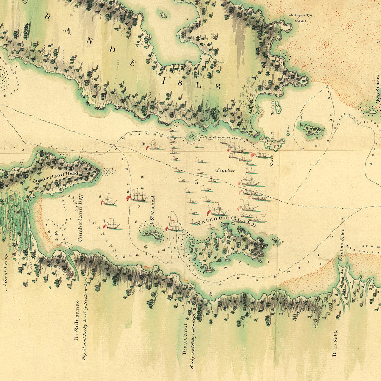
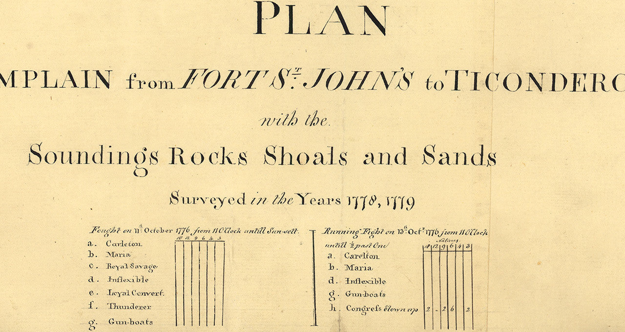
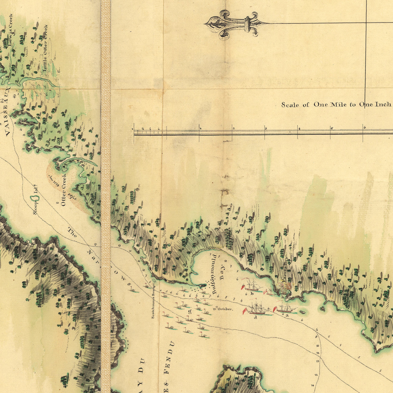

Revolutionary War map of Lake Champlain, New York in 1776, spanning from Fort Saint-Jean (Fort St. John’s) in Quebec, to Ticonderoga in New York. The plan depicts the Battle of Valcour Island on October 11, 1776, and a running fight at Button-Mold Bay (present day Button Bay), October 13, 1776. The original plan, showing positions of ships and troops, was a very detailed, large-scale 6-feet long manuscript, surveyed in 1778 and 1779. This is a scaled-down version, approximately half the size of the original. Title: Plan, Lake Champlain from Fort St. John’s to Ticonderoga, with the Soundings, Rocks, Shoals and Sands, Surveyed in the Years 1778, 1779; Legend: “Fought on 11th October 1776 from 11 O’Clock untill Sun-sett…; Running Fight on 13th Oct.r 1776 from 11 O’Clock untill 1/2 past One…” (This map is available unframed as a separate item in our collection.)
• Plan of Lake Champlain, New York, with the Battle of Valcour Island in 1776 (surveyed in 1778 and 1779)
• Premium Giclée Print (Ultra Premium Presentation Enhanced Matte Paper)
• Frame: distressed walnut wood 1.25” MDF (smooth wood grain finish)
• Custom-framed, clear facing, backing, wires, ready to hang
• Made in USA