
“The raising of that flag on Suribachi means a Marine Corps for the next five hundred years.” ~ James Forrestal, Secretary of the Navy, 23 February, 1945
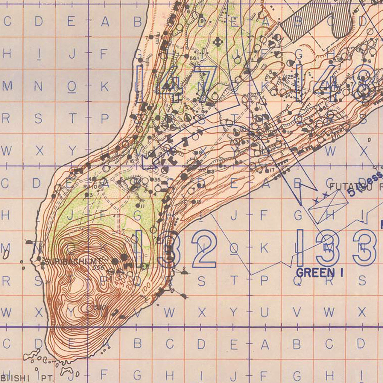
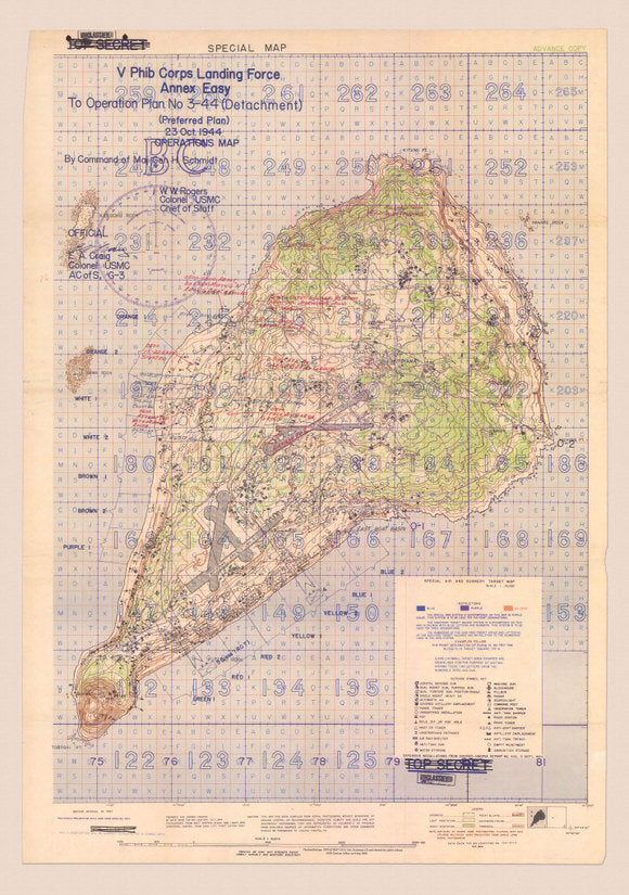
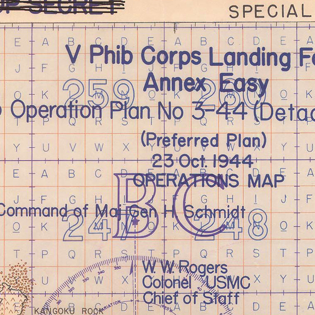
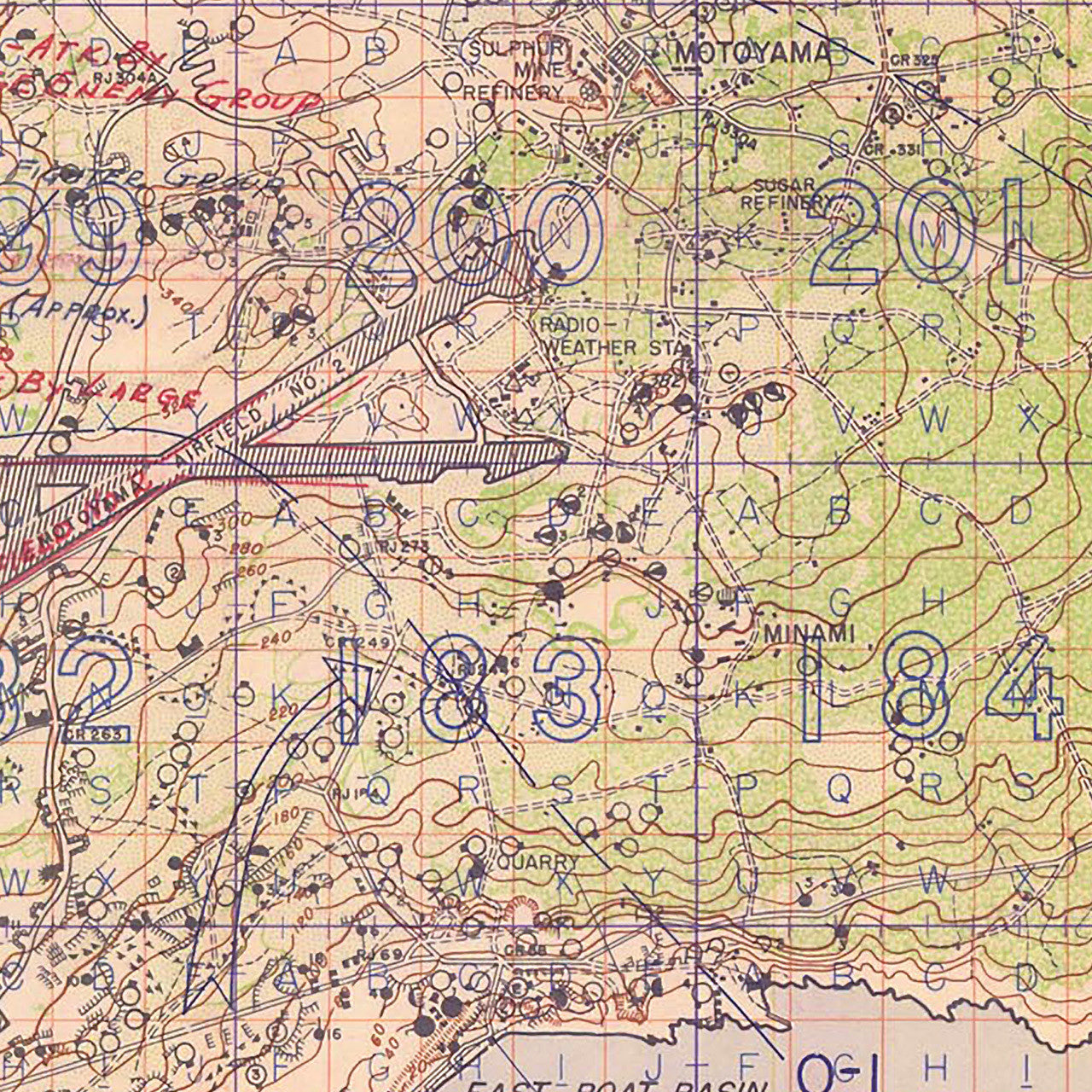
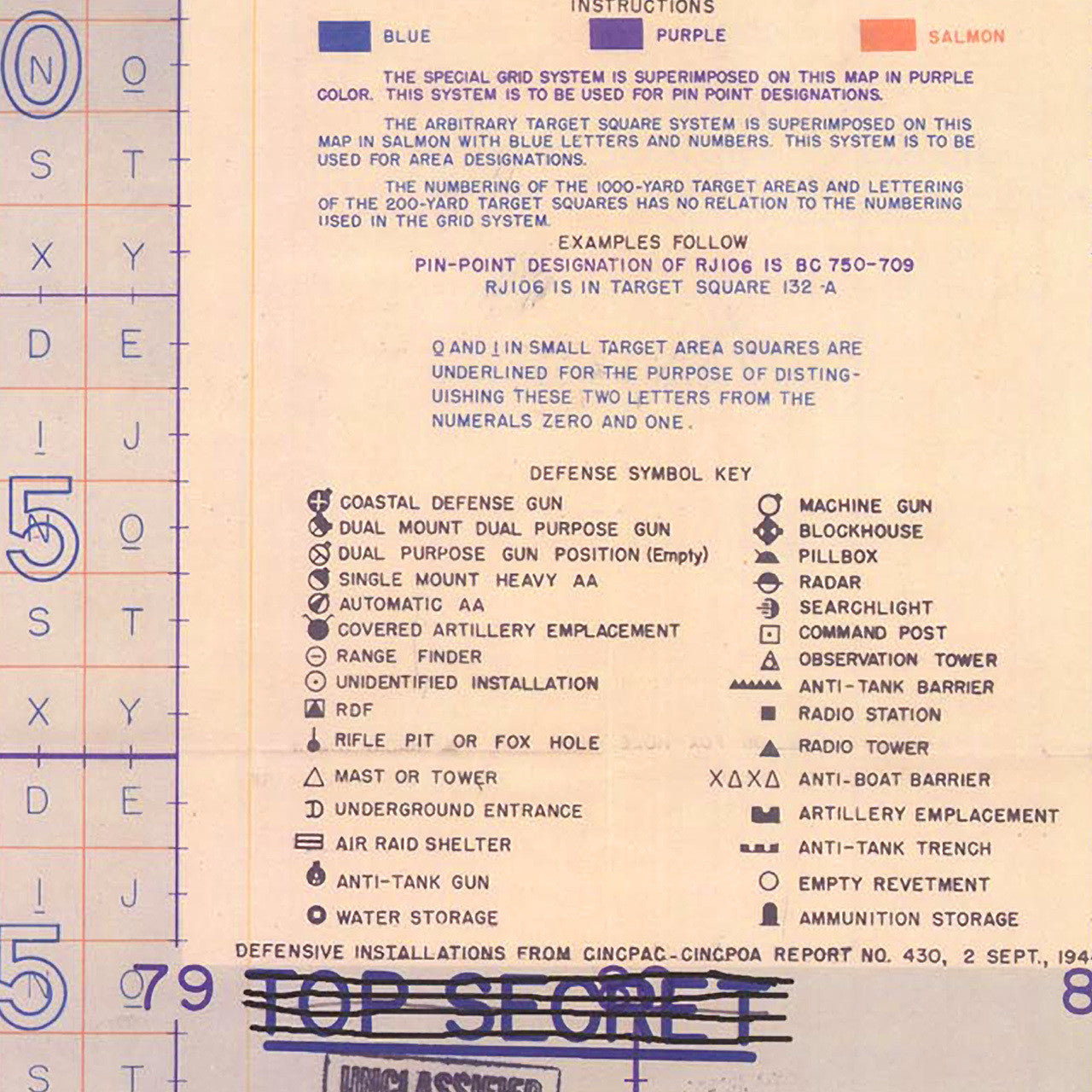
Contour map of Iwo Jima, showing Japanese defense installations on the island. The original chart was a Special Air and Gunnery Target map prepared by Joint Intelligence Center, Pacific Ocean Area, from aerial photographs taken by the U.S. Navy on 15 October, 1944. It had later added USMC operational specifics and annotations of Japanese attacks from the battle (19 February — 26 March, 1945).
• WWII Operations Map of Iwo Jima, prepared in 1944, with annotations from the battle in 1945
• Premium Giclée Print (Ultra Premium Presentation Enhanced Matte Paper)
• Made in USA