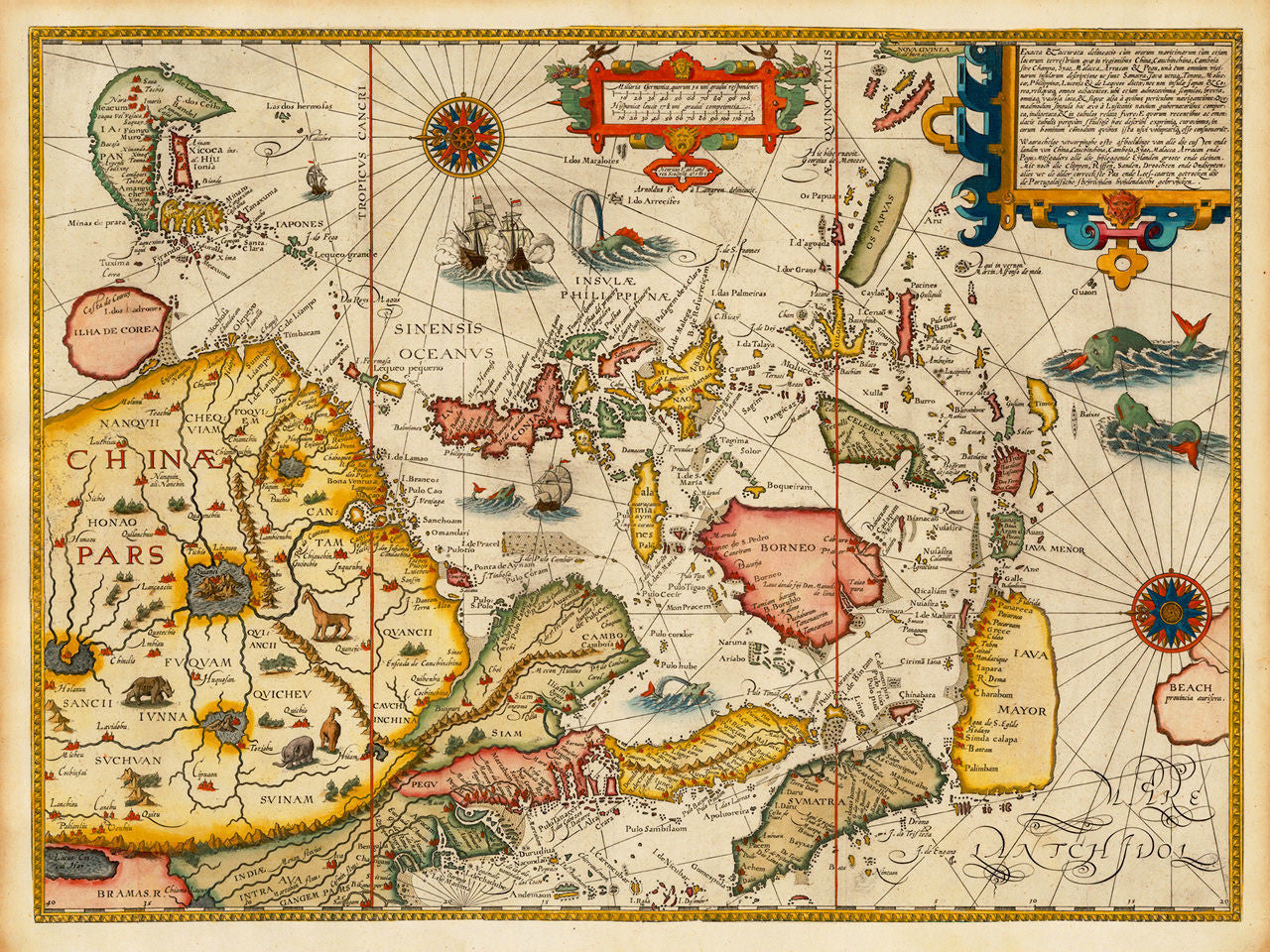

A sixteenth-century map of Southeast Asia depicting China, Korea, Japan, Malay Peninsula, Indochina Peninsula with Siam, Cambodia and Pegu, the Philippine islands, the Celebes, Papua, Nova Gvinea (New Guinea), Borneo, Java, Bali, Sumatra, and the fabled kingdom of Beach at the northernmost part of Terra Australis. The map, based on Portugese sources, is oriented with east at the top. It was created by Jan Huyghen van Linschoten and published by Cornelis Claesz in Amsterdam in 1596. Linschoten’s map is known as the first non-Portuguese European map of the region. While working as a personal secretary to the Portuguese Archbishop of Goa, Portuguese India, Linschoten — himself Dutch — obtained numerous maps and documents from secret Portuguese sources. After his return to Europe, he published the maps and so helped the Dutch and the English discover the trade routes to Asia, which broke a century-long Portuguese trade monopoly with the East.
• 16th-century map of Southeast Asia, showing China, Japan, Korea, Indonesia, Malaysia, the Philippines, etc.
• Title: Exacta & accurata delineatio cum orarum maritimarum…, 1596, Jan Huyghen van Linschoten
• Fine Art Premium Giclée (Gouttelette) Print (100% cotton 340 gsm fine art paper)
• Made in USA