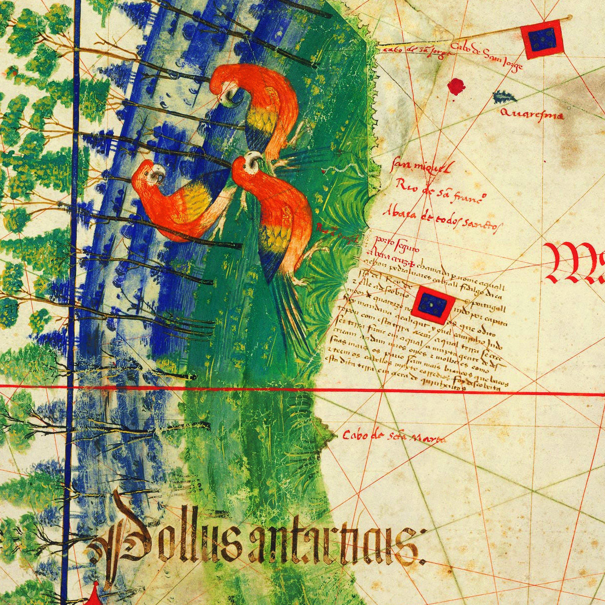
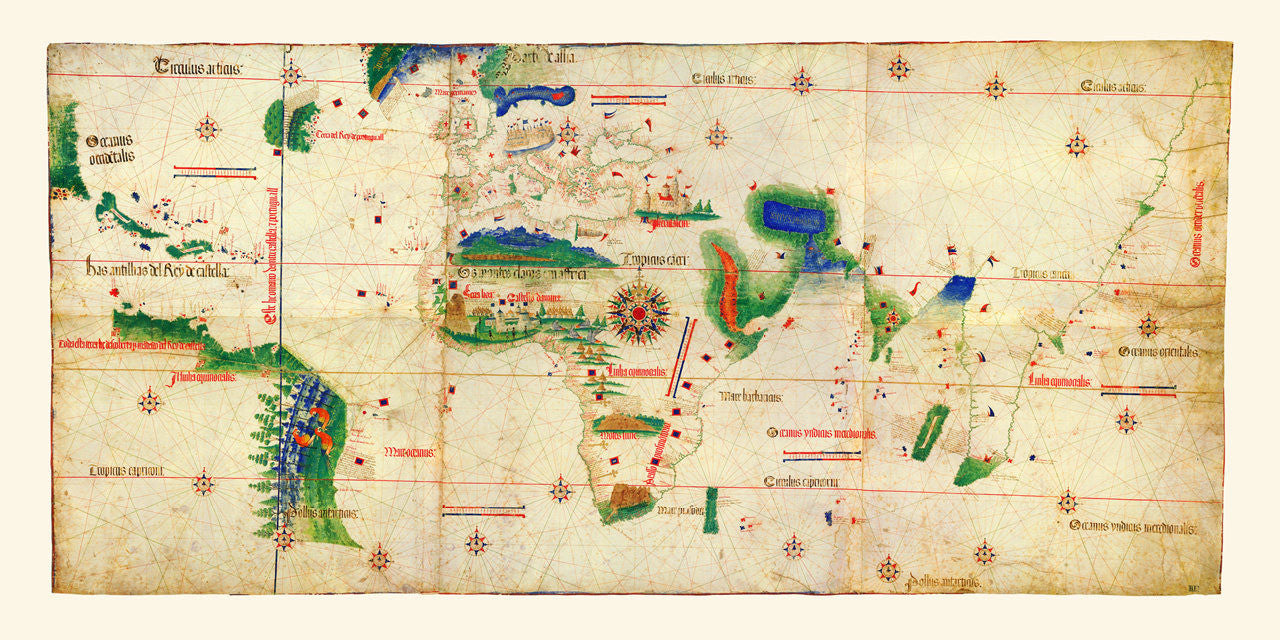
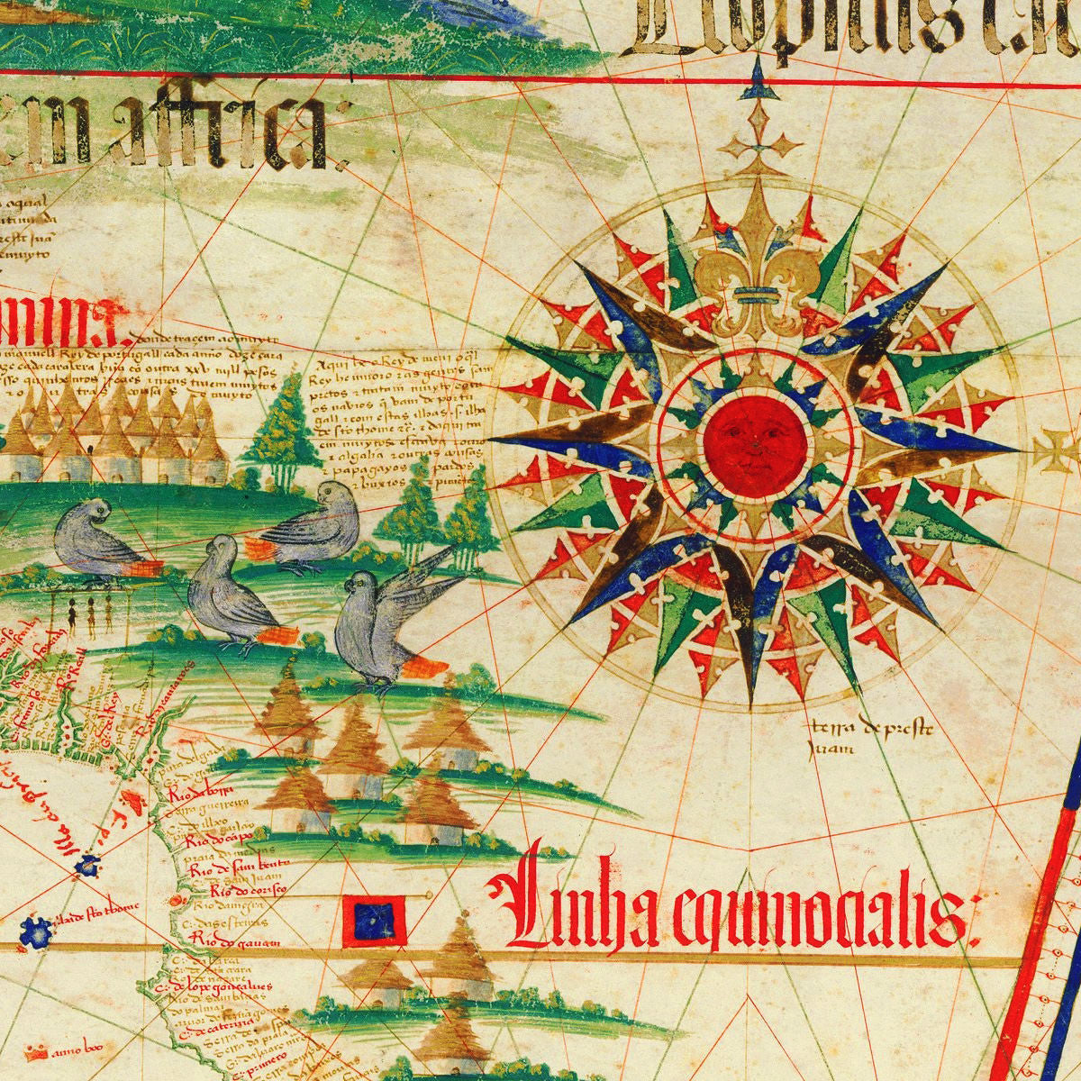
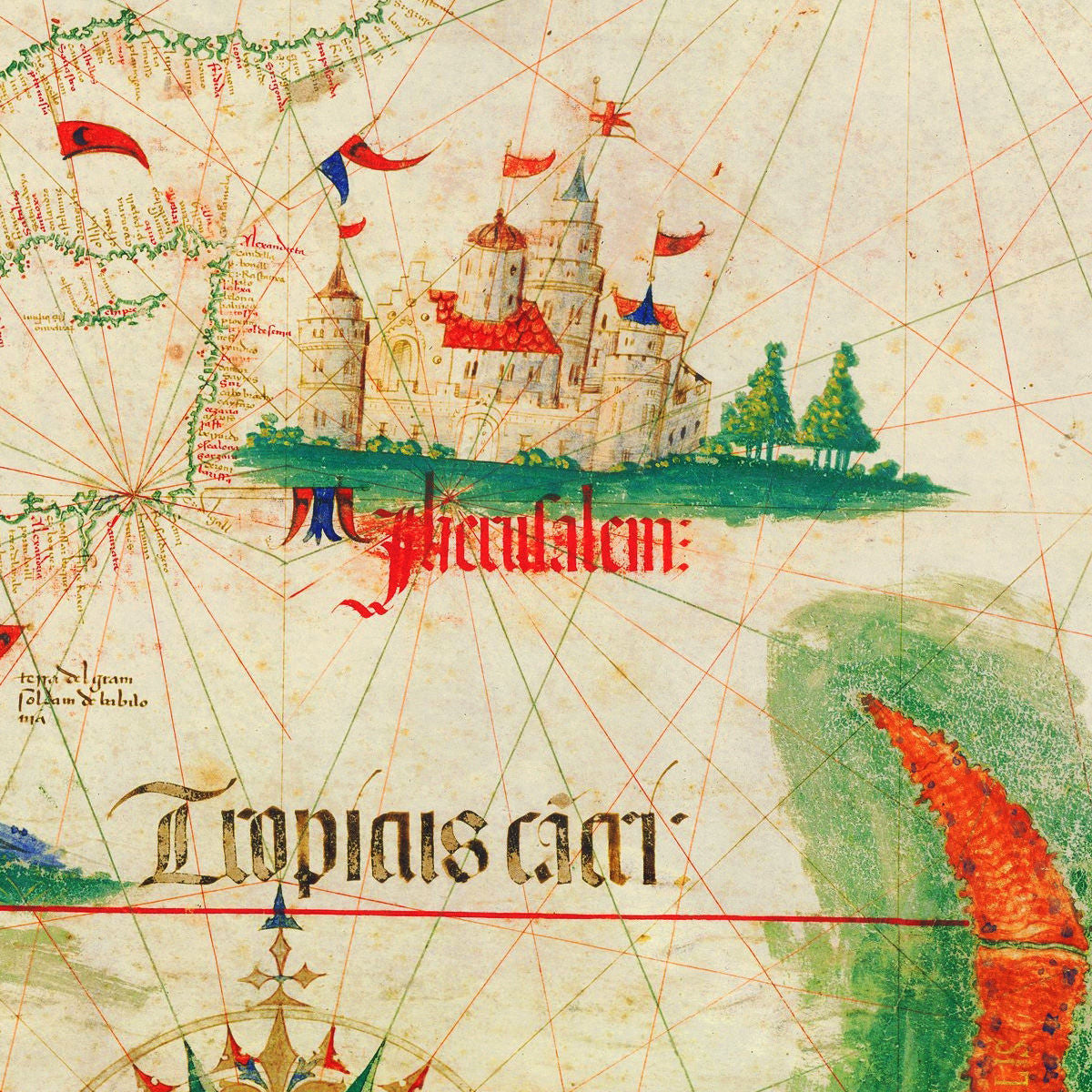
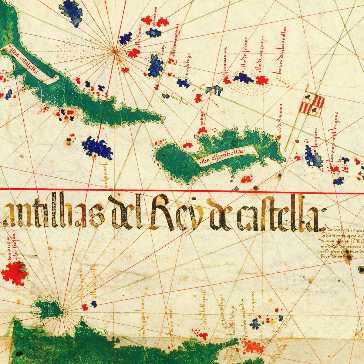

The Cantino Planisphere is one of the most significant surviving cartographic documents. Created by an anonymous Portuguese mapmaker, it depicts the world as only known to the Portuguese at the time. The large manuscript map contained the latest Portuguese discoveries around the world — the Brazilian coast of South America, explorations of the northern parts of South America and the North American coast from Florida to New York, a detailed account of the Indian Ocean, and a remarkably accurate coastline of all of Africa. All that was strategic information which was privileged and highly restricted at the time. The manuscript also features the Tordesillas Meridian — a demarkation line from the 1494 Treaty of Tordesillas, according to which Pope Alexander VI (Rodrigo Borgia), divided all the non-Christian world between the crowns of Castile and Portugal. The Cantino Planisphere was named after Alberto Cantino, an Italian spy employed by the Duke of Ferrara, who in 1502 managed to smuggle this extraordinarily valuable map from Portugal into Italy. Today the original manuscript is on display at the Biblioteca Estense Universitaria in Modena, Italy. (This item is also available framed in our collection.)
• Cantino Planisphere, a 1502 manuscript map depicting the world as known to the Europeans
• Fine Art Premium Giclée (Gouttelette) Print (100% cotton 340 gsm fine art paper)
• (I) Size Print: 48” x 24” / 122 cm x 61 cm | (I) Size Map: 44.5” x 20.8” / 113 cm x 53 cm
• (II) Size Print: 36” x 18” / 92 cm 46 cm | (II) Size Map: 33.5” x 15.7” / 85.25 cm x 40 cm
• (III) Size Print: 24” x 12” / 61 cm x 30.5 cm | (III) Size Map: 22.4” x 10.5” / 57 cm x 27 cm