Utah, 1846-1847, Route of the Mormon Pioneers, Panoramic Pictorial Map (II)
Brand: Battlemaps.us
 "Pin It")
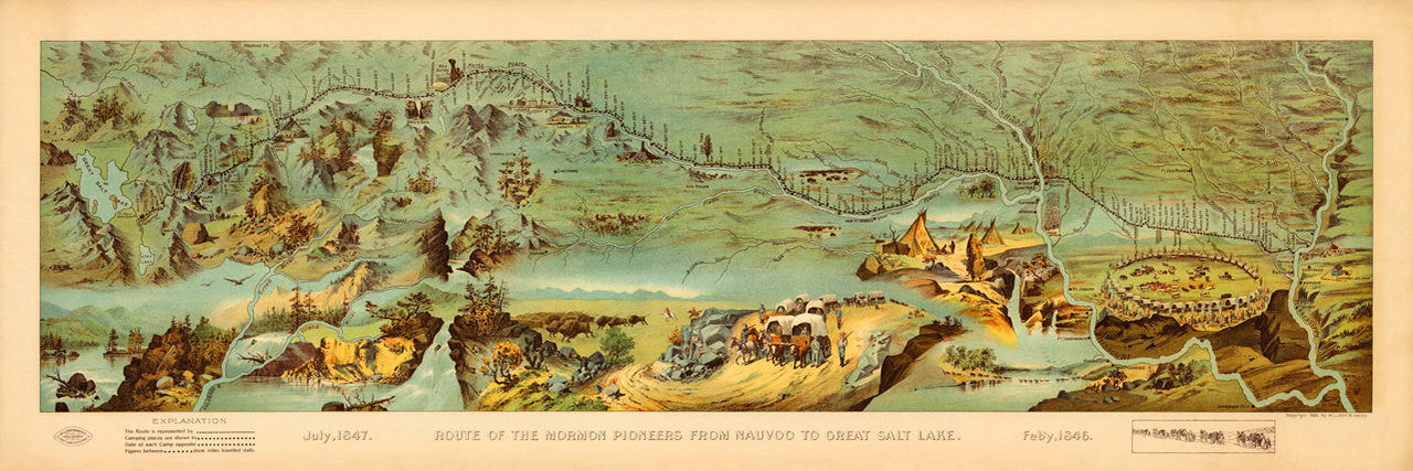
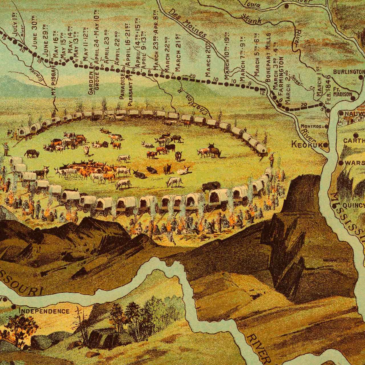
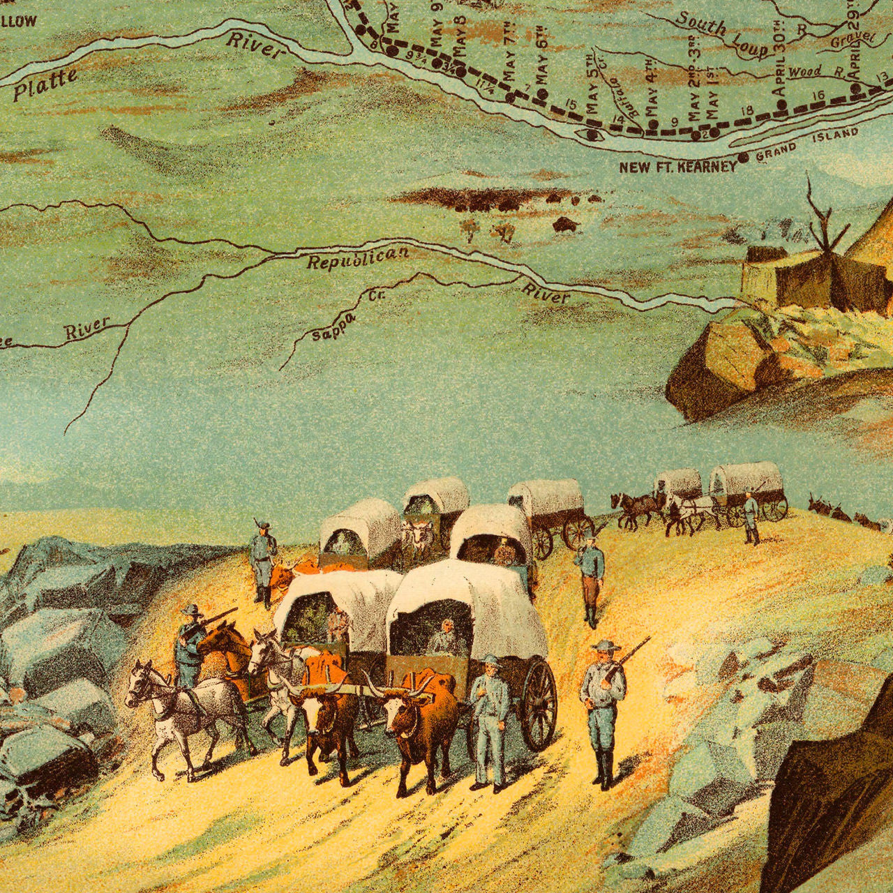
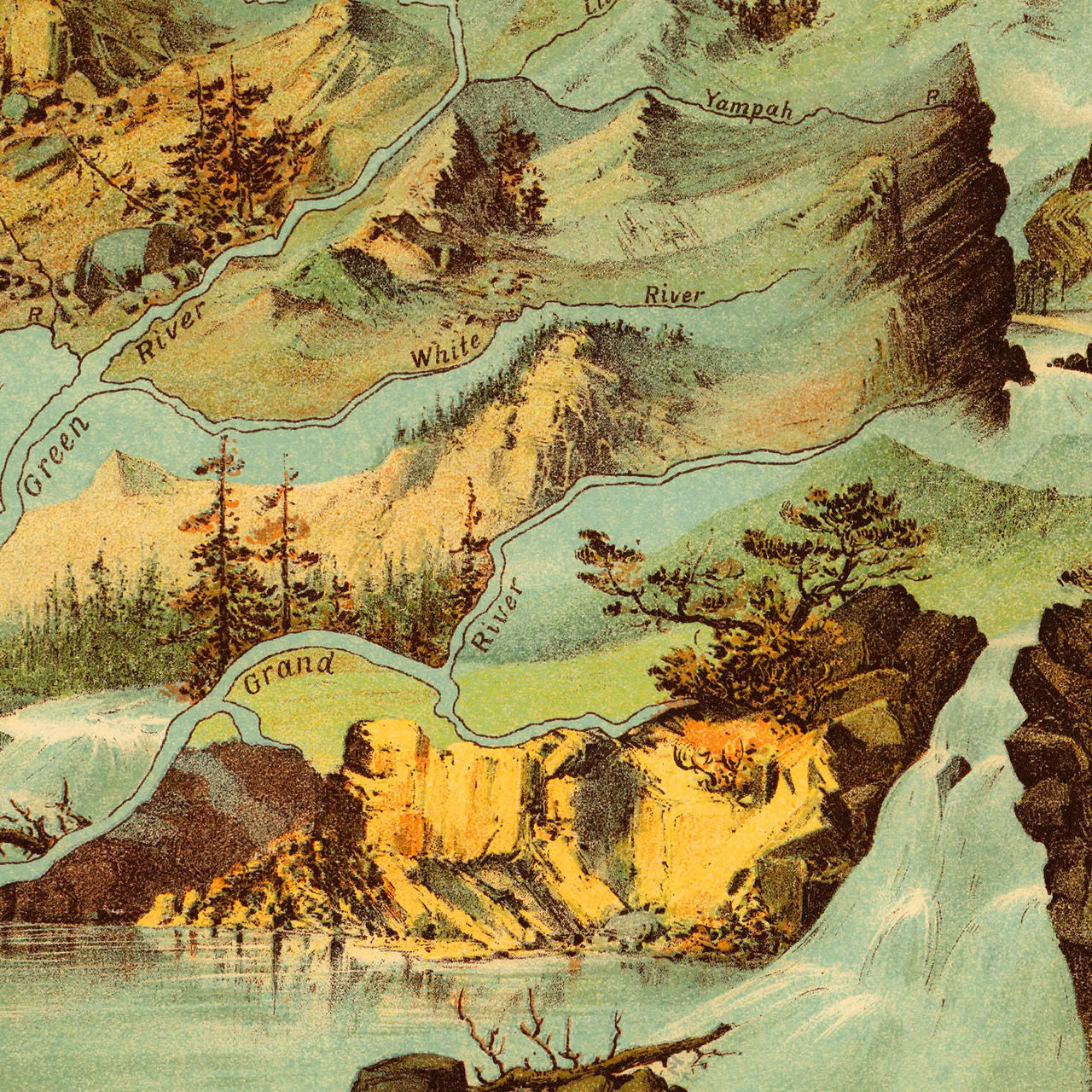
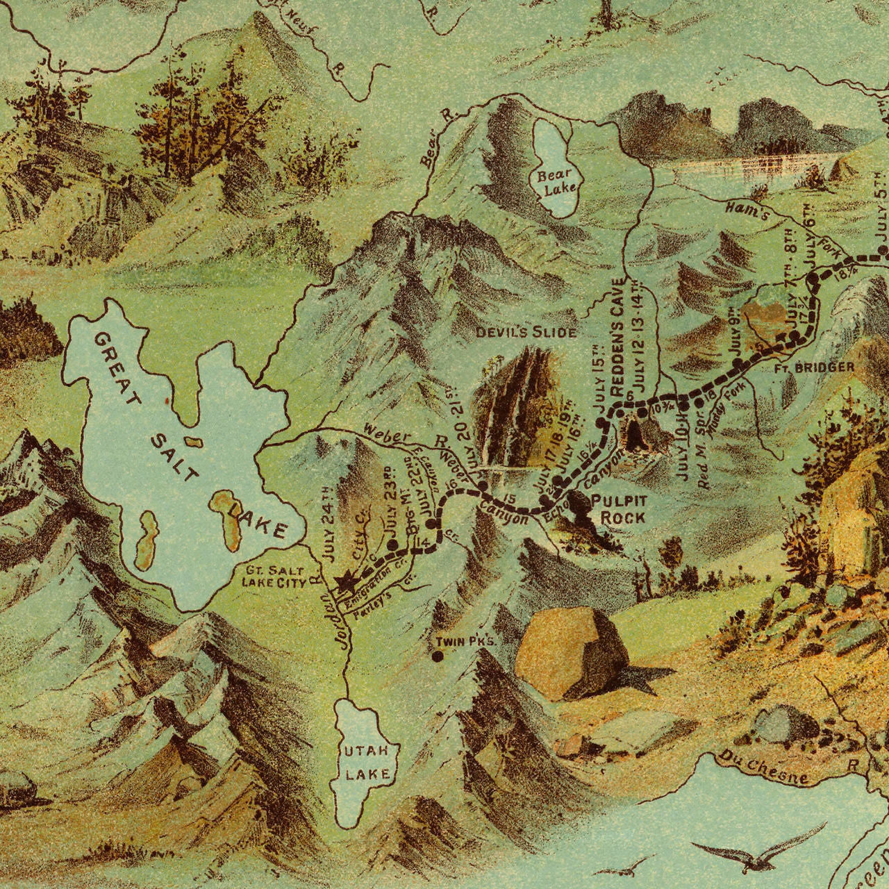
The Mormon Pioneer Trail A striking pictorial map, depicting the historical journey of the Mormon Pioneers in 1846–1847, from Nauvoo, Illinois, to the Salt Lake Valley in Mexico (present-day Utah). The map was based on Orson Pratt’s journal of the trip. Led by Brigham Young, the Saints had traveled in a wagon train, on horseback, and on foot for 18 months, to escape violence and religious persecution in the East. Today the 1,300-mile route is known as the Mormon Pioneer National Historic Trail. The chromolithograph panoramic bird’s-eye view and map was first published in 1899 by Millroy & Hayes to commemorate the 50th anniversary of the momentous event. The full map title in the lower margin reads: Route of the Mormon Pioneers From Nauvoo To Great Salt Lake. Feb’y, 1846. July, 1847. (The original size of the print was 42 in. x 14 in. A different version of the same map is available here.)
• Route of the Mormon Pioneers, 1846–1847, Latter Day Saints, Westward Expansion (II)
• Fine Art Premium Giclée (Gouttelette) Print (100% cotton 340 gsm fine art paper)
• Made in USA