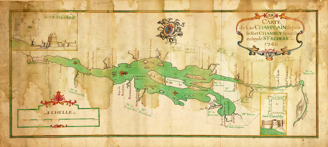

Antique French manuscript map of the Lake Champlain Region circa 1740, from Fort Chambly to Fort Saint-Frédéric (Crown Point, New York), with insets of the two forts. Hand drawn in multicolor ink and watercolor on paper, prior to the French and Indian War (aka Seven Years’ War), the map is oriented with West at the top.
• Colorful old manuscript map of the Lake Champlain region, NY, ca. 1740, watercolor, French & Indian War Era
• Fine Art Premium Giclée (Gouttelette) Print (100% cotton 340 gsm watercolor textured fine art paper)
• Made in USA