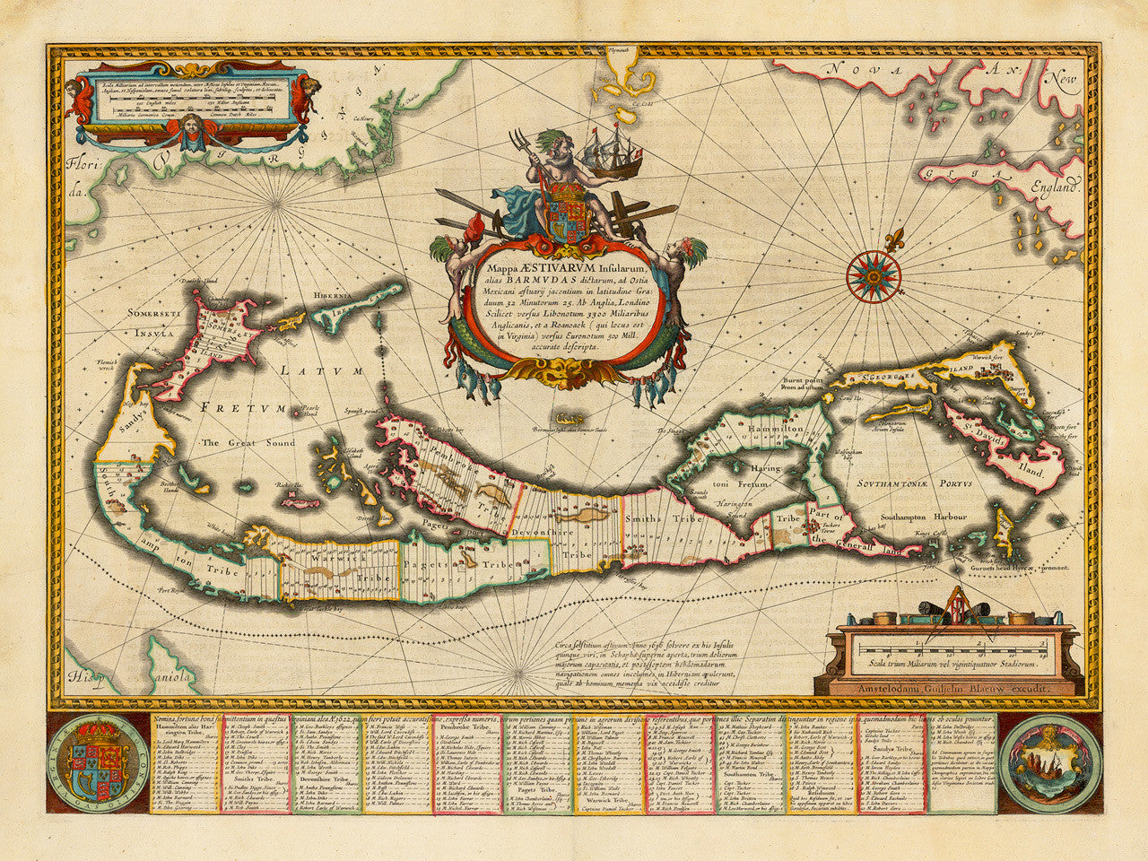

A 17th-century map of Bermuda, entitled, Mappa Aestivarum Insularum Alias Barmudas, created by Willem Blaeu and issued by his sons Joan and Cornelius Blaeu. The map follows the cartography and layout of John Norwood’s survey and of the later John Speed version. Blaeu’s variant of the Bermuda map stands out with a centrally displayed imposing title cartouche of Poseidon, flanked by sea creatures and holding a ship and a trident. The actual map is a cadastral survey with tables of lists of the lot owners on the bottom of the layout.
• Antique map of Bermuda, 1640, Willem Blaeu (Blaeu Publishing House)
• Title: Mappa ÆSTIVARUM Insularum Alias BARMUDAS dictarum…
• Fine Art Premium Giclée (Gouttelette) Print (100% cotton 340 gsm fine art paper)
• Made in USA