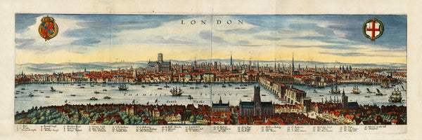
Interesting and expansive view of Jacobean London, showing the City before the Great Fire of 1666. Merian, who first published his map in 1638, was influenced by Visscher’s view of London from 1616, which captured its cityscape exactly 50 years before the Great Fire. The map contains a key with 43 locations, spreading from Whitehall (Whyite hall) to St Katherine’s Church in the east. Old London Bridge is covered with buildings, and its Southwark Gate is adorned with spiked heads of executed criminals. Shakespeare’s theatre The Globe and the Southwark Cathedral St Mary Overie can be seen in Southwark in the foreground, while Old St Paul’s Cathedral is dominating the view across the River Thames.
• Panoramic view of London in the early 1600s, Matthäus Merian der Ältere (Matthew Merian), 1638
• Fine Art Premium Giclée (Gouttelette) Print (100% cotton 340 gsm textured fine art paper)
• Made in USA


