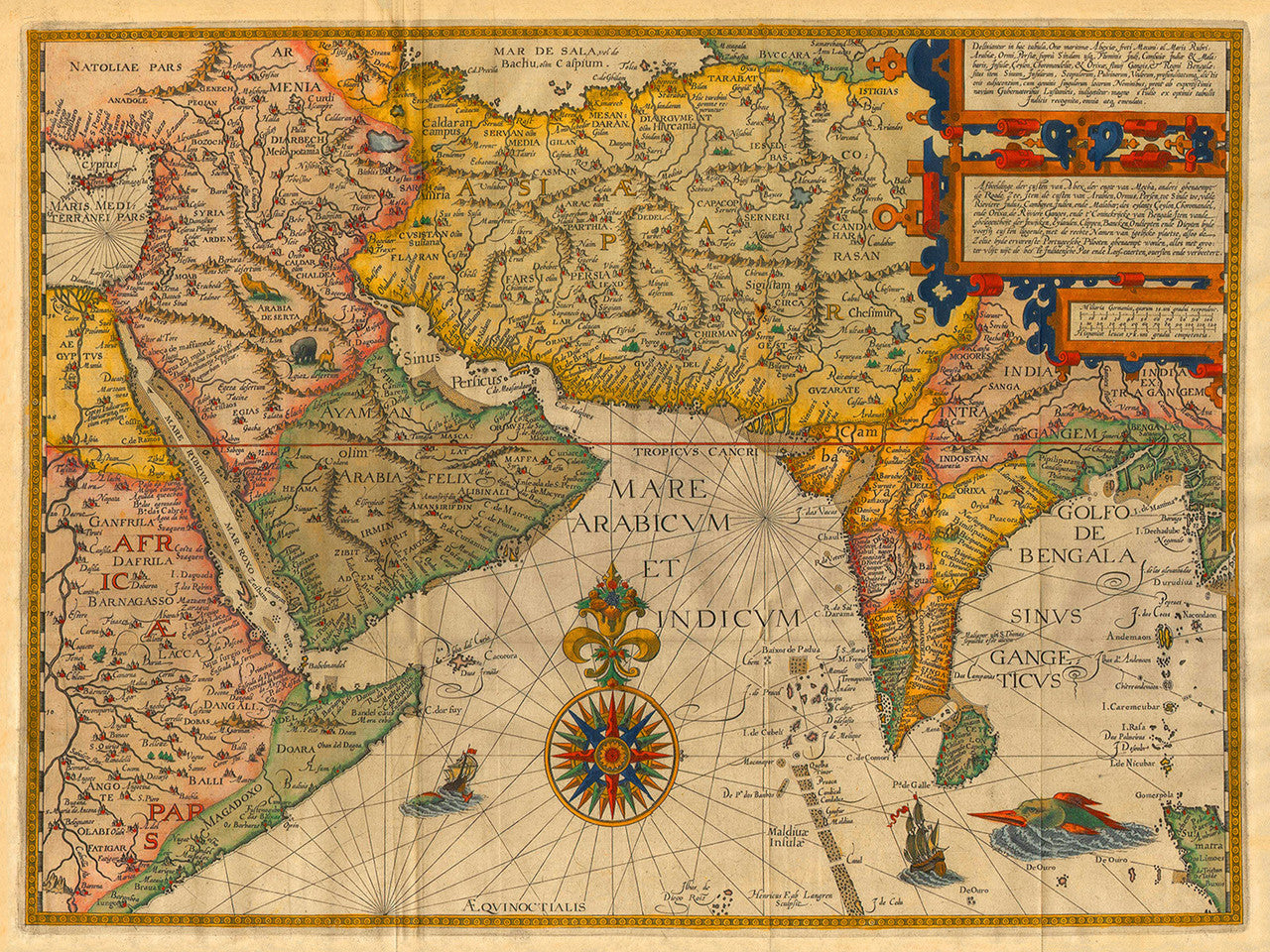

An antique map of the Indian Ocean with parts of Central and Southwest Asia, by the famed Dutch explorer Jan Huyghen van Linschoten. Deriving from 16th-century Portuguese portolan charts and Linschoten’s personal travels to the Indian subcontinent and Southeast Asia, the map was prepared for his book Itenerario. The book had a great historical significance as it contained very valuable and sensitive information. It showed maps and disclosed routes and passages to the East, known only to the Portuguese. Upon its release, the book effectively ended the Portuguese monopoly on Asian trade in Europe. Itinerario was first published in 1596 in Amsterdam by Cornelis Claesz.
The present map Deliniantur in hac tabula extends from the Nile basin, the Horn of Africa, the Red Sea, and the Arabian Peninsula in the west, through the Middle East and to the Caspian Sea, Bukhara and Samarkand to the north, and to India, the Bay of Bengal, Burma, and Sumatra in the east. Delhi, Bahrain and Kabul are named, among other locations one can recognize today. The map was engraved for Linschoten by Hendrick Florent Van Langren, (Latin: Henricus Florentius {Floris} Van Langren), of the Van Langren mapmaking dynasty. It is richly decorated with a lavish compass rose, sea monsters and mythical creatures. The bilingual titles (in Latin and Dutch), are placed within a strapwork cartouche — an emblematic element of the finest maps of that period. The strong, vibrant colors may have been chosen to convey the fabled riches of the East.
• Sea chart of the Indian Ocean with parts of Asia, 1596, Itenerario, J. H. Van Linschoten
• Title: Deliniantur in hac tabula, Orae maritimae Abexiae, freti Mecani: al. Maris Rubri: …
• Fine Art Premium Giclée (Gouttelette) Print (100% cotton 340 gsm fine art paper)
• Made in USA