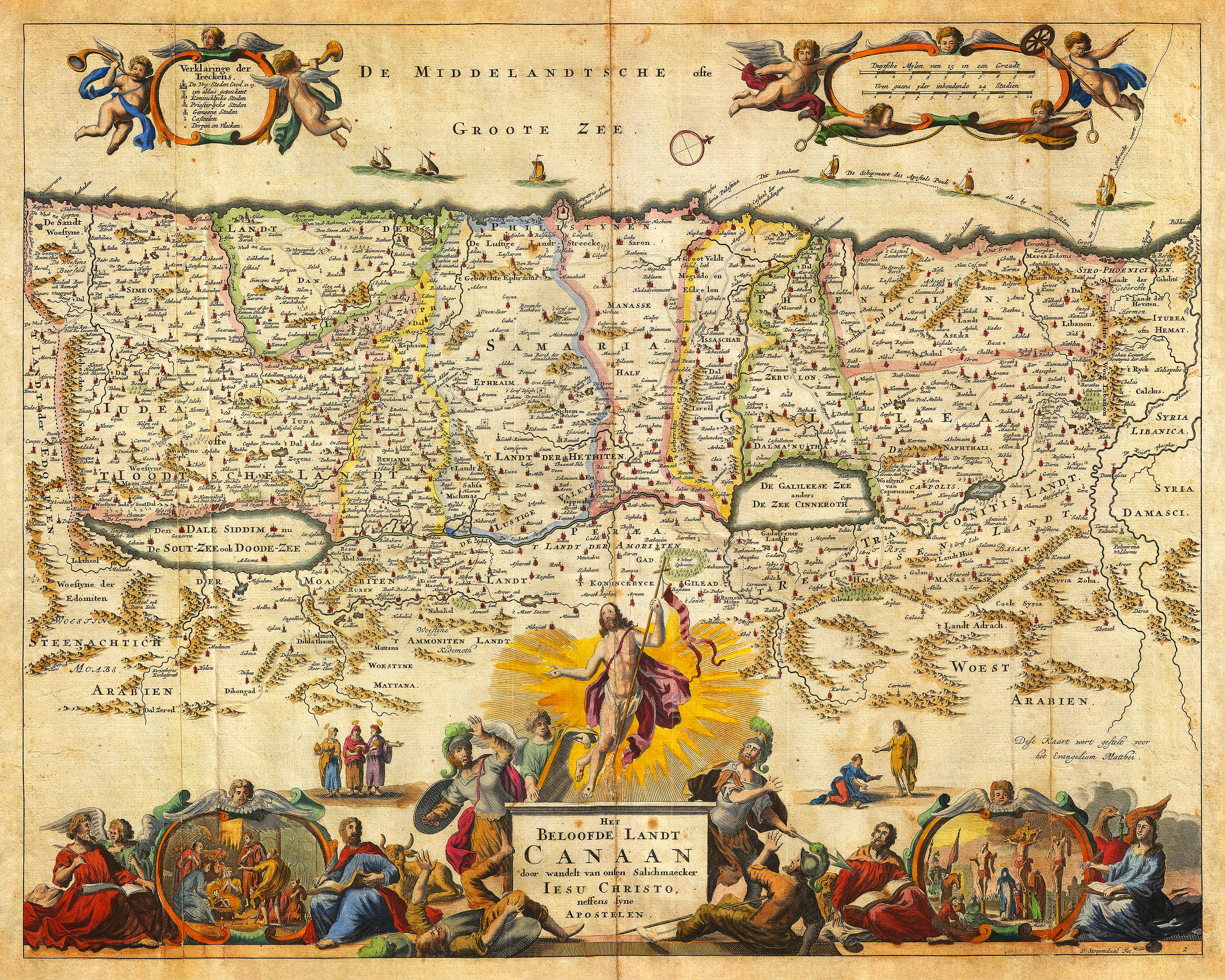

A map of Holy Land, based on the Book of Ezekiel, prepared by Daniel Stoopendaal and published in the Dutch Statenbijbel (State Bible) in late-17th century, with Jesus Rising, and 2 more Biblical vignettes.
• Ancient map of Holy Land with Jesus Rising and Bible Illustrations, D. Stoopendaal
• Fine Art Premium Giclée (Gouttelette) Print (100% cotton 340 gsm fine art paper)
• Made in USA