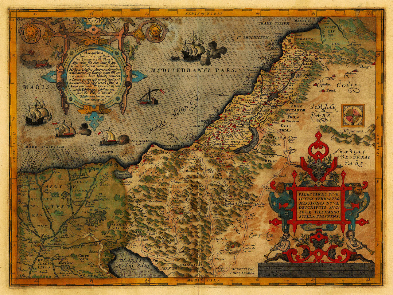

Beautiful antique map of the Holy Land (Promised Land) in ancient times, by Sigenens and Ortelius, published in 1579. The map depicts present-day Israel, Palestine and the Sinai Peninsula in Egypt, as well as part of the Southeast Mediterranean.
• 16th-century map of the Holy Land, as it appeared in antiquity, Abraham Ortelius, 1579
• Title: Palestinae sive Totivs Terrae Promissionis Nova Descriptio
• Fine Art Premium Giclée (Gouttelette) Print (100% cotton 340 gsm fine art paper)
• Made in USA