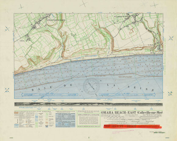

A very interesting map created for the Allied invasion of the continent of Europe on the 6th of June 1944. The map consists of three parts: conventional military contour map, panoramic view of the Normandy shoreline, and map data and legend. The contour map covers the area that planners named “EASY RED” and “FOX GREEN” where the 16th Regiment of the 1st Infantry Division landed.
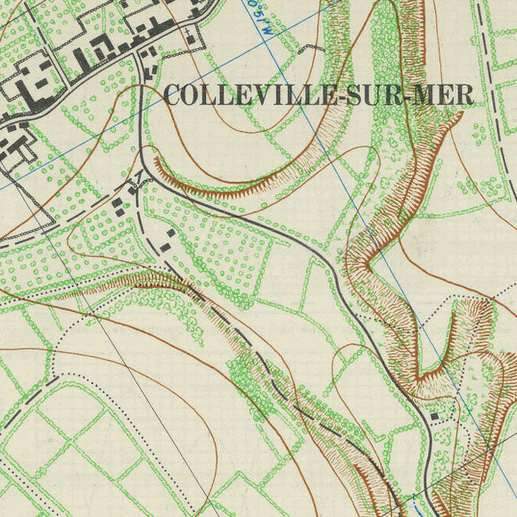
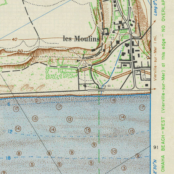
The top section features a map that shows the villages of Colleville-sur-Mer and St. Laurent -sur-Mer and surrounding fields. The 10m contour lines provide the detail needed to examine the bluff and draws that were designated Exit E-3, Exit E-1 and Exit D-3 by Allied planners. Hydrography data is also marked showing soundings and direction of currents.
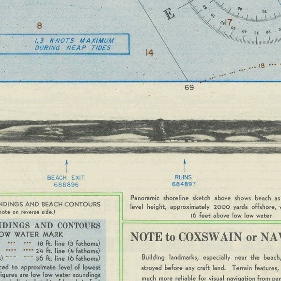
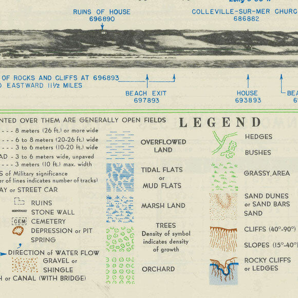
The middle section is a panoramic view of the shoreline as seen from sea level and 2,000 yards out to sea. Landmarks are highlighted to help assault craft crewmen to navigate to their assigned landing areas.
The bottom section provides legend data, notes to coxswains or navigators, scale, and classification of the map.
• WWII Operations Map of Omaha Beach - East, Date of Information was April 21, 1944• Premium Giclée Print (Ultra-Premium Presentation Enhanced Matte Paper)
• Made in USA