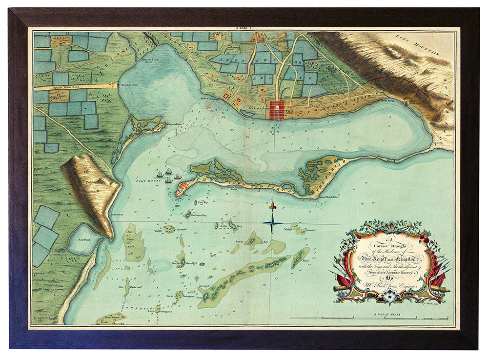
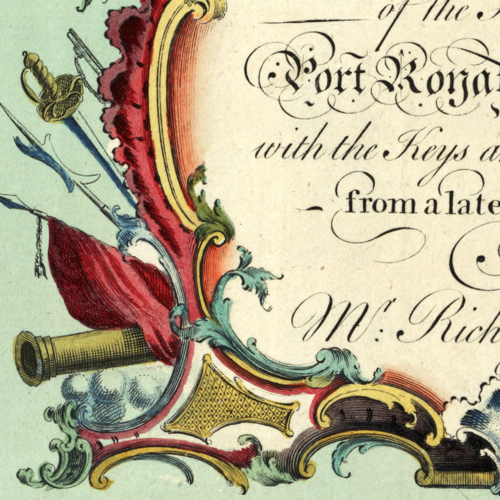
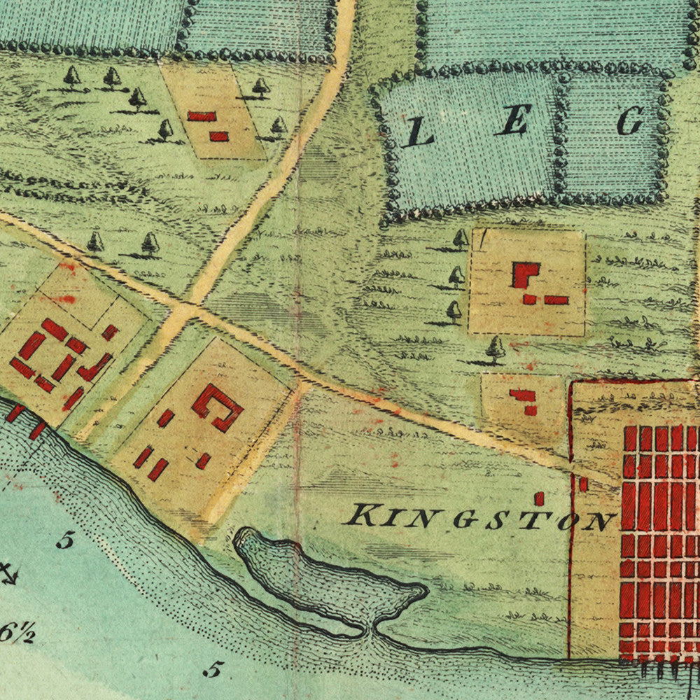
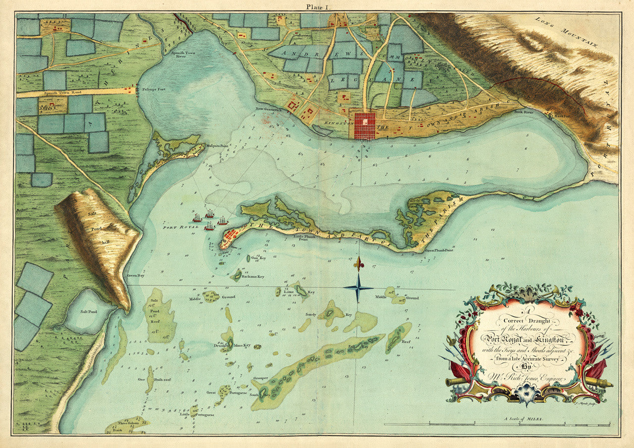

Antique map of Kingston, Jamaica from 1756. Includes historical Port Royal, the Palisadoes, and the Harbour with shoals and soundings at the time. The full title in the ornate cartouche reads: A correct Draught of the Harbours of Port Royal and Kingston, with the Keys and Shoals adjacent &c. from a late Accurate Survey, By Mr. Rich’d Jones, Engineer.
• 1756 chart of Kingston, Port Royal & Harbour in Jamaica, framed
• Custom-framed in a ‘faded black’ wooden frame, facing, backing, wires
• Fine Art Premium Giclée Print
• Made in USA