 "Pin It")
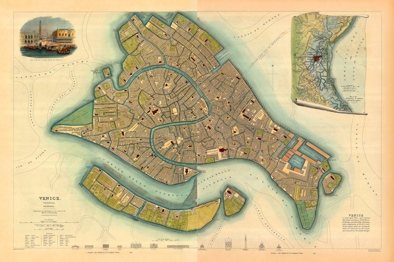
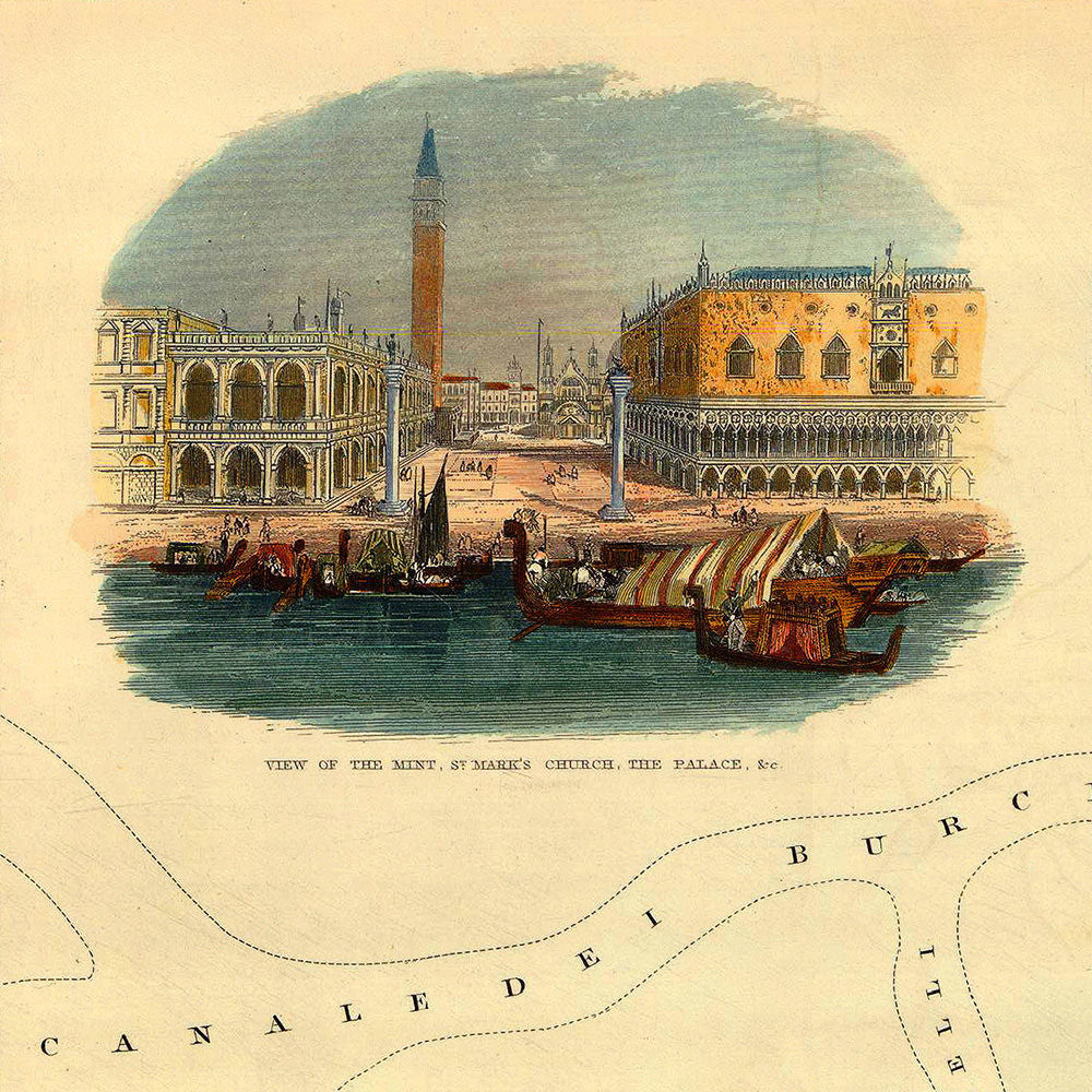
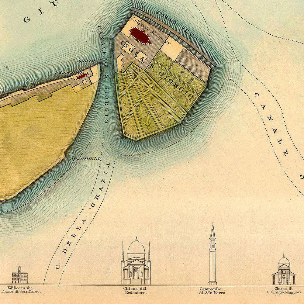
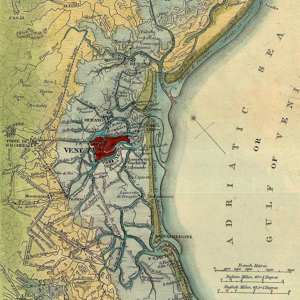
Venice. Venezia. Venedig. A beautiful and detailed 19th-century city plan of Venice with insets — a view of the Piazza San Marco from the Grand Canal, and a map of the Gulf of Venice, entitled: Plan of the Environs of Venice, Shewing the Lagunes. The bottom area of the layout contains little icons, as most city plans by the SDUK, of famous landmarks — Ponte di Rialto, Piazza di Rialto, La Zecca (The Mint), Prigoni (Prison), St. Marco, Palazzio, The Palace (The Doge’s Palace), Piazza di S. Marco, Chiesa del Redentore, Campanile di St. Marco, Chiesa di S. Giorgio Maggiore, Dogana (Customs House), etc. Below the main title is a compact table with explanatory notes. All the streets, canals, bridges, churches, piazzi and other landmarks are richly inscribed onto the map itself. The main map title reads: “Venice. Venezia. Venedig. / Published under the Supeintendence of the Society for the Diffusion of Useful Knowledge”. The original map was published in 1838 (1835) as a large, double-page, steel-plate engraving, which was fully hand-colored — a rarity among all SDUK publications. The plan is very accurate. If it were to be superimposed onto a modern-day plan of Venice, one would clearly see the change and growth of the City of Canals over the past 180 years. (The Venice map pairs well with some other SDUK city plans in our collection — Bordeaux, Liverpool, Munich, Naples.)
• Beautiful 19th-century map of Venice with insets, published in 1838 by SDUK (S.D.U.K.) (I)
• Fine Art Premium Giclée (Gouttelette) Print (100% cotton 340 gsm fine art paper)
• Made in USA