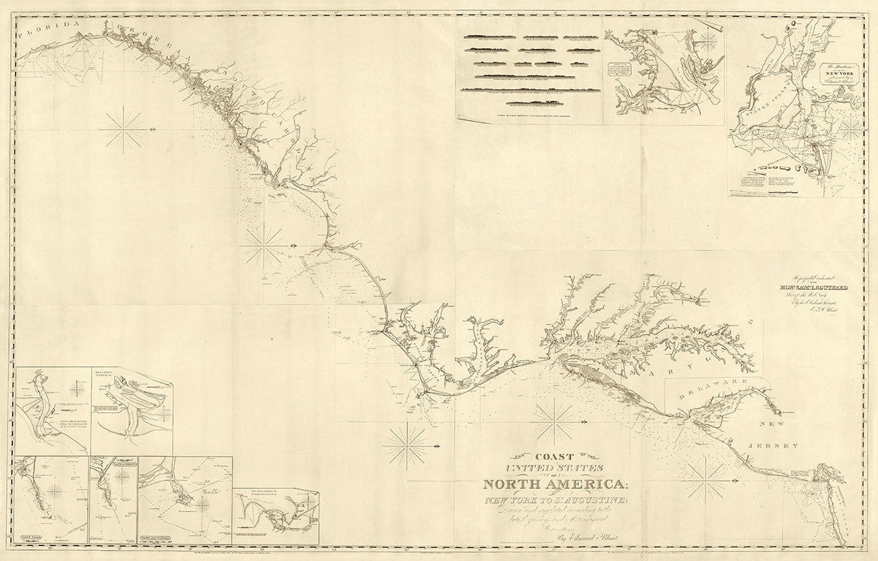
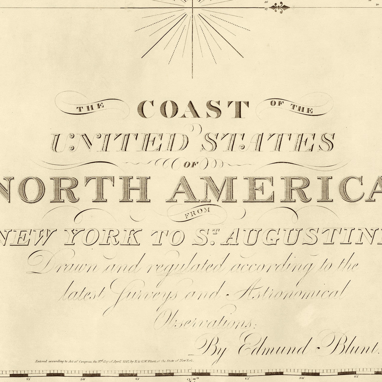
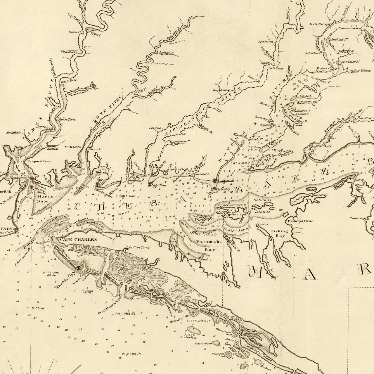
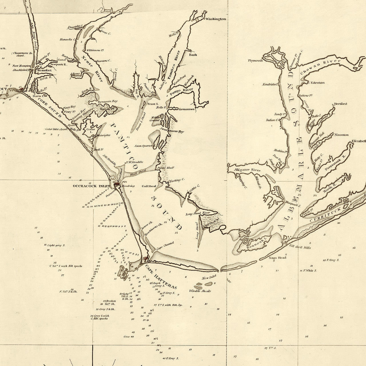
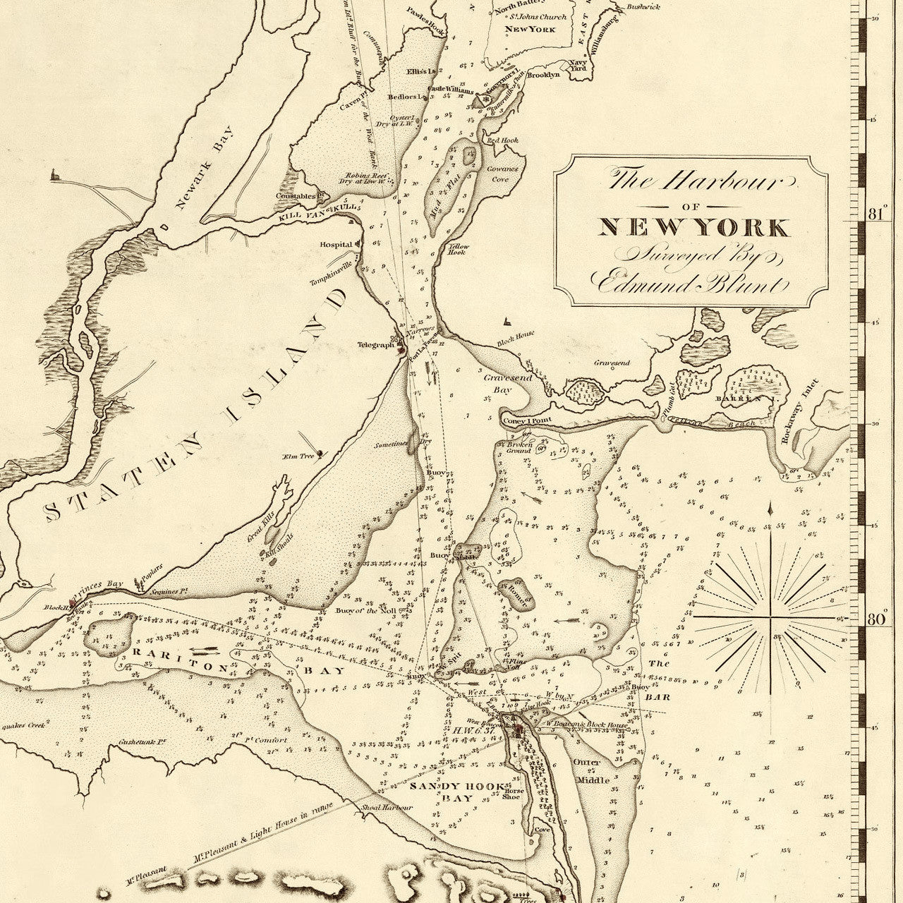

An early 19th-century chart of the Atlantic coast of the United States from New York to St. Augustine, Florida; includes inset maps of New York Harbor, Entrance to Chesapeake Bay, Cape Fear, Cape Lookout, Cape Hatteras, Beaufort Harbor, etc. This extensive and detailed chart was surveyed, drawn and published in 1827 by navigator and hydrographer Edmund Blunt.
• 1827 Nautical chart of the U.S. East Coast from NY to FL, with insets of harbors
• Premium Giclée Print (Ultra Premium Presentation Enhanced Matte Paper)
• Made in USA