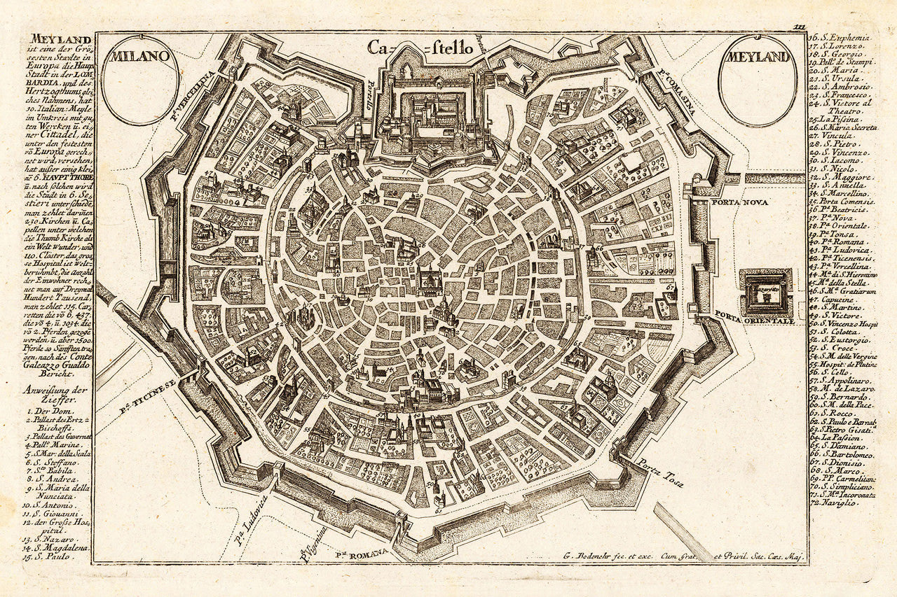

A bird’s-eye-view plan of the town and fortifications of Milan, entitled: Milano / Meyland, showing the city at the end of the 17th and beginning of 18th century. It contains a key to the locations and buildings of note in Milan, crowned by Castello Sforzesco (the Sforza Castle) right at the top. The map was originally engraved by Johannes Stridbeck the Younger around 1700, for the Stridbeck atlas Curioses Staats und Kriegs Theatrum — a collection of engravings depicting city views, plans, fortresses, and castles in Northern Italy, first published in Augsburg in 1704. Gabriel Bodenehr acquired the plates in 1717 and published the atlas under his name around 1720.
• Milan, ca. 1700, Milano - Meyland, city plan, bird’s-eye-view by Stridbeck/Bodenehr
• Fine Art Premium Giclée (Gouttelette) Print (100% cotton 340 gsm fine art paper)
• Made in USA