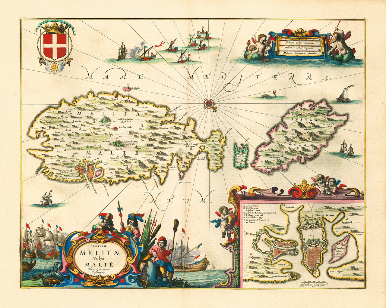
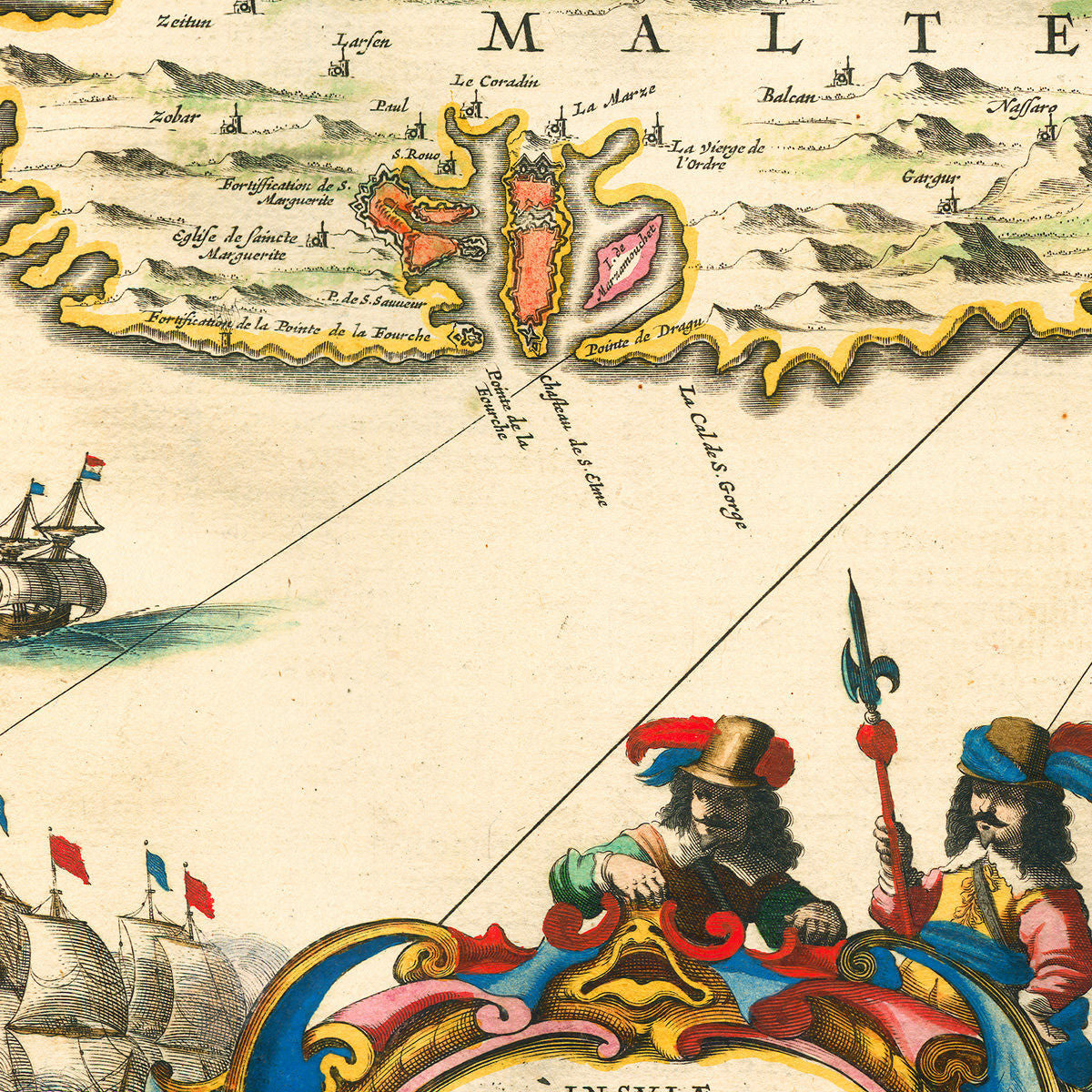
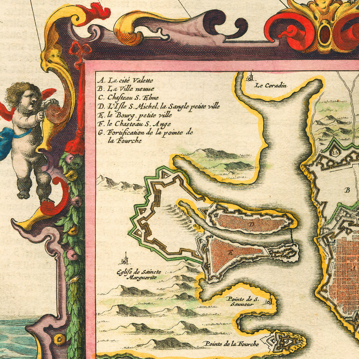

A seventeenth-century map of Malta, showing the islands of Malta, Gozo and Camino. The map features beautiful vignettes with naval battles and sea monsters, a compass rose, rhumb lines and elaborate cartouches. An inset plan of Valletta’s Grand Harbour takes up the bottom right corner. The top left is reserved for a coat of arms of the Order of the Knights of Saint John, crested with a “Pour La Foy” motto. The Insulae Melitae map was first published in 1650 in Johannes Janssonius’ Novus Atlas Absolutissimus. The current copy is from the 1657 edition of the atlas.
• Old map of Malta, Insulae Melitae Vulgo Malte Nova et Accurata Descriptio, (1650) 1657, Janssonius
• Fine Art Premium Giclée (Gouttelette) Print (100% cotton 340 gsm fine art paper)
• Made in USA