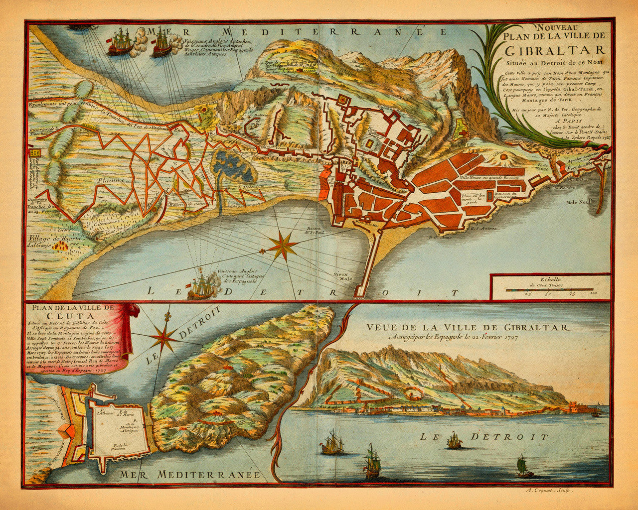
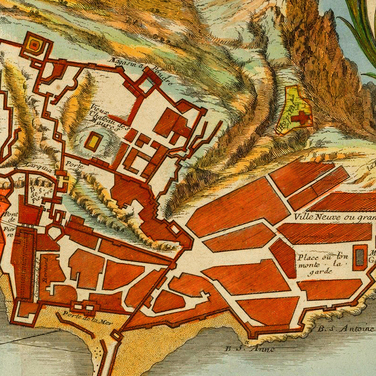
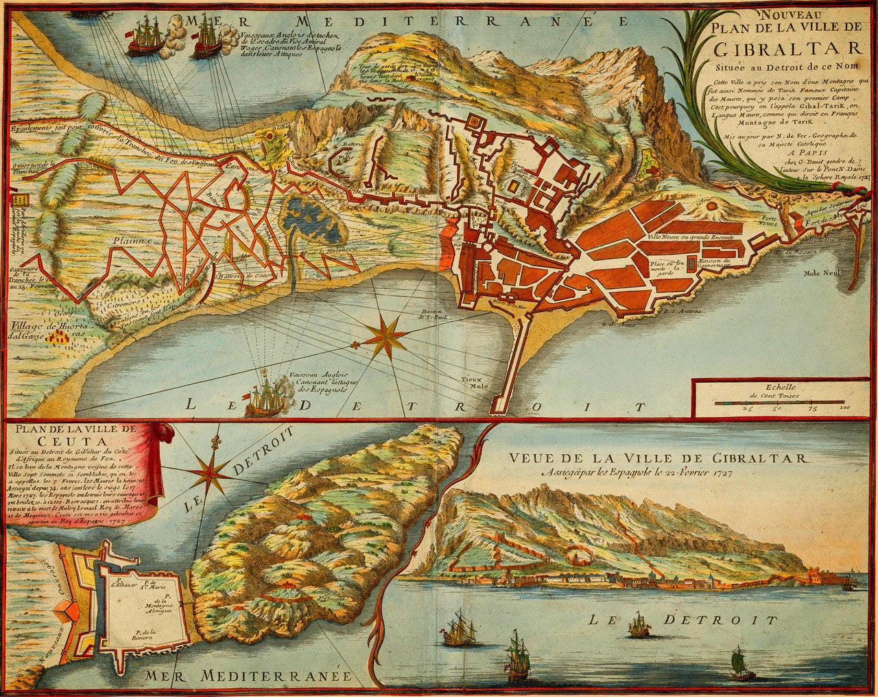

An early-eighteenth-century plan of Gibraltar with an inset plan of Ceuta and a view of Gibraltar. The triple map was engraved by Antoine Coquart, and although it is bearing the inscription of Nicolas de Fer’s office, it was published after de Fer’s death by Guillaume Danet. The map was issued in 1727 as it was supposed to depict the Anglo-Spanish War of 1727–1729. The main map at the top shows British ships on both sides of the peninsula, protecting the land approaches to Gibrltar, and barraging the Spanish artillery positions attacking the garrison. Short descriptions annotate the ships as Rear Admiral Wager’s fleet of the Royal Navy: “Vaisseaux Anglois detaches de l'Escadre du Vice Admiral Washer, Canonant les Espagnols dans leurs Attaques”, and, “Vaisseau Anglois Canonant l’attaque des Espagnols”. Main title reads: Nouveau Plan de la ville de Gibraltar Située au Detroit de ce Nom… 1727. The secondary map is a plan of the Spanish exclave city of Ceuta, sitting on the north coast of Africa, across from Gibraltar. Its title reads: Plan de la ville de Ceuta… 1727. The third part of the map is an easterly coastal view of the town and Rock of Gibraltar, as seen from the strait. Its title reads: Veue de la ville de Gibraltar Assiegée par les Epagnols le 22 Fevrier 1727 (View of the City of Gibraltar besieged by the Spaniards February 22, 1727).
• Map of Gibraltar, Ceuta, and the Strait of Gibraltar, 1727, Anglo-Spanish War, de Fer, Danet
• Fine Art Premium Giclée (Gouttelette) Print (100% cotton 340 gsm textured fine art paper)
• Made in USA