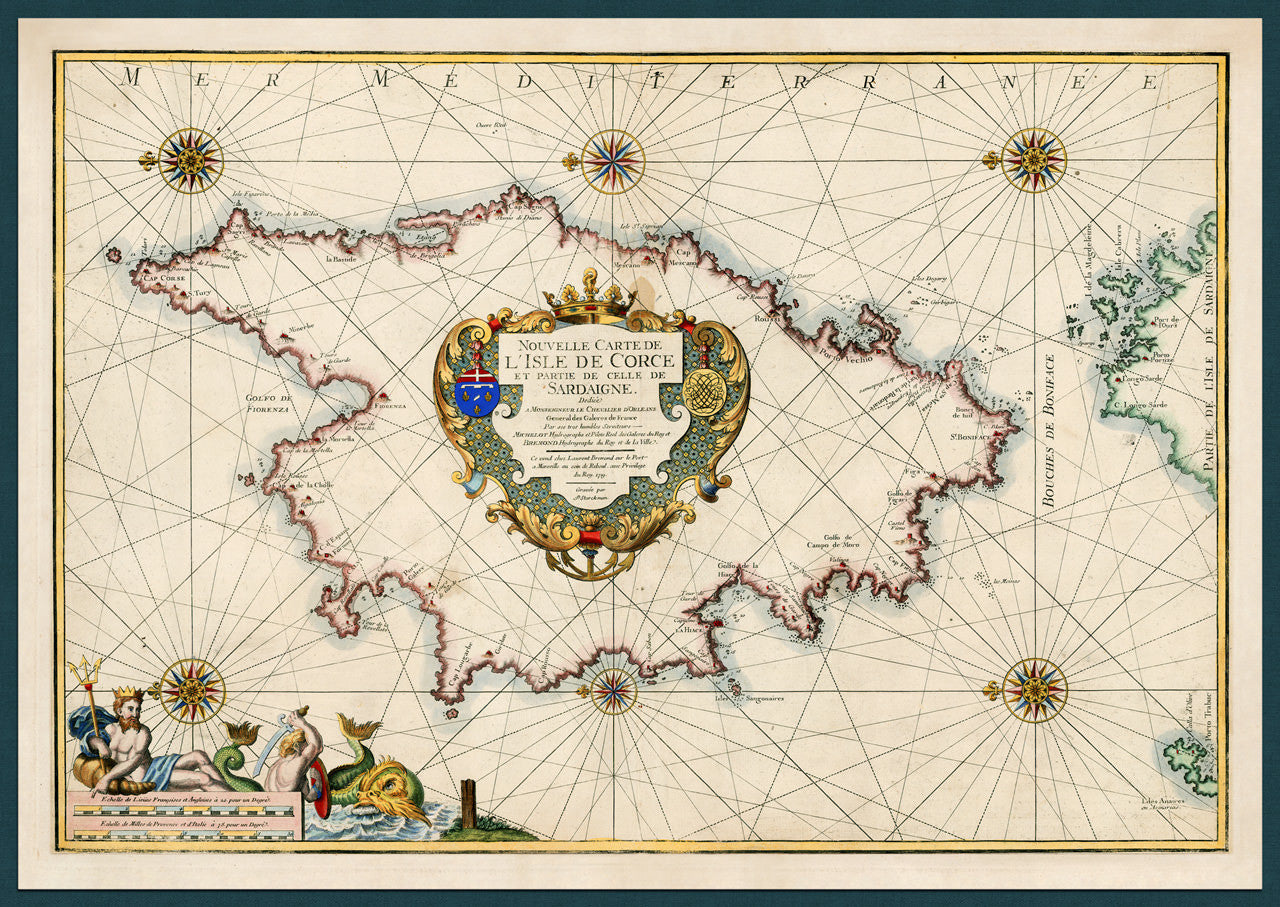
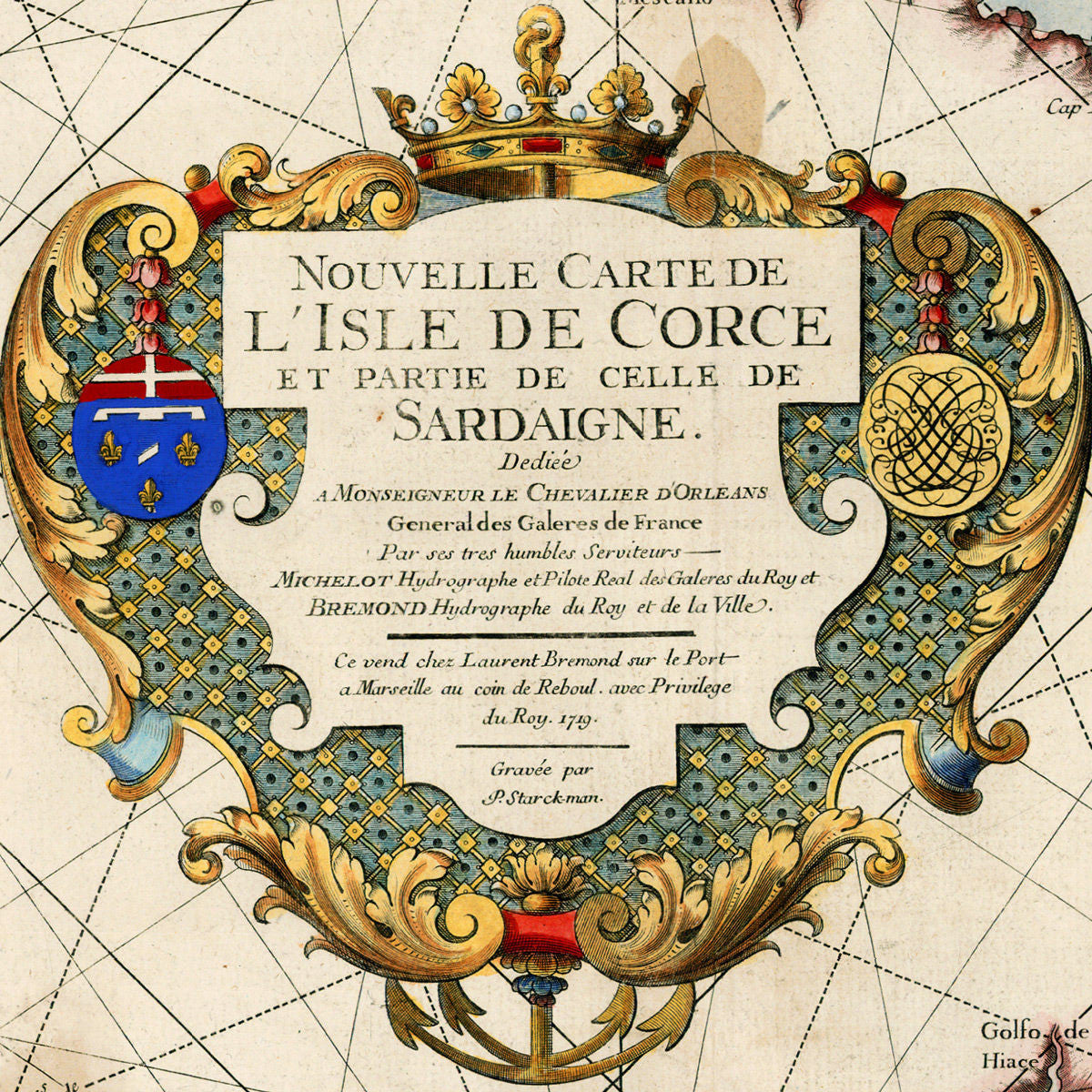
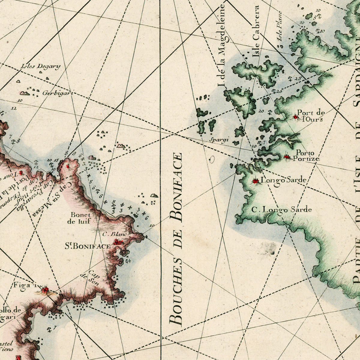

An early eighteenth-century map of the island of Corsica, by Henry Michelot and Laurent Bremond, from their atlas of the Mediterranean, Recueil de Plans et Ports de la Méditerranée. The map was engraved by Peter Starckmann, (gravée par P. Starck-man; P. Starckman sculp.).
Map title: Nouvelle Carte de L’Isle de Corce et Partie de Celle de Sardaigne. (This map pairs well with another item in our collection: Sardinia, 1719, Michelot & Bremond Map. The Corsica map is also available in a set.)
• Map of Corsica, showing part of Sardinia, 1719, H. Michelot & L. Bremond
• Title: Nouvelle Carte de L’Isle de Corce et Partie de Celle de Sardaigne
• Fine Art Premium Giclée (Gouttelette) Print (100% cotton fine art paper)
• Made in USA