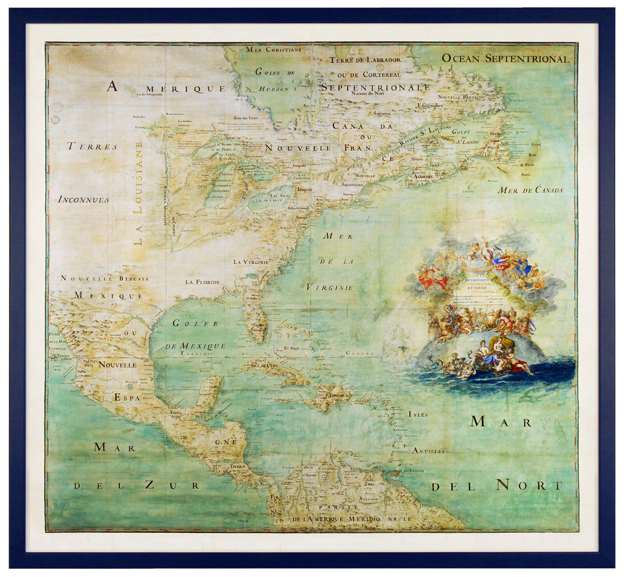
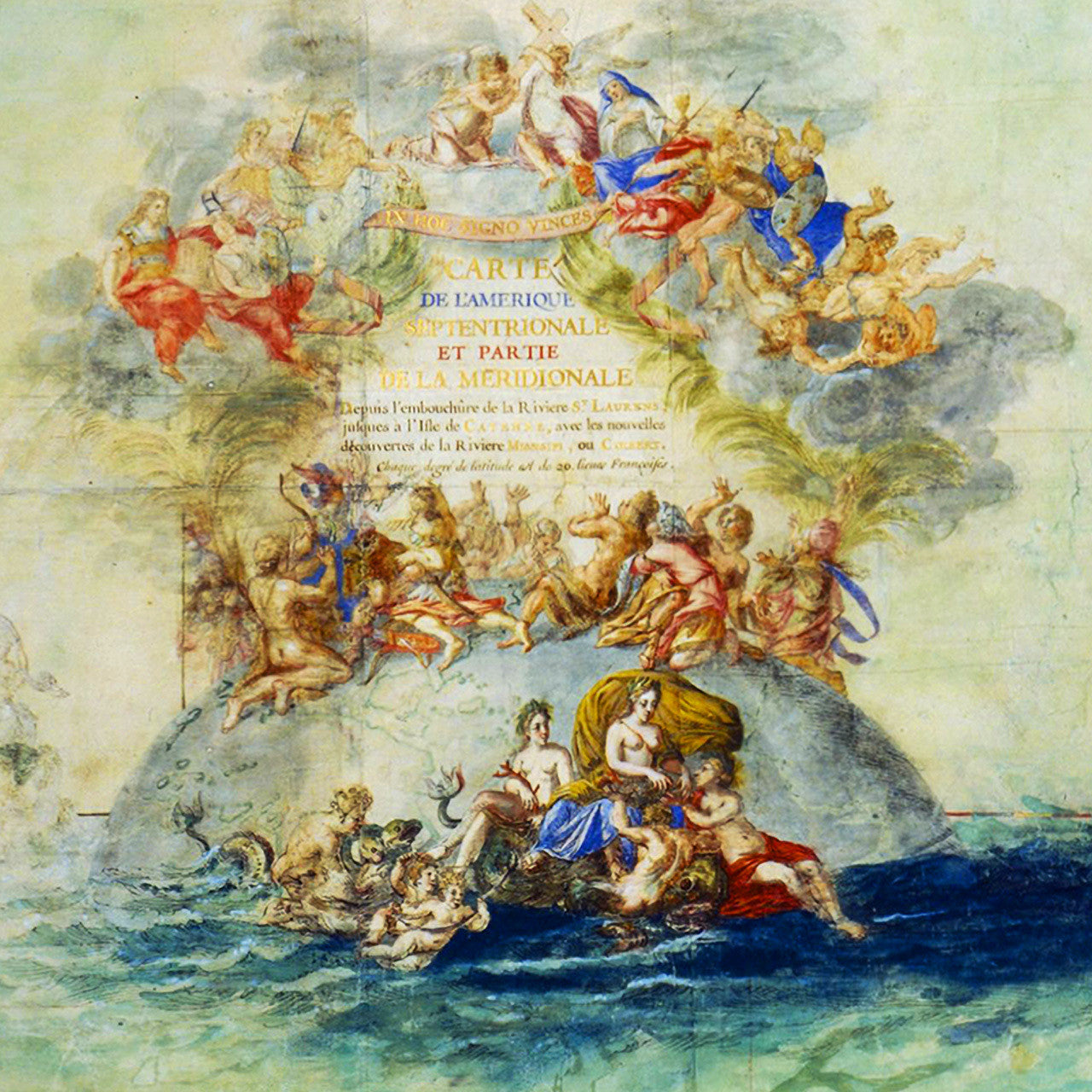

A stunning, watercolor manuscript map of North and Central America, the Caribbean, the northernmost parts of South America, and part of the Atlantic Ocean, attributed to the French Jesuit priest Abbé Claude Bernou (Father Claude Bernou). The map was created in the late 1600s from the latest discoveries and surveys brought back to Europe from the French explorers in the New World. Map title in cartouche reads: Carte de l'Amérique septentrionale et partie de la méridionale depuis l'embouchure de la rivière St. Laurens jusqu'à l'isle de Cayenne avec les nouvelles découvertes de la rivière de Mississipi ou Colbert (EN: Map of North America and part of South America, from the mouth of Saint Lawrence River to Cayenne Island, with new discoveries of the Mississippi or Colbert River).
• Old French manuscript map of North America, with the Caribbean and parts of South America, ca. 1681, framed
• Title: Carte de l'Amérique Septentrionale et Partie de la Méridionale depuis l'Embouchure…
• Framed: dark blue (navy blue) wooden frame, clear facing, backing, wires: ready to hang
• Fine Art Premium Giclée (Gouttelette) Print (100% cotton 340 gsm fine art paper)
• Made in USA