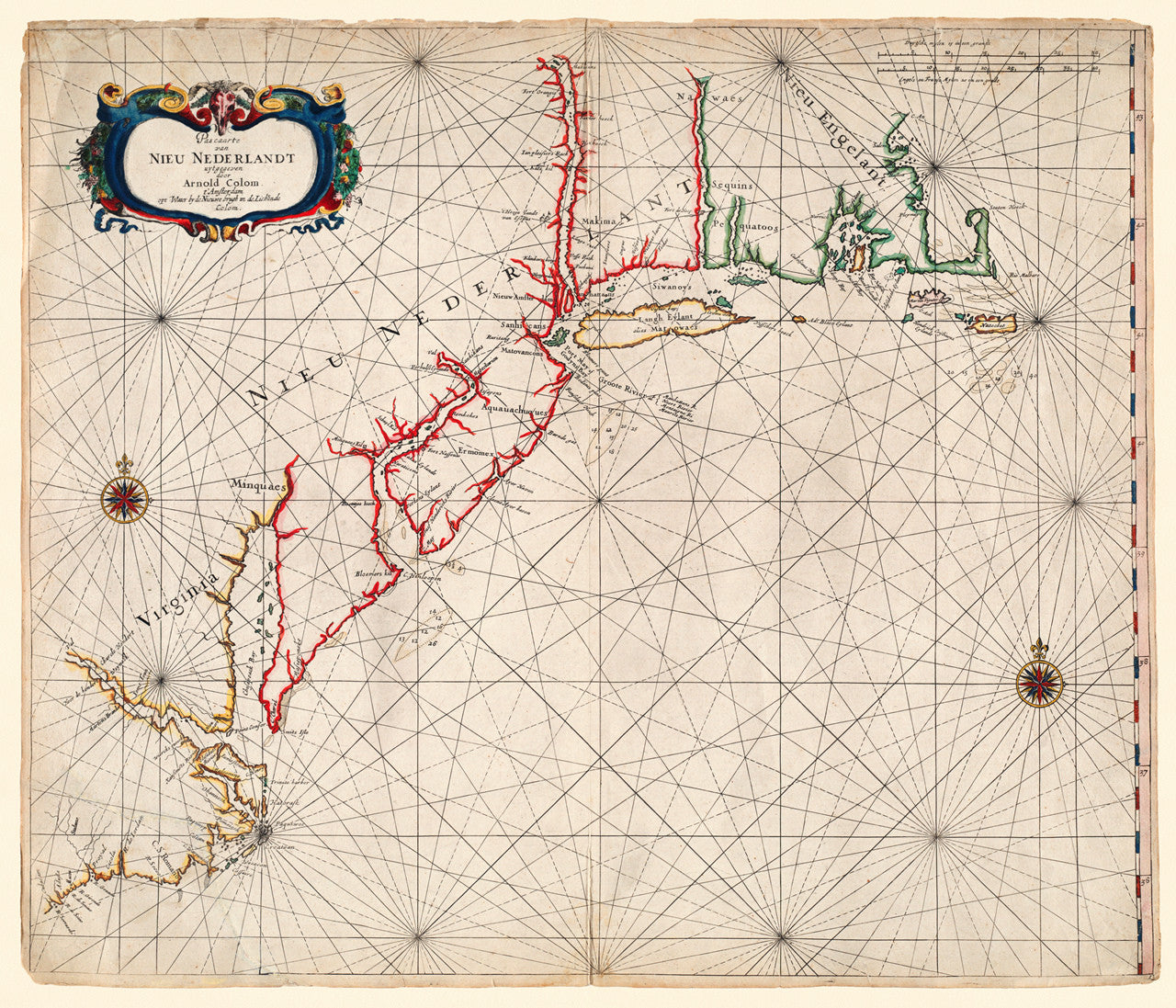
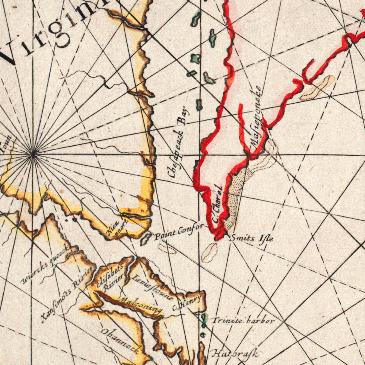
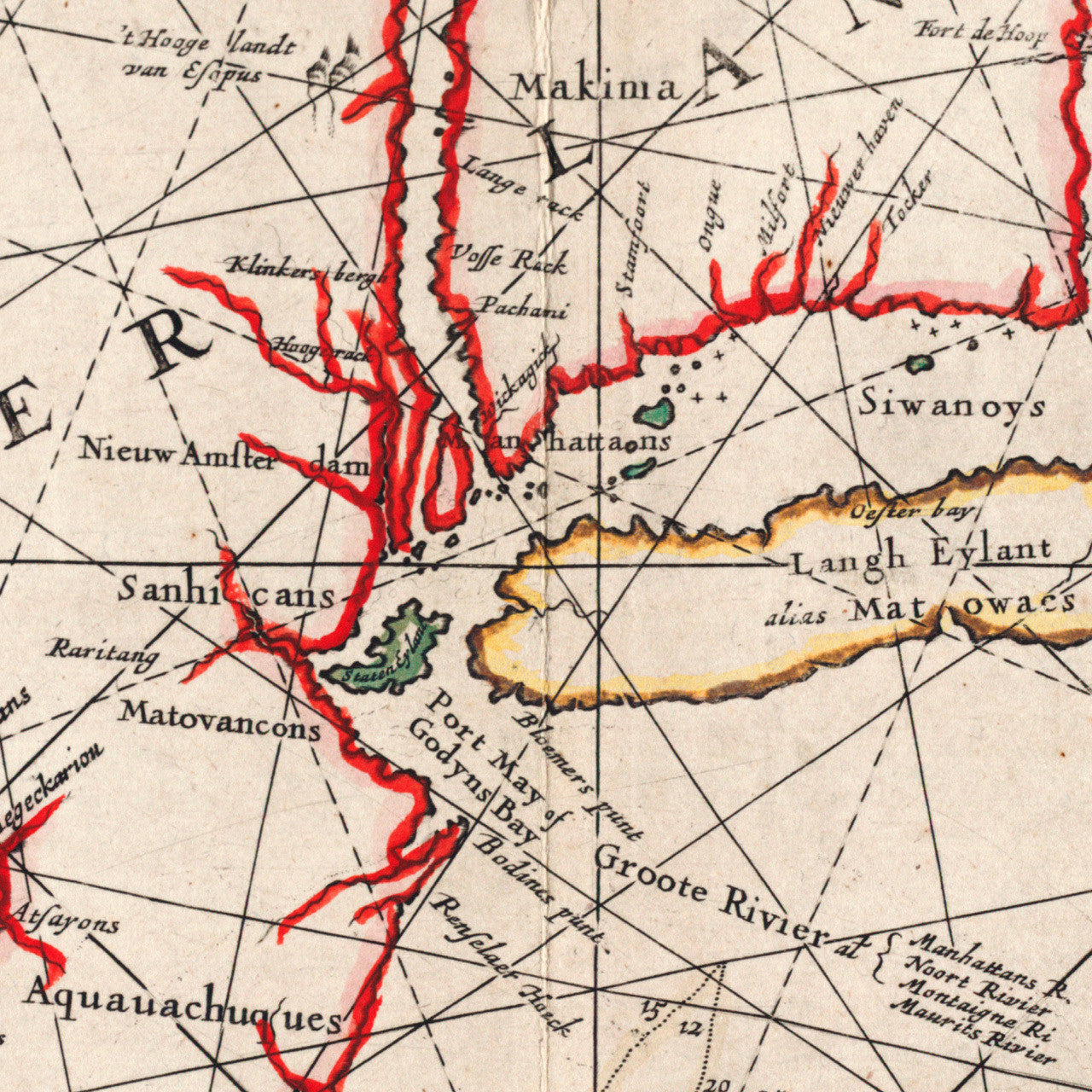
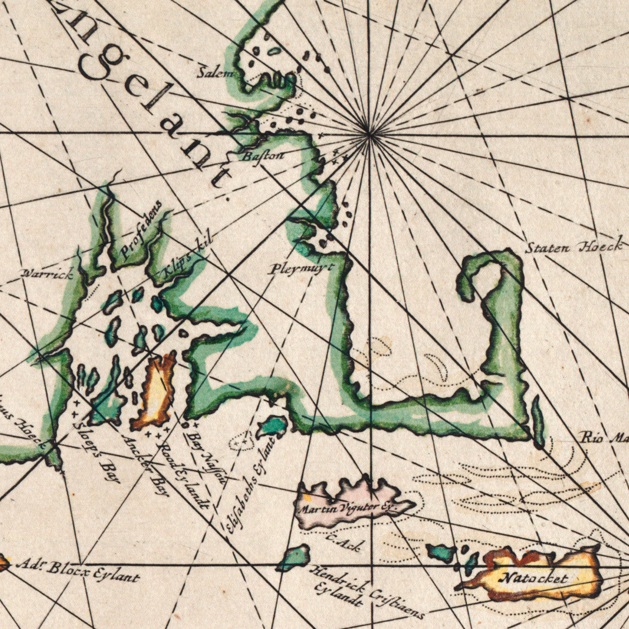

An early Dutch sea chart of New Netherland by Arnold Colom, depicting in detail the Atlantic coast of North America, approximately from today’s Gloucester, Massachusetts to the north, to Cape Hatteras, North Carolina to the southwest. The main provinces are outlined in a different color and marked as Virginia, Nieu Nederlant, and Nieu Engelant. Early English settlements in New England are clearly identified as Salem, Baston (Boston), Pleymuyt (Plymouth), etc. New Netherland included territories of today’s states of New York, New Jersey, Delaware, Connecticut and Rhode Island.
• Early Dutch nautical chart of New Netherland, with Virginia and New England, 1656, Arnold Colom
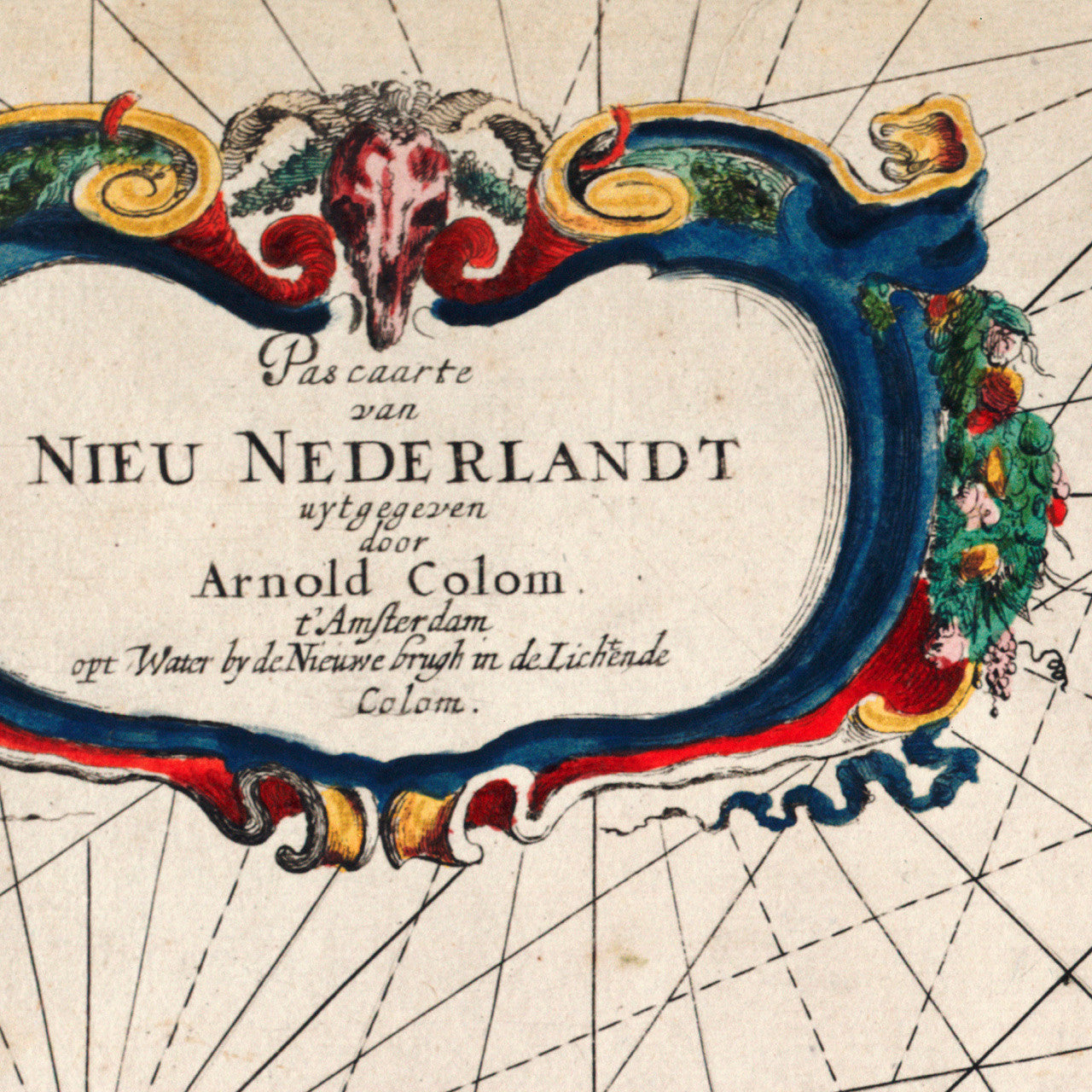
• Title: Pascaarte [pas caarte] van Nieu Nederlandt uytgegeven door Arnold Colom t’ Amsterdam…
• Fine Art Premium Giclée (Gouttelette) Print (100% cotton 340 gsm textured fine art paper)
• Made in USA