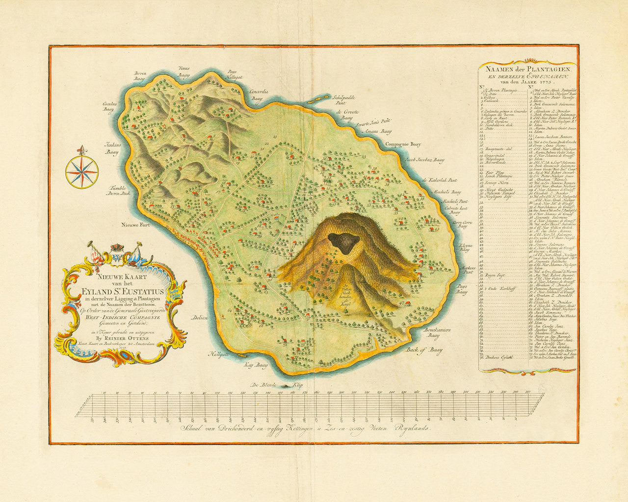
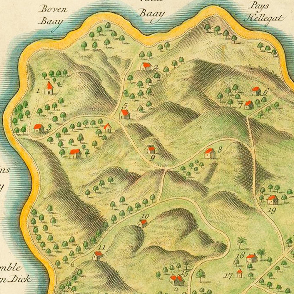
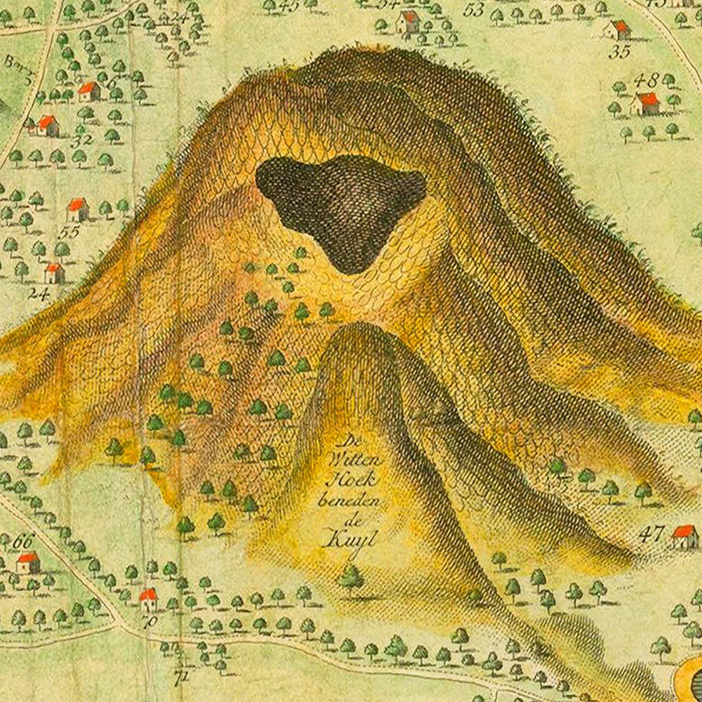
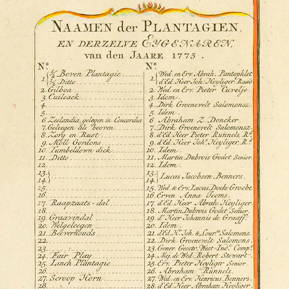

An 18th-century map of the small Caribbean island of Sint Eustatius, (English: Saint Eustatius, colloquial: Statia), engraved, printed and published by Reiner Ottens II, of the prominent Amsterdam Ottens family of cartographers. The map was issued by order of the Dutch West India Company (GWC). It shows tobacco and sugar plantations with the owners’ names and a key to 76 different property lots. At the time, Sint Eustatius was the most important Dutch island in the Caribbean, and one of the busiest centers of commerce in the world. The strategically located island was an entrepôt and a free port, and was nicknamed the Golden Rock because of its immense riches. The current map could be summarized as depicting the Golden Era of the Golden Rock. It records key topographical features and important locations, e.g., Buccaneer Bay, Jenkins Bay, New Fort, The Great Bay, The Company Bay, Venus Bay, The Ghost Rock, etc. Another noteworthy site, prominently featured on the map, is the Quill (Kuyl/Kuil) volcano, today the Quill National Park, located in the southeastern part of the island. Because of its attractive position to buccaneers and major naval powers alike, the island of St. Eustatius has changed hands 22 times over the course of its history.
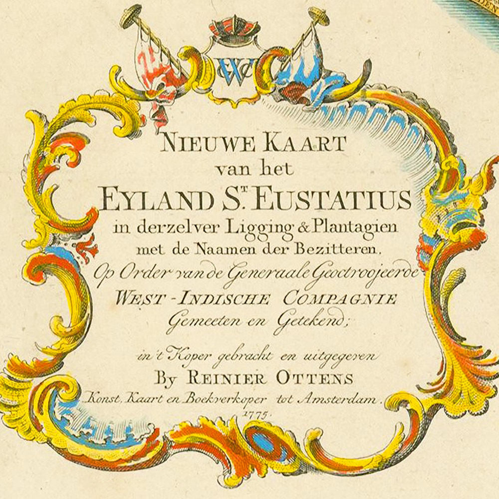
Full map title: Nieuwe Kaart van het Eyland St. Eustatius in derzelver Ligging & Plantagien met de Naamen der Bezitteren. Op Order van de Generaale Geoctroojerde West – Indische Compagnie Gemeeten en Getekend; in ’t Koper gebracht en uitgegeren By Reinier Ottens Konst, Kaart en Boekverkoper tot Amsterdam. 1775.
• 1775 Dutch map of the island of St. Eustatius, by R. Ottens (II), Revolutionary War Era
• Fine Art Premium Giclée (Gouttelette) Print (100% cotton 340 gsm fine art paper)
• Made in USA