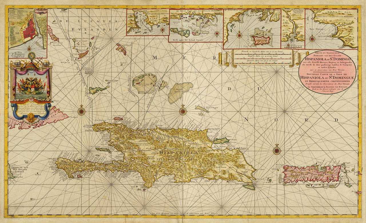
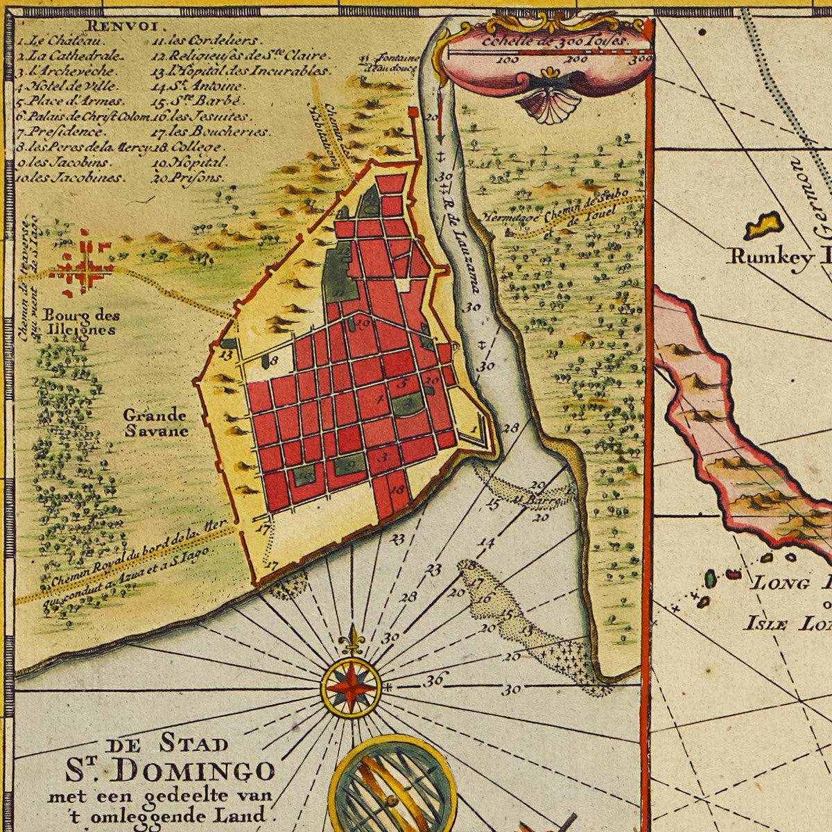
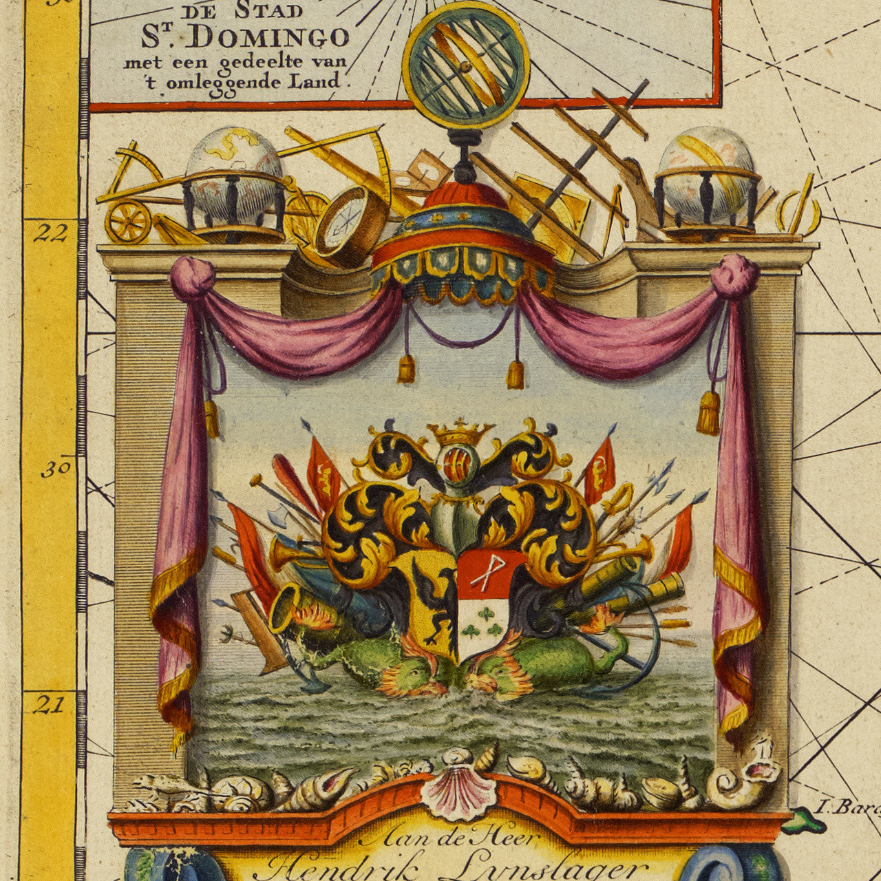
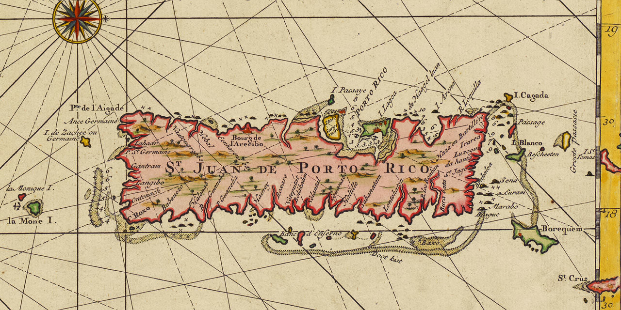

Large format antique map of the Caribbean, with the island of Hispaniola, the port of Santo Domingo, (today’s Dominican Republic), Puerto Rico, and parts of Cuba and the Lucayan Archipelago (the Bahamas). The map contains navigational routes, soundings, and insets with bays and estuaries on Hispaniola. The top left corner contains a plan of Santo Domingo and an elaborate cartouche with a coat of arms and sea monsters. Created by Gerard van Keulen and published in Amsterdam, ca. 1729. (The chart pairs well with another Caribbean favorite from the same period — van Keulen’s map of Cuba.)
• 1720s sea chart of Hispaniola, Puerto Rico, and the Bahamas by Gerard van Keulen
• Fine Art Premium Giclée (Gouttelette) Print (100% cotton 340 gsm fine art paper)
• Made in USA