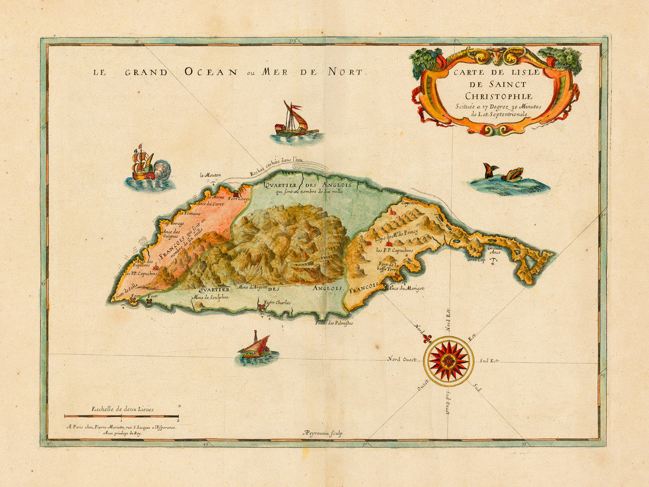

A mid-seventeenth-century French map of the Carribean island of Saint Kitts (Saint Christopher), showing the division of the island between the French and English settlers, after the Europeans briefly united to massacre the indigenous Kalingo Carib population in 1626. Map title: Carte de Lisle de Sainct Christophle Scituée a 17 Degrez 30 Minutes de Lat. Septentrionale, A Paris Chez Pierre Mariette, rue S. Iaques a l’Esperance, Auec privilege du Roy, APeyrounin sculp. The authors are: Nicolas Sanson (Cartographer), Abraham Peyrounin (Engraver), and Pierre Mariette (Publisher). This is the first known printed map of St. Kitts.
• Old French map of St. Kitts (St. Christopher / Sainct Christophle / Saint-Christophe), ca. 1650, Sanson
• Fine Art Premium Giclée (Gouttelette) Print (100% cotton 340 gsm textured fine art paper)
• Made in USA