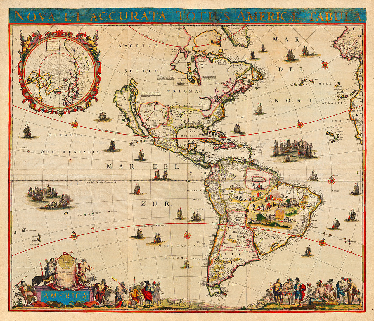
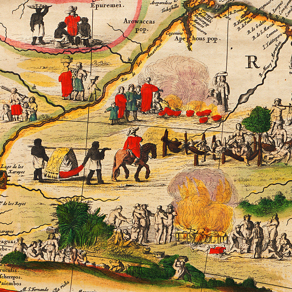
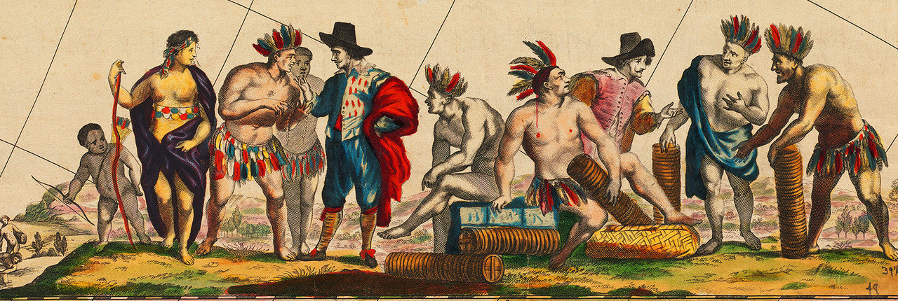
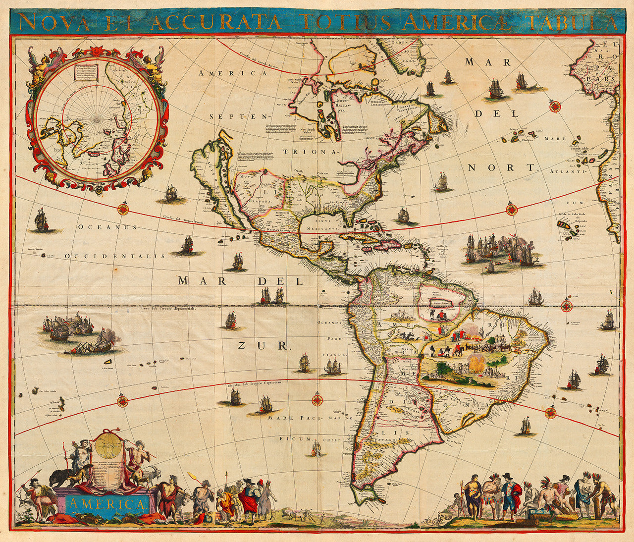

A seventeenth-century map of the Western Hemisphere, featuring North and South America with the Pacific and Atlantic Oceans, and several beautifully engraved and colored vignettes. The cartouche in the lower left corner is simply and aptly entitled, “America”. The map was first published in Amsterdam by the brilliant 17th-century Dutch cartographer and printer Frederick de Wit.
• 17th-century map of the Americas by Frederick de Wit, entitled: Nova et Accurata Totius Americæ (Americae) Tabula
• Fine Art Premium Giclée (Gouttelette) Print (100% cotton 340 gsm fine art paper)
• Made in USA