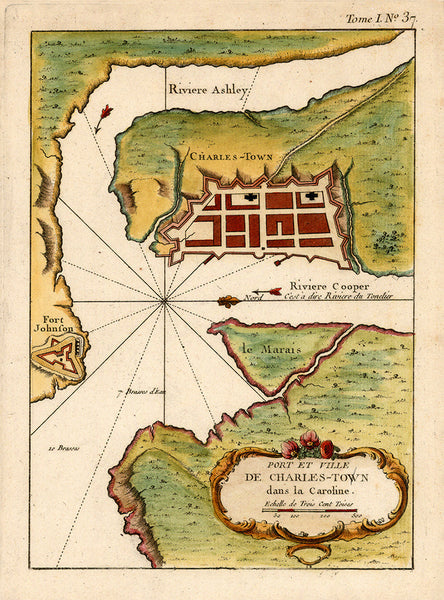
South Carolina, 1764, Plan of Charleston, Port et Ville de Charles-Town, Bellin Map
$45
Brand: Battlemaps.us
Colonial era plan of Charleston, South Carolina and its surrounding areas. The map depicts the Cooper River, Ashley River, Fort Johnson and miscellaneous fortifications. Drawn and engraved by Jacques Nicolas Bellin for his 1764 sea atlas, Le petit atlas maritime.
• Title: Port et Ville de Charles-Town dans la Caroline, 1764, J. N. Bellin, Le petit atlas maritime
• Fine Art Premium Giclée (Gouttelette) Print (100% cotton 340 gsm textured fine art paper)
• Made in USA


