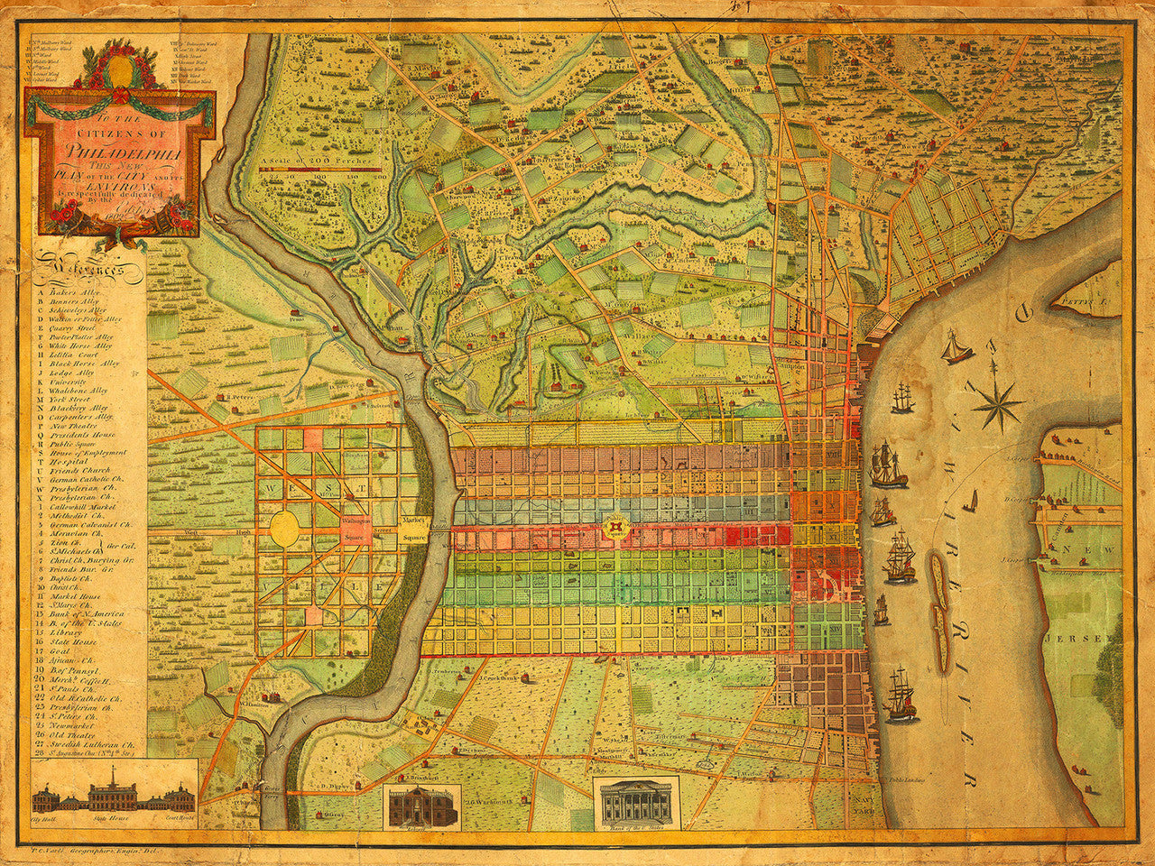
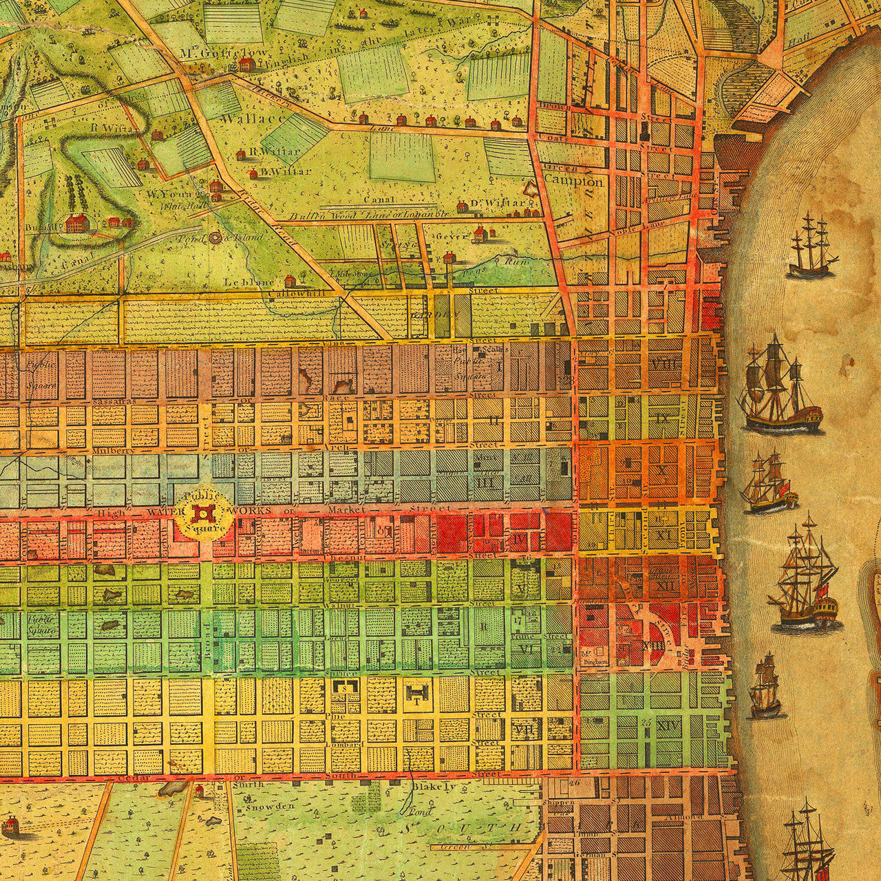
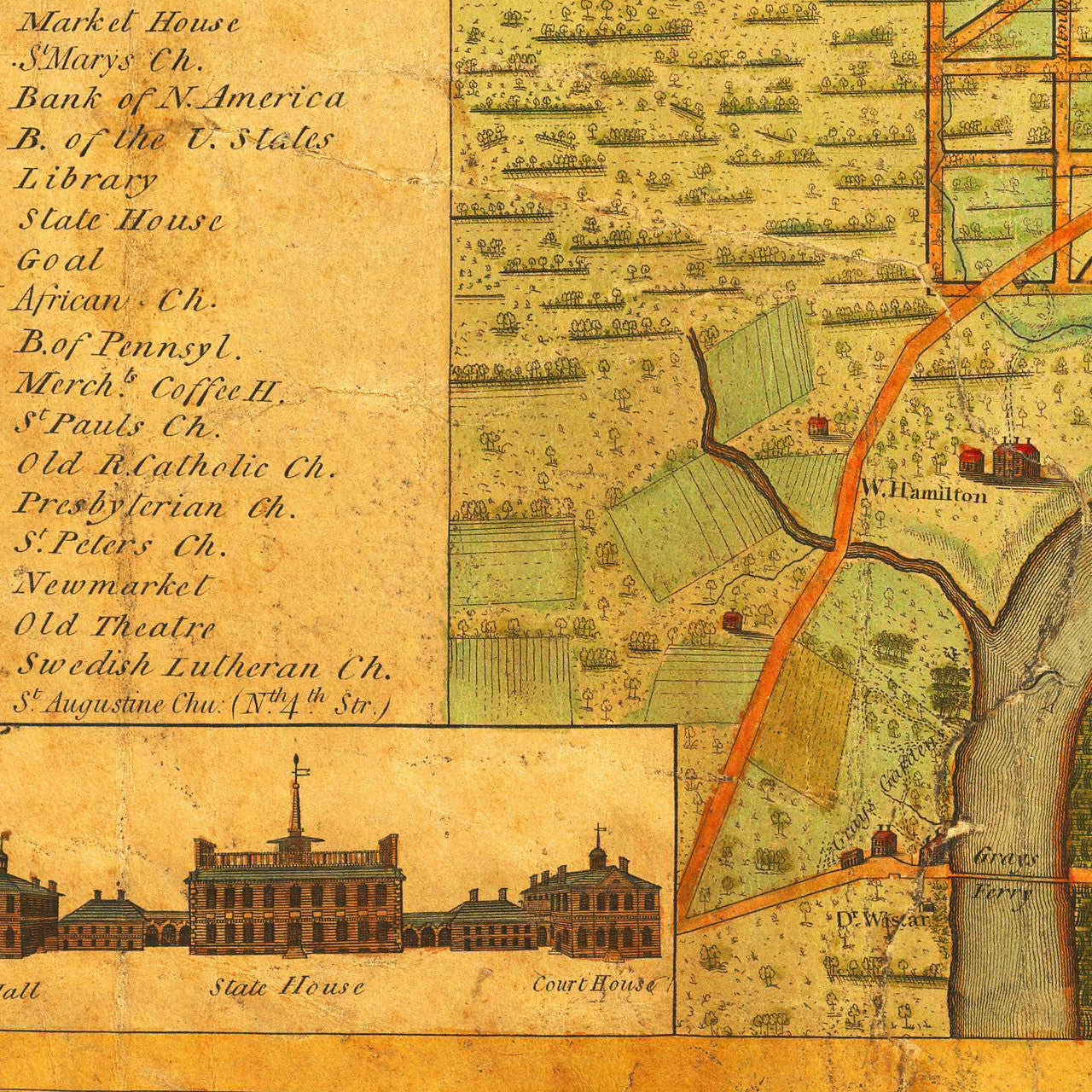
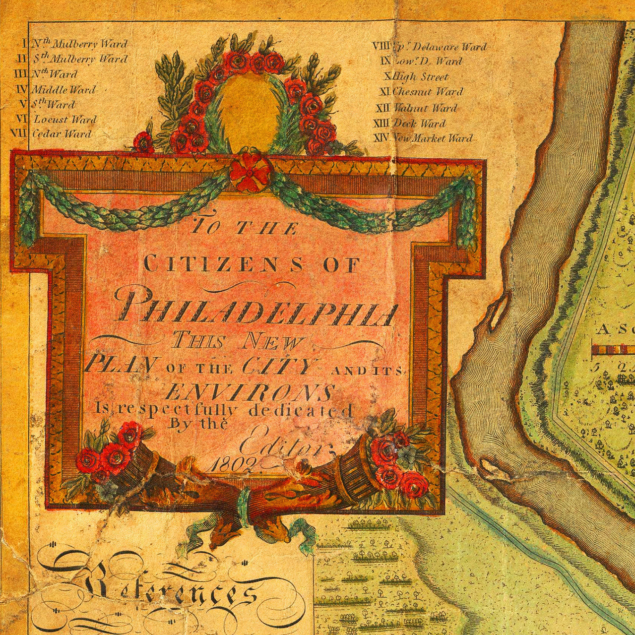
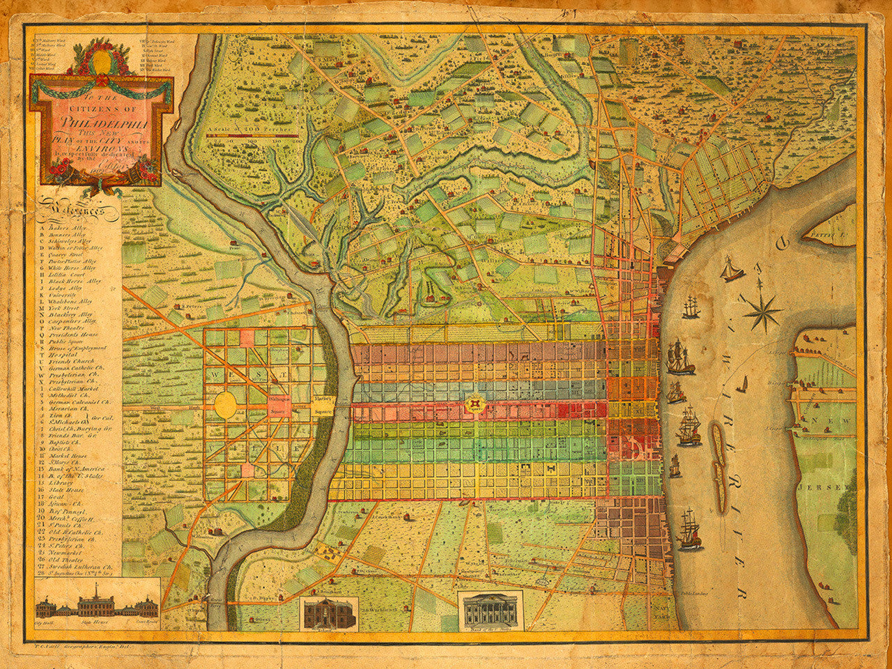

This is an early map of Philadelphia created by Charles P. Varle. The city is shown from the Delaware River to the Schuylkil River with the environs on the north and south. It contains several references to important buildings and places. Three inset views show City Hall, the State House, Court House, Library, and Bank of the United States. The map title in the cartouche reads: To The Citizens Of Philadelphia This New Plan Of The City And Its Environs Is respectfully dedicated By the Editor, 1802 [P. C. Varle Geographer & Enginr. Del.]
• Antique plan of the city of Philadelphia, 1802, Charles Varle
• Fine Art Premium Giclée (Gouttelette) Print (100% cotton 340 gsm textured fine art paper)
• Made in USA