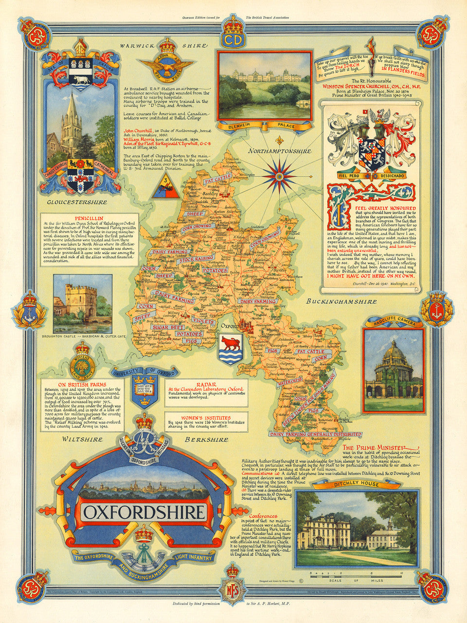
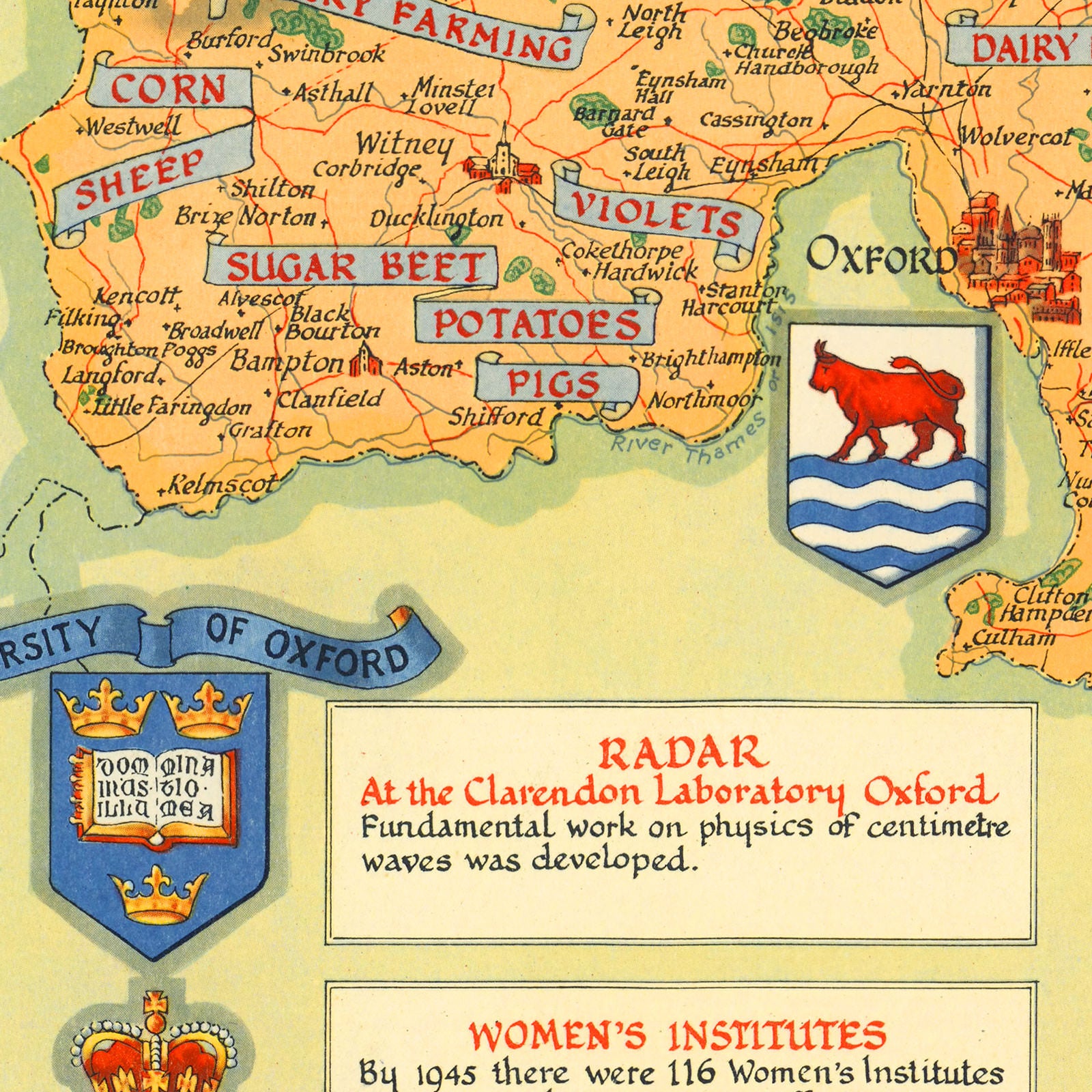
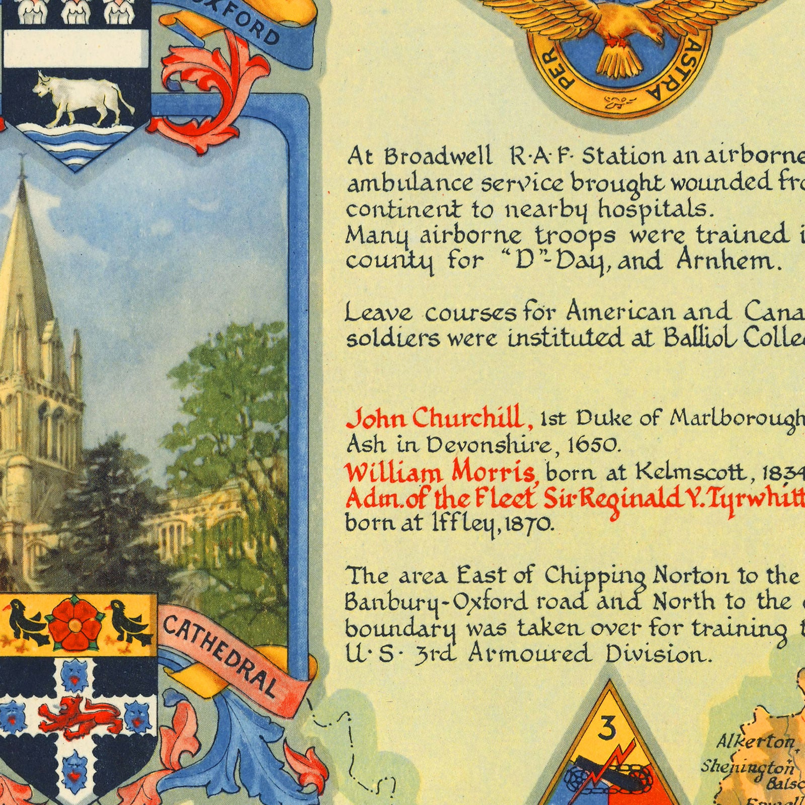
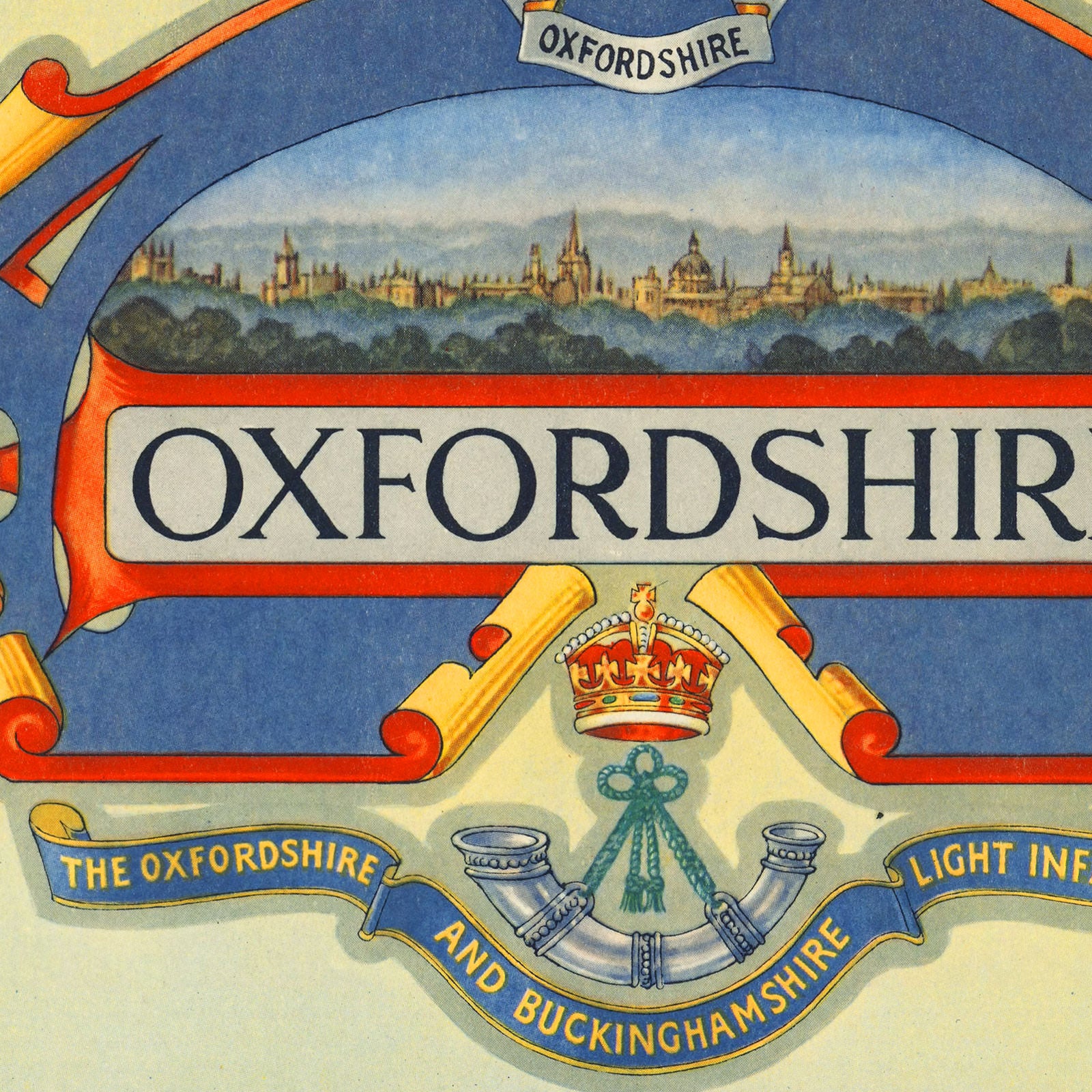

Attractive pictorial map of Oxfordshire, England, commemorating the conclusion of the Second World War, and celebrating the rich heritage and bountiful economy of the famous county. The captivating and colorful map was designed by Ernest Clegg and published by John Waddington for the British Travel Association abroad. The map is peppered with military insignia of units involved in the war effort in the region. It also features numerous vignettes and insets of important historical places: Blenheim Palace, Broughton Castle, Radcliffe Camera at Oxford University, Ditchley House, Christ Church Cathedral, and a panoramic view of Oxford incorporated into the title cartouche. Centrally in the layout, the county map proudly displays the agricultural resources of the region. Various insets include significant facts and historical figures. Most prominently, the Coat of Arms of Sir Winston Churchill, grandson of the 7th Duke of Marlborough and Prime Minister of Great Britain, adorns a quote from his famous speech in the U.S. Congress in 1941.
• Pictorial historical map of Oxfordshire, England, WWII / post-WWII Era
• Fine Art Premium Giclée (Gouttelette) Print (100% cotton 340 gsm fine art paper)
• Made in USA