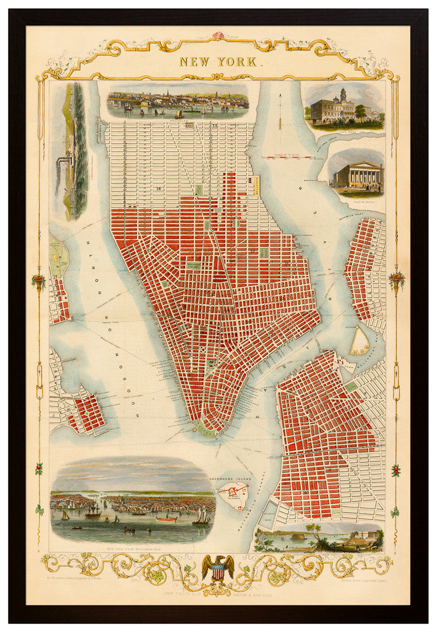
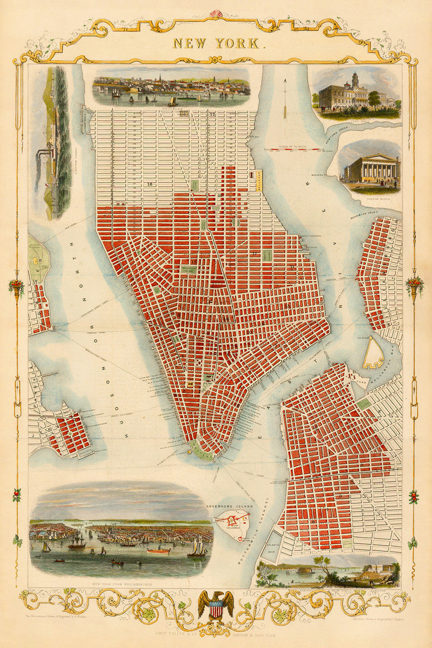
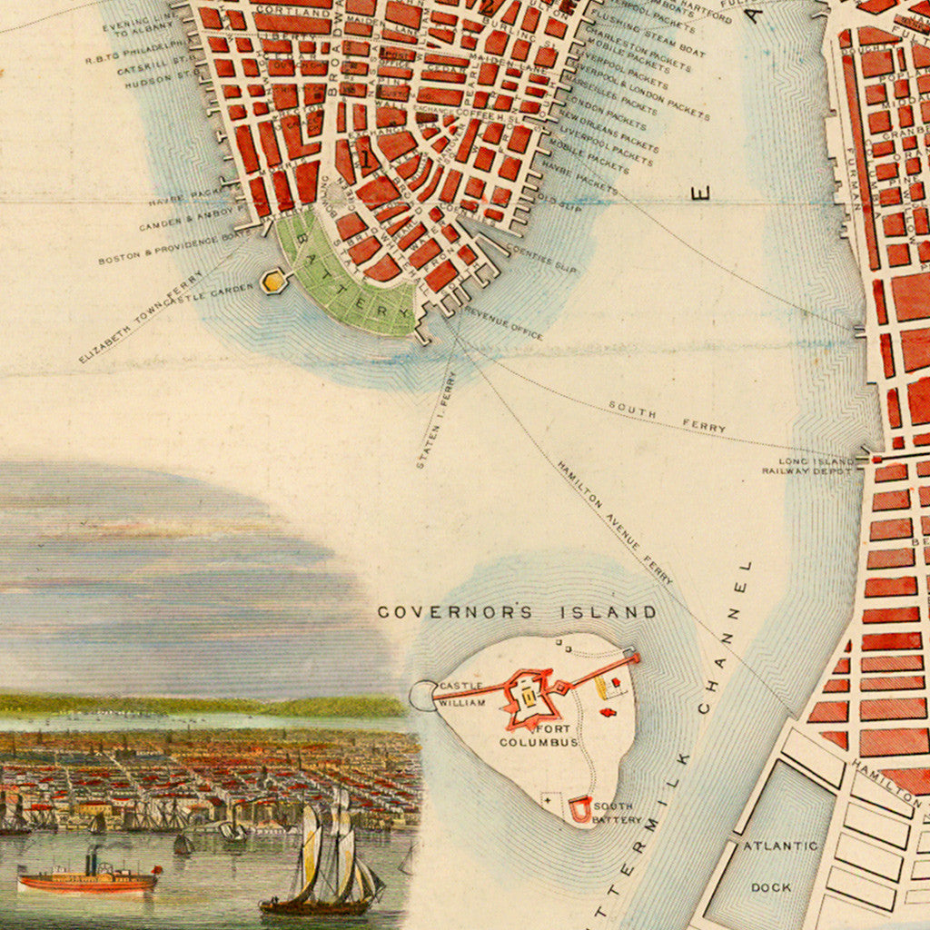
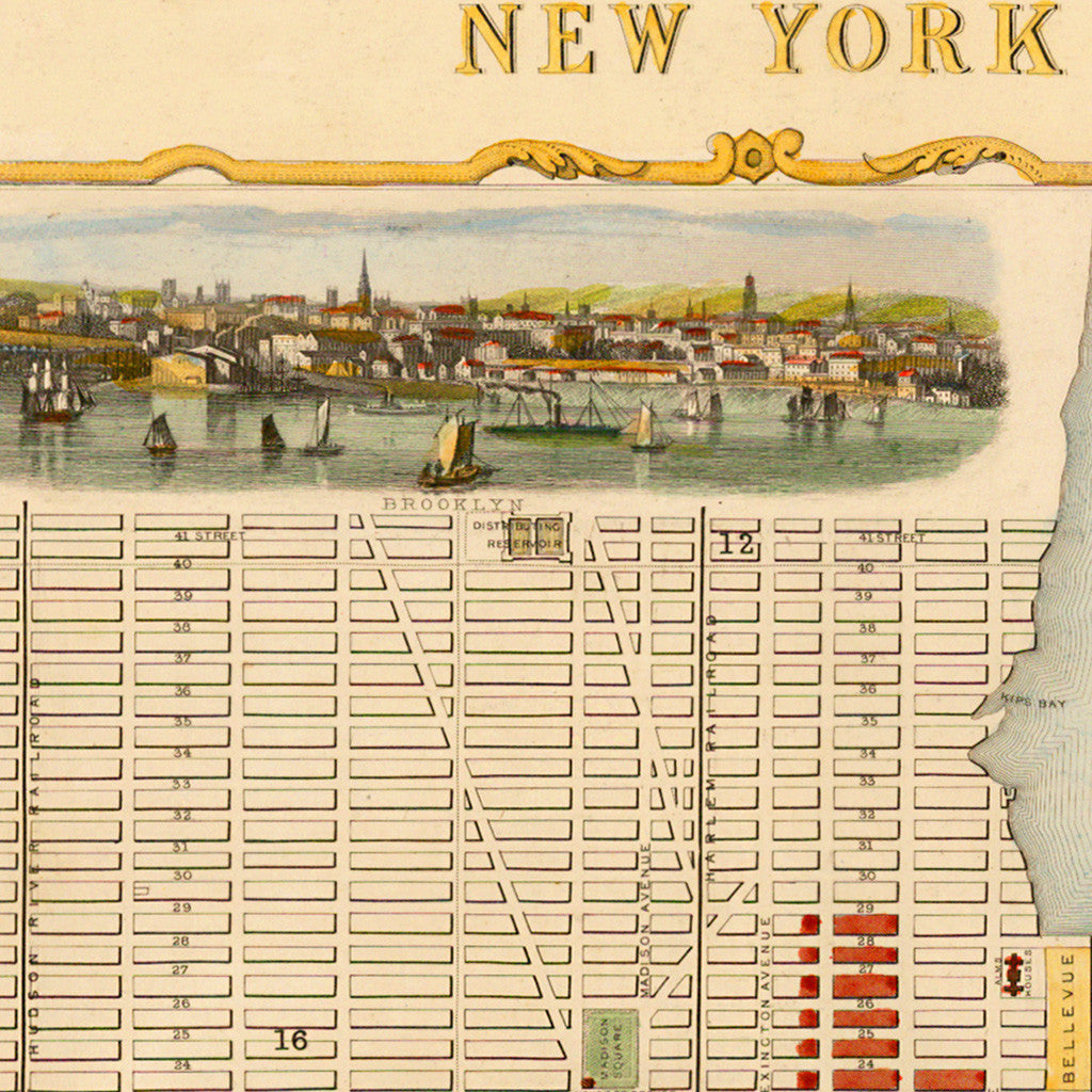

A beautiful and detailed 1851 city plan of New York by John Tallis & Co. Tallis was one of the most prominent and prolific mapmakers of the 19th century. The map was drawn and engraved by John Rapkin. It includes several vignettes with illustrations made by Henry Winkles, with views of Brooklyn, New York from Williamsburg (Williamsburgh), the Narrows of New York Harbor form Fort Hamilton, City Hall, Custom House, and a steamboat on the Hudson River. It also shows sailing boats and ferry lines on both the Hudson and the East Rivers before the arrival of the great bridges. (This map is also available unframed.)
• Decorative old map by John Tallis showing New York City ca. mid–19th century (framed)
• Fine Art Premium Giclée (Gouttelette) Print (100% cotton 340 gsm fine art paper)
• Custom-framed in a black wooden frame, with backing, wires; ready to hang
• Made in USA