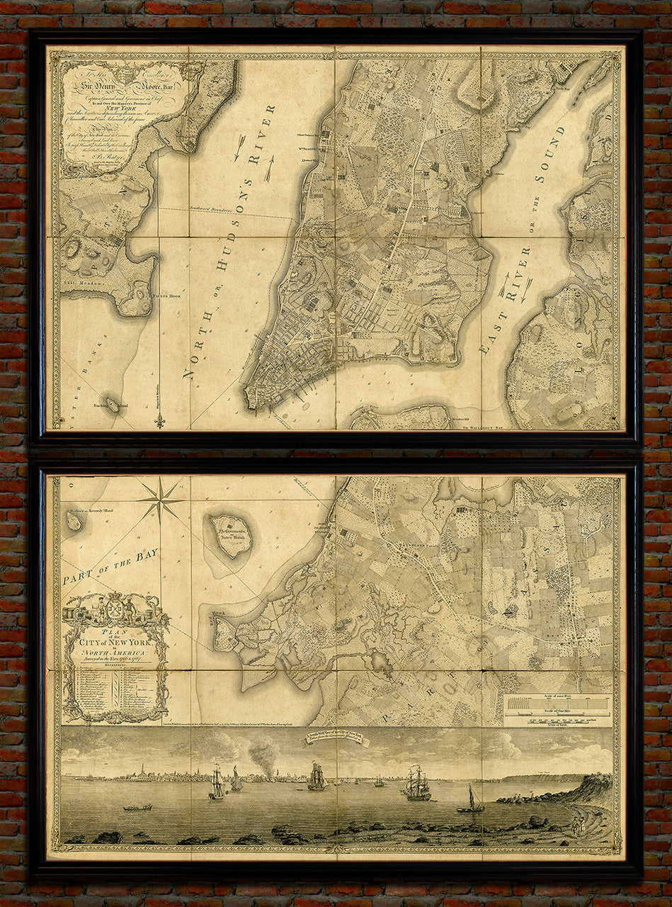
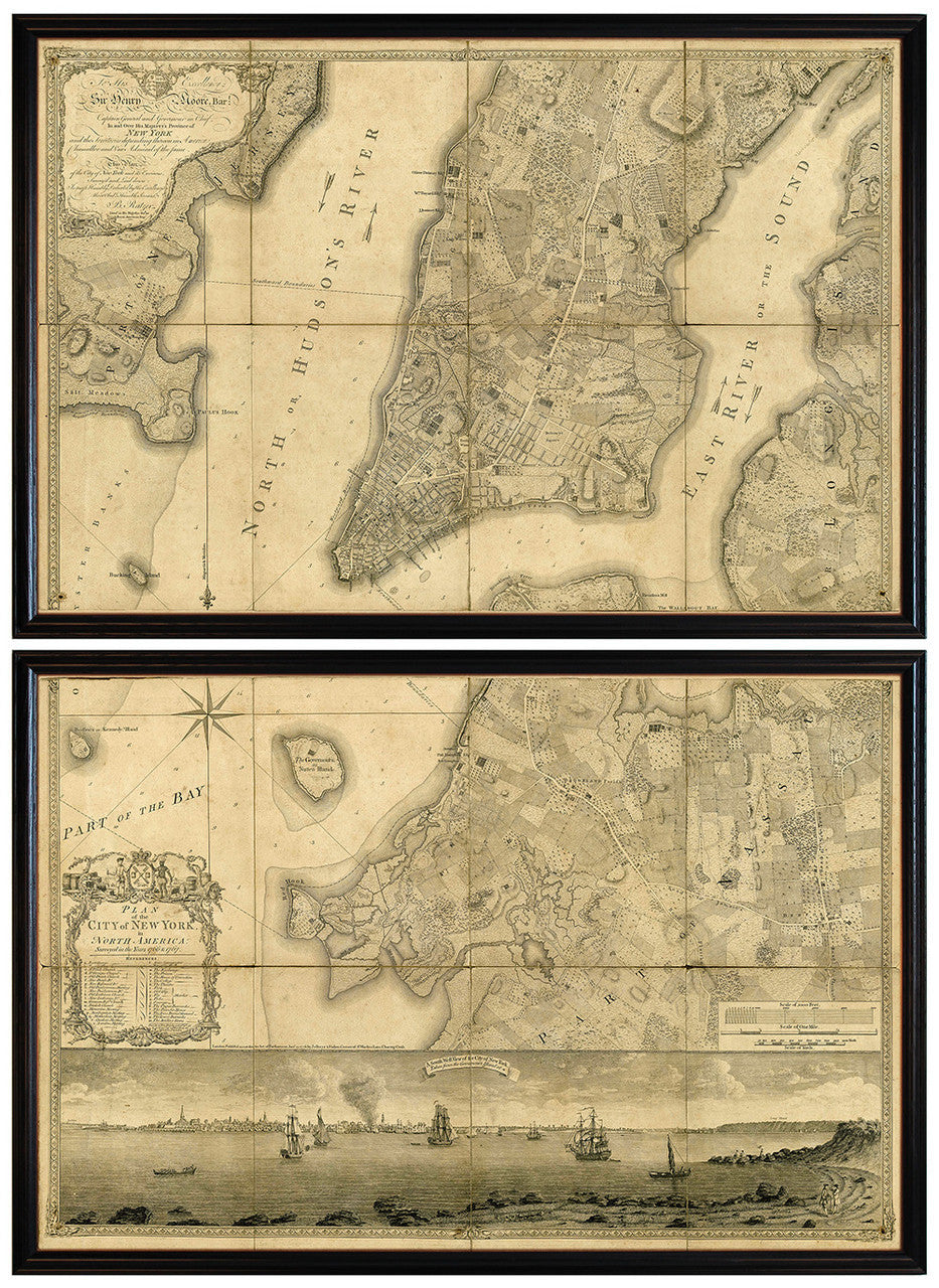
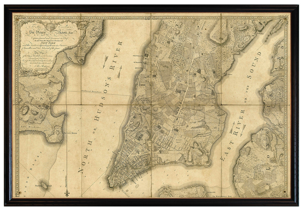
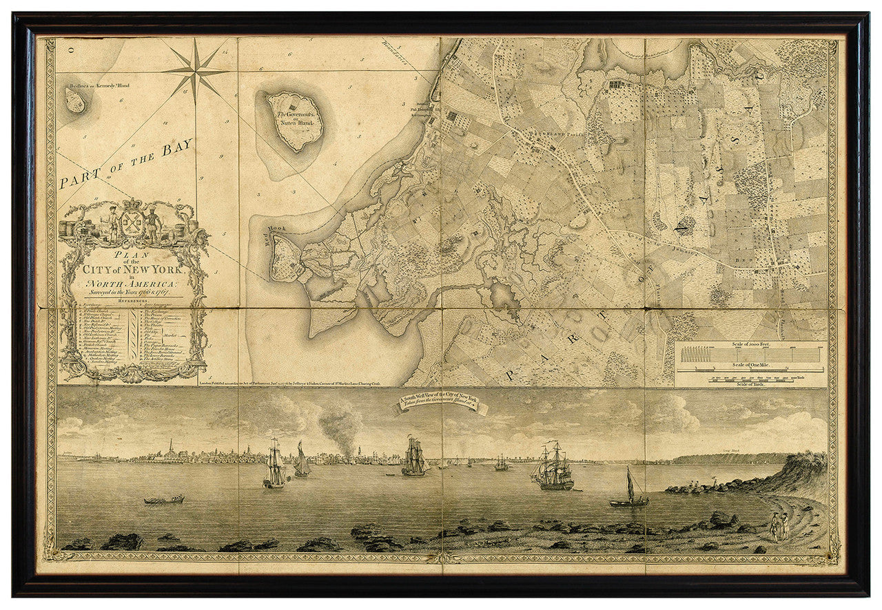
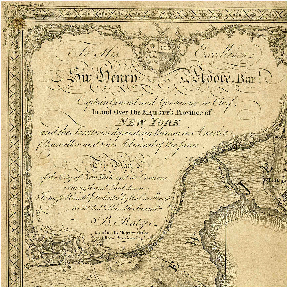

“Plan of the City of New York in North America surveyed in the years 1766 & 1767”, is Ratzer’s most famous map. It is also the most famous map of New York City ever produced. This beautiful and highly-detailed plan was surveyed and drawn by Bernard Ratzer (with help from Claude Sauthier), engraved by Thomas Kitchin, and printed and published by Thomas Jefferys and William Faden in London in 1776. Made literally by the Who’s Who of mapmaking of their time, this large piece of cartographic art has rightfully been called “the Rolls Royce of all New York maps”. The current set has the two plates framed individually — 1. Manhattan 1767, and 2. Brooklyn 1767 — to form a flawless facsimile recreation.
• Plan of the City of New York in North America by Bernard Ratzer (framed set)
• Fine Art Premium Giclée Print (Ultra Premium Presentation Enhanced Matte Paper)• Framed: 1” black ash wood frames, backing, wires & facing; ready to hang
• Size of single panel: 37.5” x 25.5” x 1”
• Size of set: 37.5” x 1” x 51”(+)