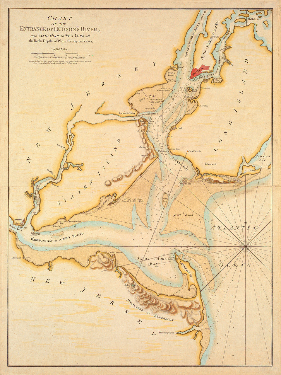
New York, 1776, Hudson River, Sandy Hook, New Jersey, Revolutionary Era Map
$100
Brand: Battlemaps.us

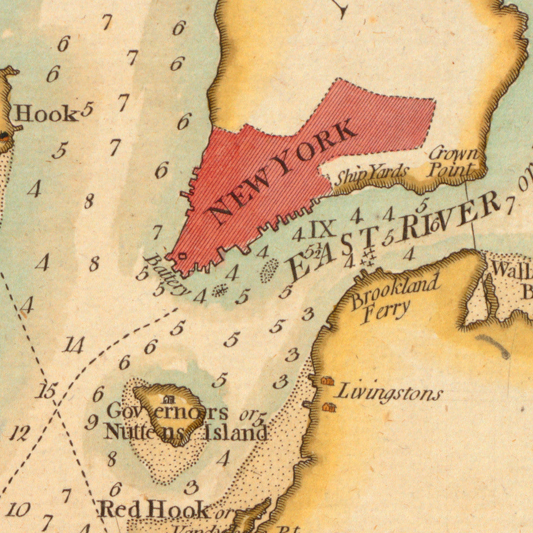
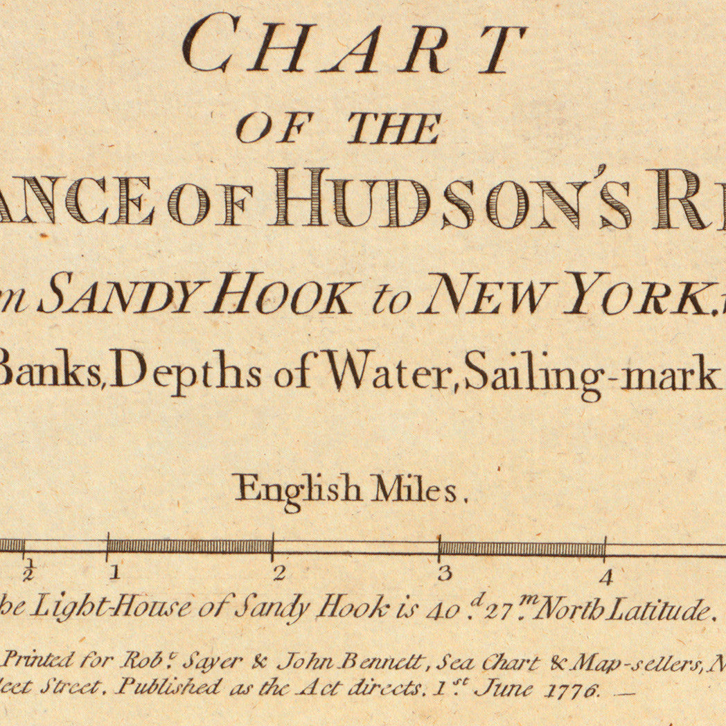
Revolutionary War Era nautical chart of the Hudson River mouth, Sandy Hook, New Jersey, and the New York banks. The map shows banks, depths of water in soundings, and sailing marks. It was created by Sayer & Bennett in London in 1776.
• Revolutionary Era chart of the Hudson River mouth, New York, Sandy Hook, New Jersey, 1776
• Fine Art Premium Giclée (Gouttelette) Print (100% cotton 340 gsm fine art paper)
• Made in USA
Customer Reviews
Based on 1 review
Write a review