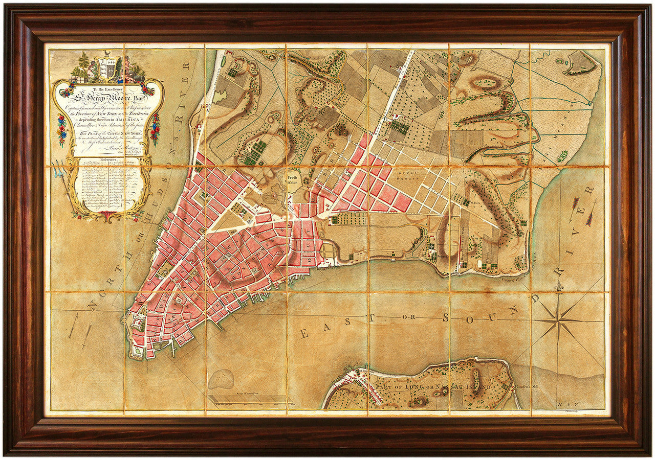
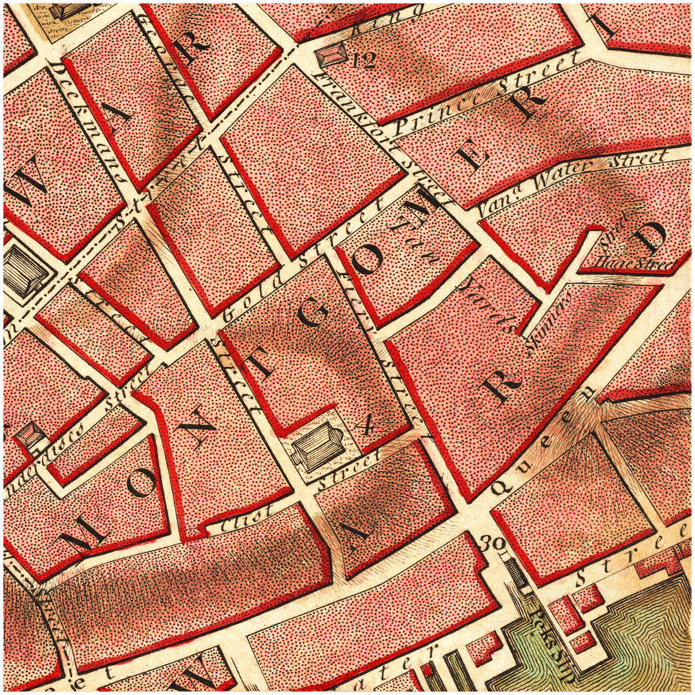
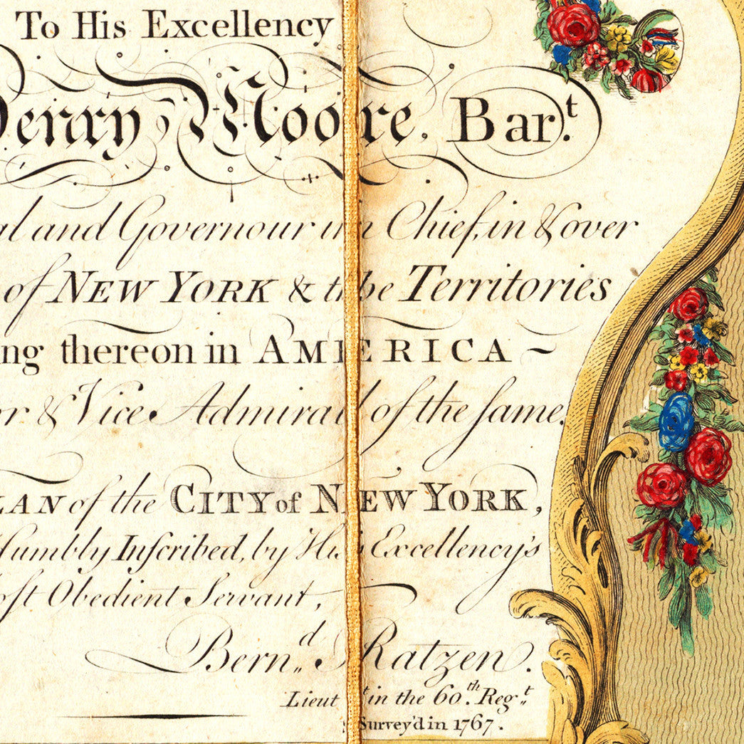

Bernard Ratzer was a prominent British engineer, cartographer and surveyor in the mid to late 18th century. During the French and Indian War, and just prior to the American Revolution, he was assigned to survey the eastern coast of America, specifically New York, New Jersey (the Jerseys), and the Carolinas. Ratzer is best known for his large format map of New York City (also available in our collection), considered to be the best city plan ever produced. Ratzer’s name was misspelled as “Ratzen” in this early edition of the map, by engraver and publisher Thomas Kitchin.
• Plan of the City of New York, surveyed by Bernard Ratzer in 1767, framed
• Fine Art Premium Giclée (Gouttelette) Print (100% cotton 340 gsm fine art paper)
• Framed: dark solid wood frame, facing, backing, wires; ready to hang
• Made in USA