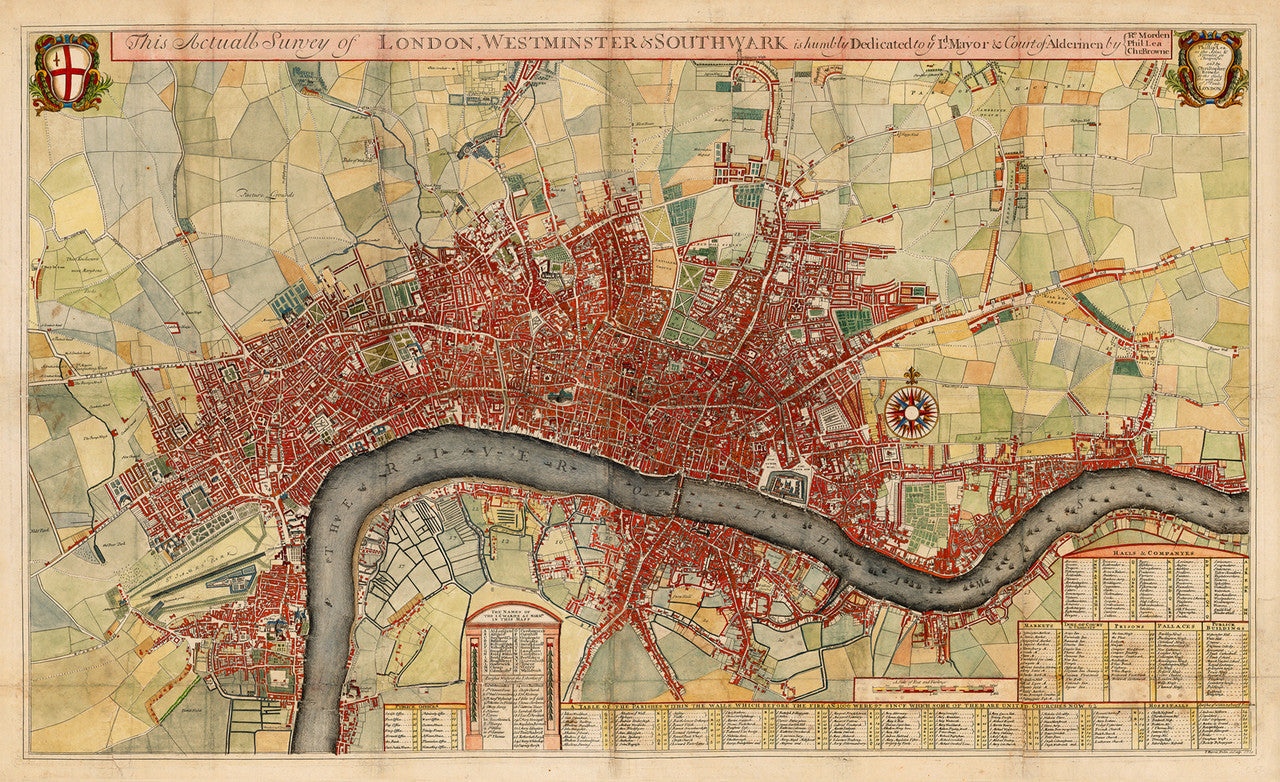


Large-format city plan of London, showing the city shortly after the Great Fire of 1666, and somewhat based on the John Ogilby/William Morgan map of 1682. “This Actuall Survey of London, Westminster & Southwark...”, by Robert Morden, Philip Lea and Christopher Browne, depicts in great detail streets, palaces and public buildings. The detailed plan also includes tables with wards, parishes, and public offices. It is beautifully engraved and hand colored. The current copy is carefully recreated on the finest quality cotton fine art paper.
• Antique map of the City of London, ca. 1700, Morden, Lea & Browne
• Title: This Actuall Survey of London, Westminster & Southwark...
• Fine Art Premium Giclée (Gouttelette) Print (100% cotton 340 gsm fine art paper)
• Made in USA