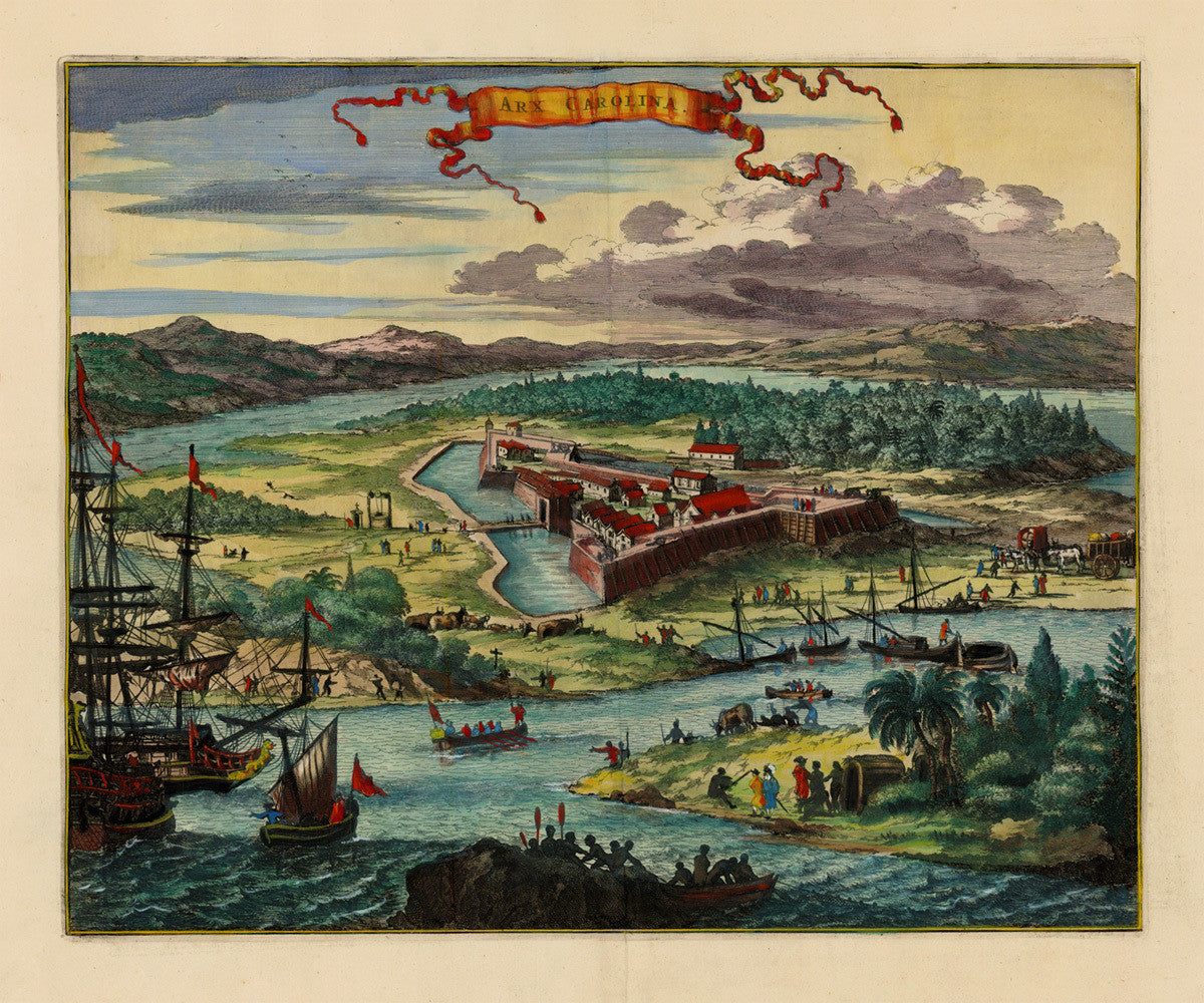
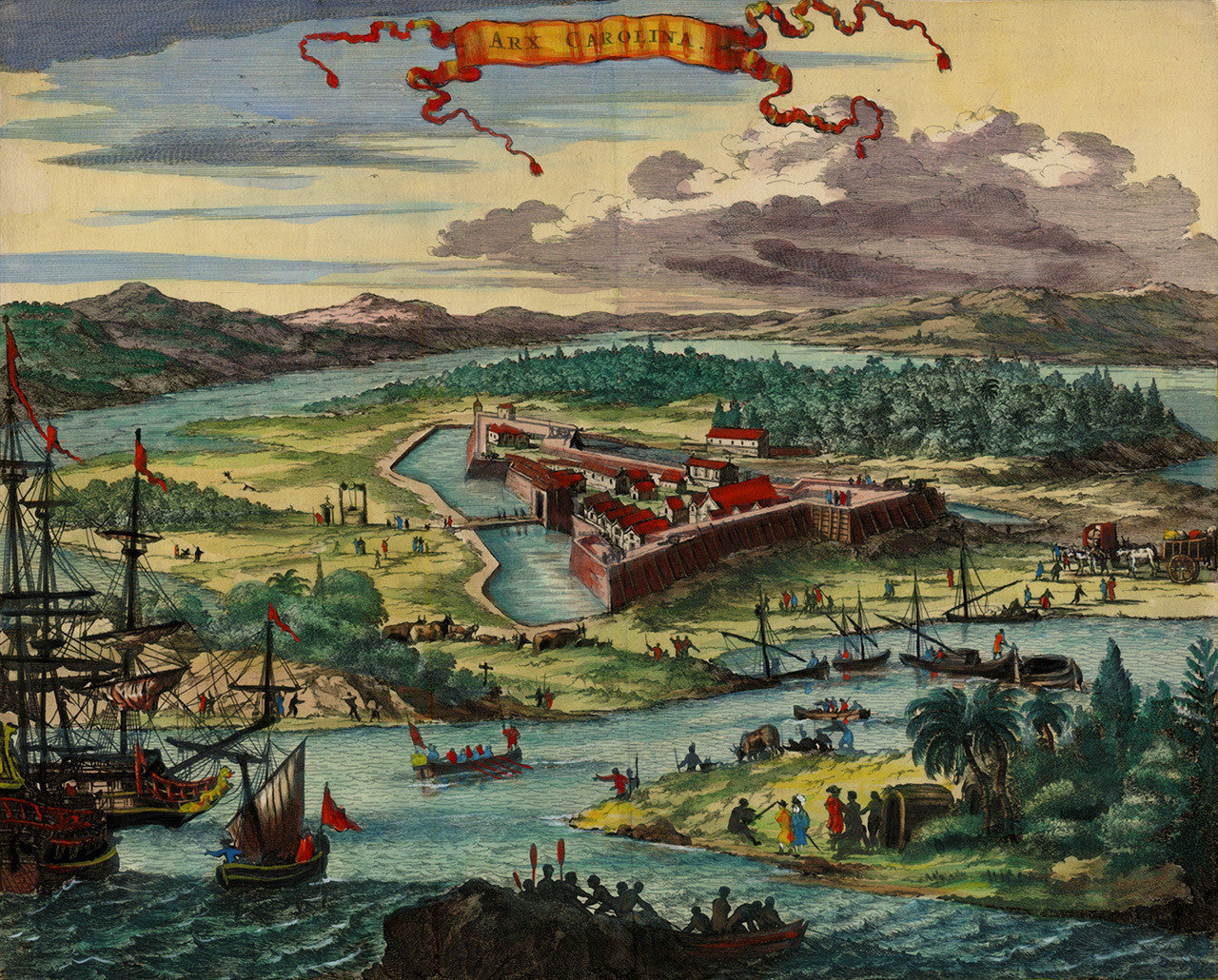
, Arx Carolina, Florida, View "Pin It")
A seventeenth-century illustration of Fort Caroline, at the mouth of the River of May (St. Johns River), in what is today Jacksonville, Florida. The illustration was part of John Ogilby’s 1671 English edition of Arnold Montanus’ book America: Being the Latest, and Most Accurate Description of the New World… (De Nieuwe en Onbekende Weereld). In his rendering of Arx Carolina, Montanus was clearly influenced by the descriptions and engravings by Theodor de Bry, (based on Jacques le Moyne’s firsthand stories, drawings and watercolors), in his Brevis Narratio, published in 1591. (Please, see last slide for reference.)
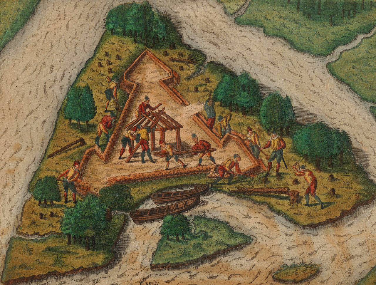
Fort Caroline (or Fort de la Caroline), was built in 1564 by Hugenots as the second French attempt to establish a colony on the Atlantic coast. The fort was destroyed a year later by the Spanish in what became known as the 1565 Massacre (at Matanzas Inlet and Fort Caroline). The Montanus-Ogilby illustration Arx Carolina is a somewhat idealized view of the triangular-shaped fort. The well protected fort itself is surrounded by a moat, while the nearby countryside is buzzing with trade and daily activities. Native Timucua (Saturiwa) people, colonists and cattle are scattered all around the river banks, while the harbor is filled with boats and ships.
• Arx Carolina, a view of Fort Caroline (present-day Jacksonville, Florida) in 1564, Montanus/Ogilby, 1671
• Fine Art Premium Giclée (Gouttelette) Print (100% cotton 340 gsm textured fine art paper)
• Made in USA