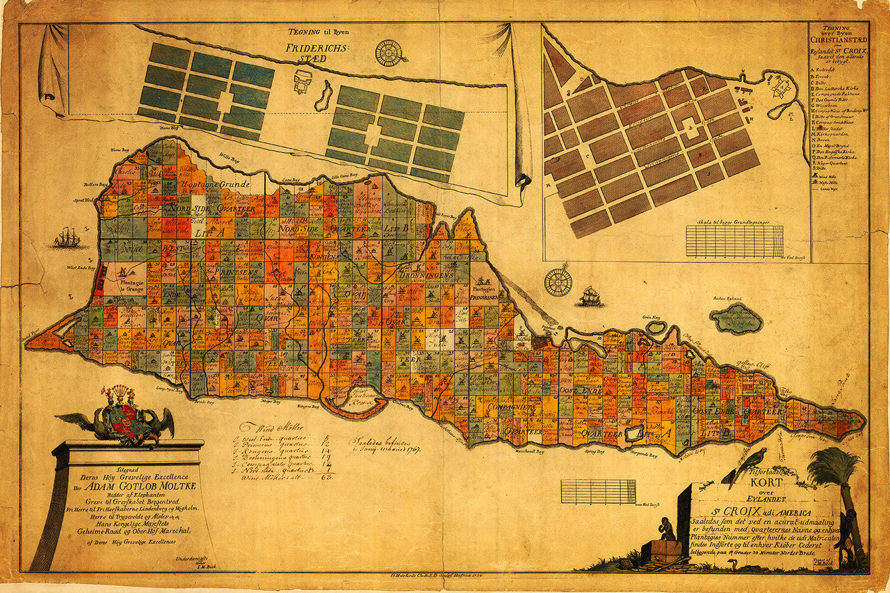
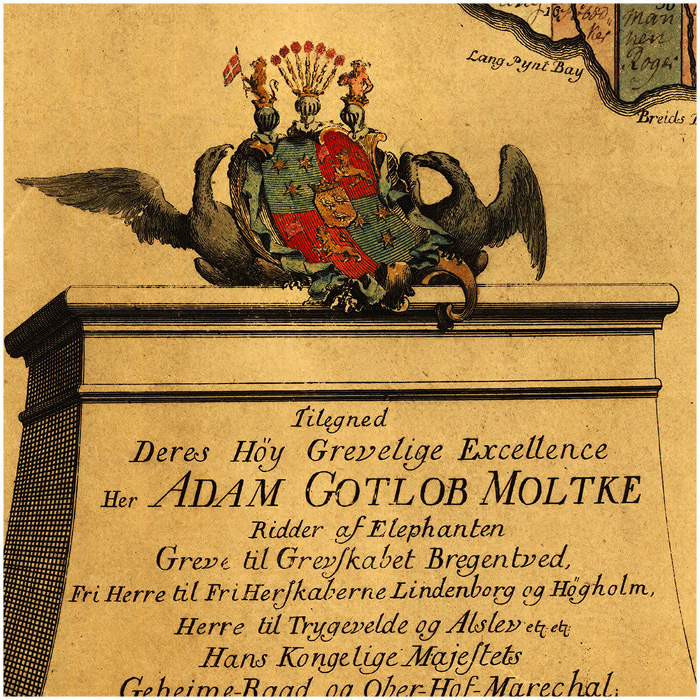
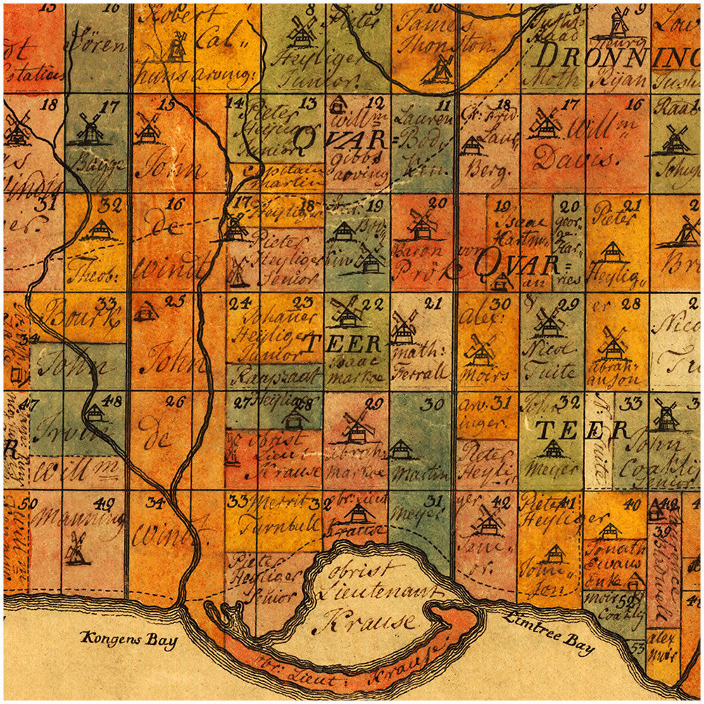
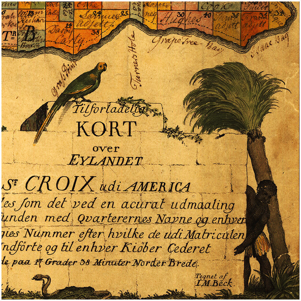
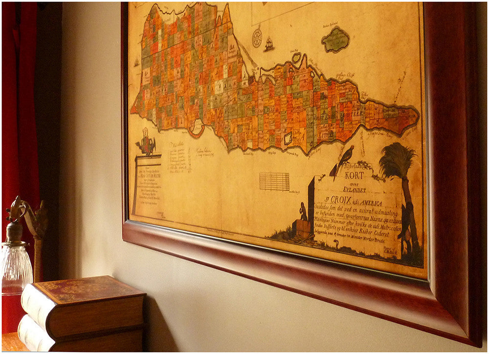

An 18th-century antique plan/map of the island of Saint Croix. For nearly 200 years the now U.S. Virgin Islands of St. Croix, St. John, and St. Thomas were Danish Crown holdings, known as the Danish West Indies (Dansk Vestindien) or Danish Antilles. This cadastral map shows land owners on the island up to 1767, (handwritten notes in pen-and-ink in the lower middle), including plans of the towns of Frederiksted (Friderichsstæd) and Christiansted (Christianstæd). A beautiful cartouche in the lower left corner reads in Danish: “Dedicated to His Excellency, Lord Chamberlain Count Adam Gotlob (Gottlob) Moltke, Rider of Elephants…”; created and published by Danish cartographer I. M. Beck in 1754.
• Old map of St. Croix, Virgin Islands (USVI), ca. 1754, with insets of Christiansted & Frederiksted
• Fine Art Premium Giclée (Gouttelette) Print (100% cotton 340 gsm fine art paper)
• Made in USA