 "Pin It")
Halifax at its Birth
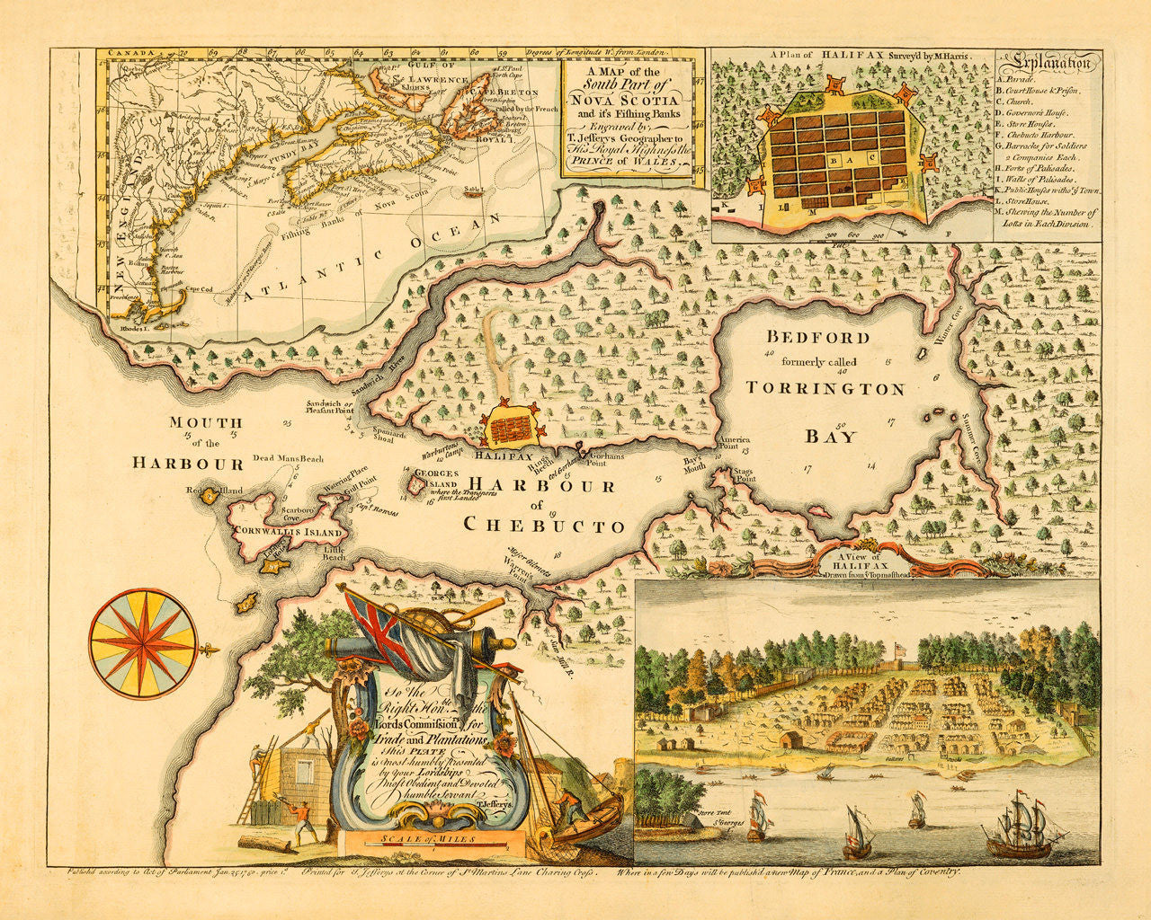
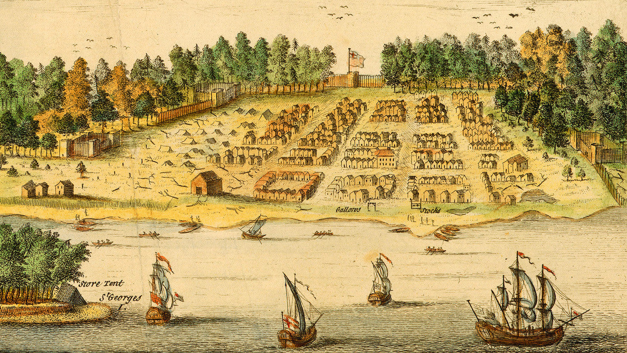
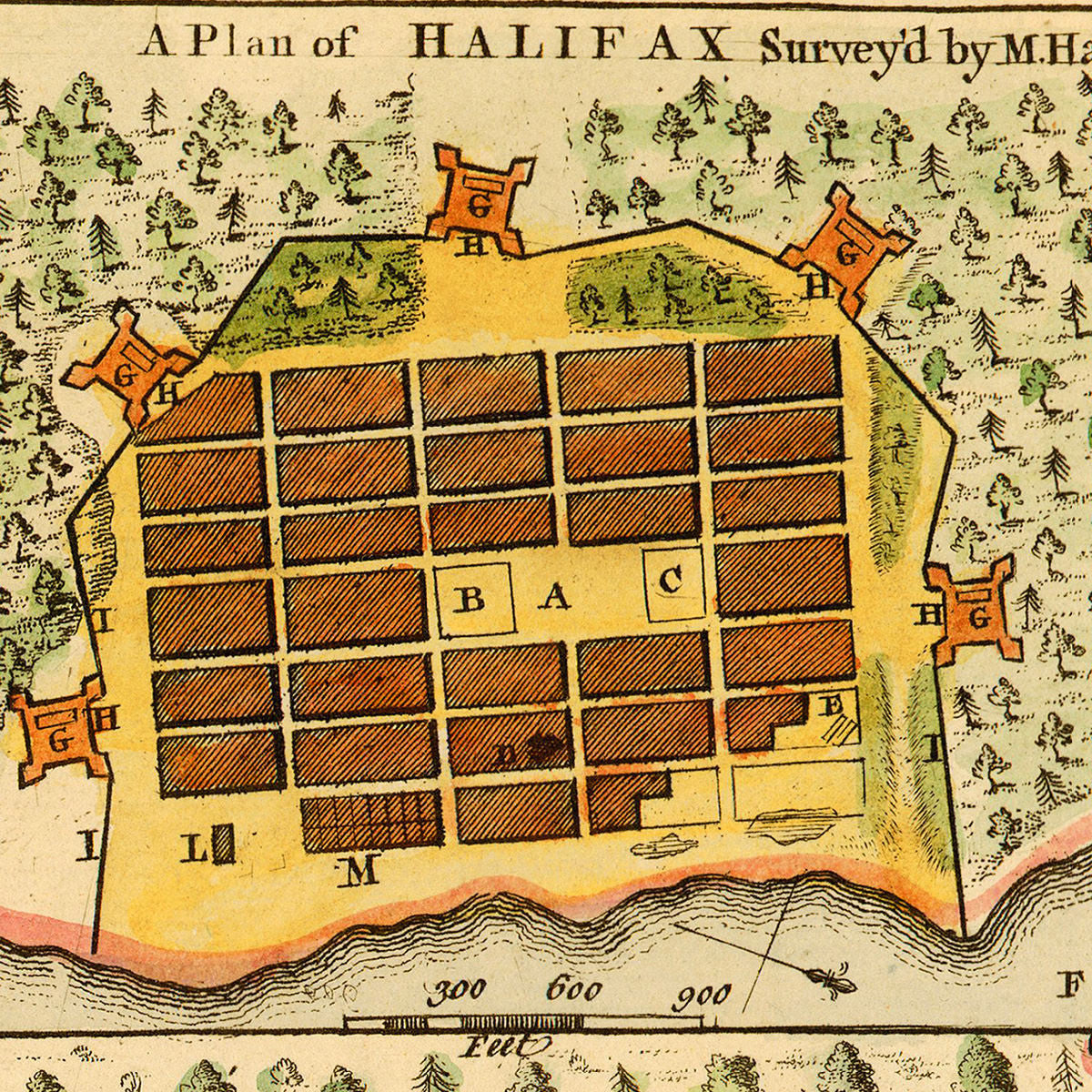
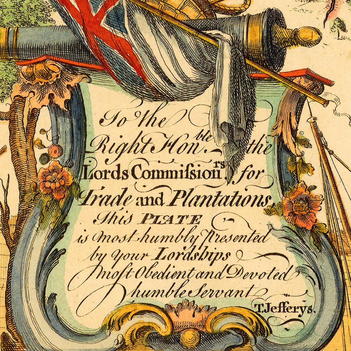
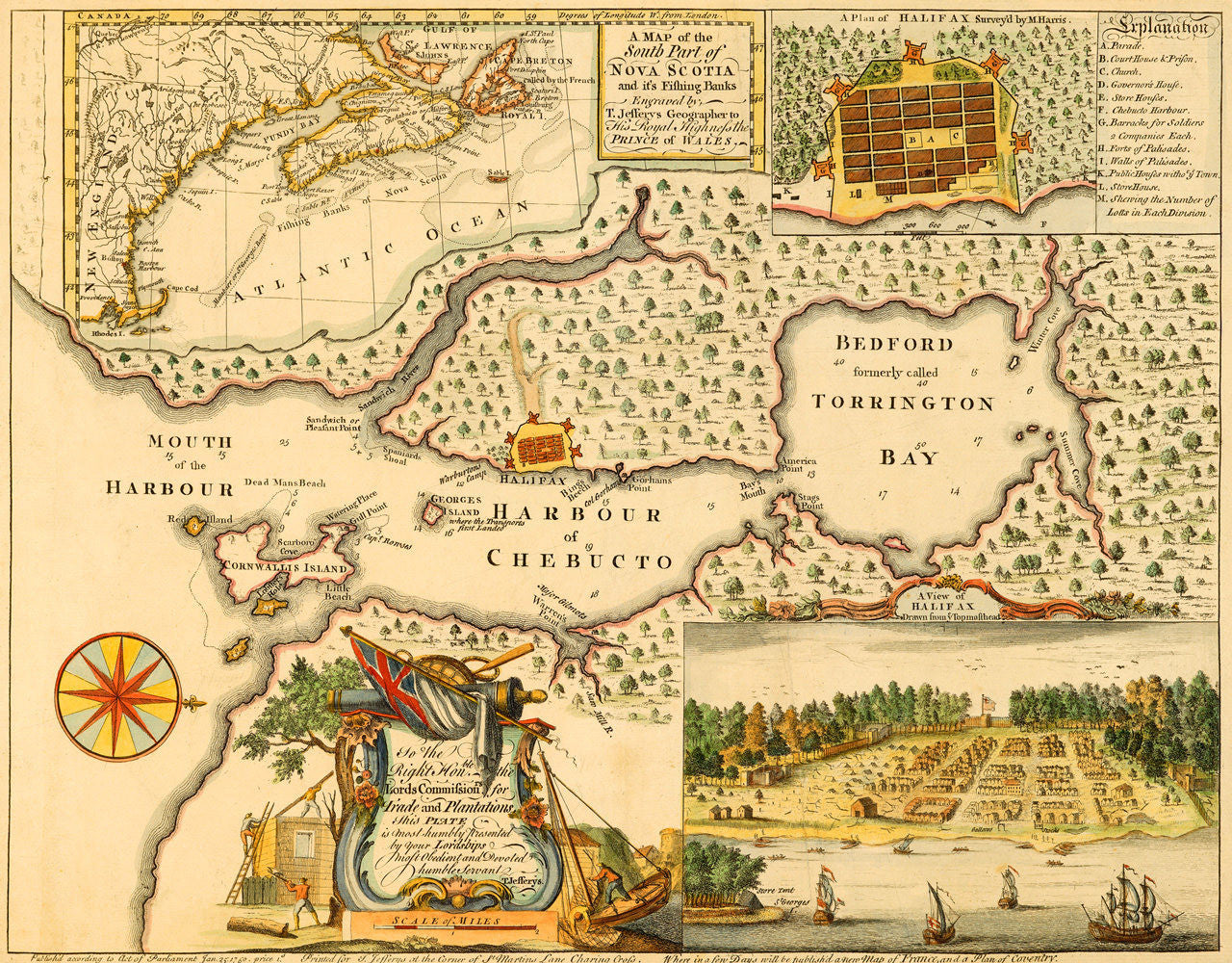
An attractive 1750 map of Halifax, Nova Scotia, showing the town shortly after its founding. The Town of Halifax was settled by the British on June 21, 1749, only seven months before this map’s publication. The map consists of four distinct cartographic images and a decorative cartouche. In the top left corner a vignetted map, (taken from Jean-Baptiste Bourguignon d’Anville’s 1746 Amérique Septentrionale), shows Nova Scotia (formerly Acadia) in its entirety, and the Atlantic coastline of northeastern North America — from Cape Breton and Prince Edward Island to Cape Cod and Rhode Island (Rhodes I.). The top right corner is occupied by a plan of Halifax, surveyed and drawn by Moses Harris, and an inset “Explanation” key with itemized descriptions of the shown locations. The main and central part of the layout is allotted to a detailed chart of the Halifax Harbour with soundings, showing the “Mouth of the Harbour”, “Cornwallis Island” (McNabs Island), “Harbour of Chebucto” and “Bedford, formerly called Torrington Bay”(Bedford Basin). The harbor map/chart is oriented with SW at the top. The lower left area is occupied by a windrose and a beautifully drawn and engraved cartouche, featuring the Union Jack, a cannon, oar, rope, and men building a fort and mending fishing nets. A view in the lower right corner depicts the newly founded settlement of Halifax in the Citadel Hill area, as seen from “the top masthead” of a ship. Below the neatline the lower margin bears Thomas Jeferys’ signature sign-off: “Printed for T. Jefferys at the Corner of St Martins Lane Charing Cross”. In the margin Jefferys included a curious advertisement of his upcoming work: “Where in a few Days will be publish’d a new Map of France, and a Plan of Coventry.” Another oddity found in this otherwise beautifully crafted map, is the misspelling of “its” in the main title, which in itself is a testament to the current edition’s expedience and its precedence over proofreading. (This map is also available uncolored.)
Map Title: A Map of the South Part of Nova Scotia and it’s Fishing Banks Engraved by T. Jefferys Geographer to His Royal Highness the Prince of Wales
PlanTitle: A Plan of Halifax Survey’d by M. Harris
View Title: A View of Halifax Drawn from ye Topmasthead
Inscription in Cartouche: To the Right Hon.ble the Lords Commission.rs for Trade and Plantations. This Plate is most Humbly Presented by Your Lordships Most Obedient and Devoted humble Servant T. Jefferys
• Plan of Halifax, View of Halifax, Map of Nova Scotia, 1750, Moses Harris, D’Anville, Thomas Jefferys
• Fine Art Premium Giclée (Gouttelette) Print (100% cotton 340 gsm fine art paper)
• Made in USA