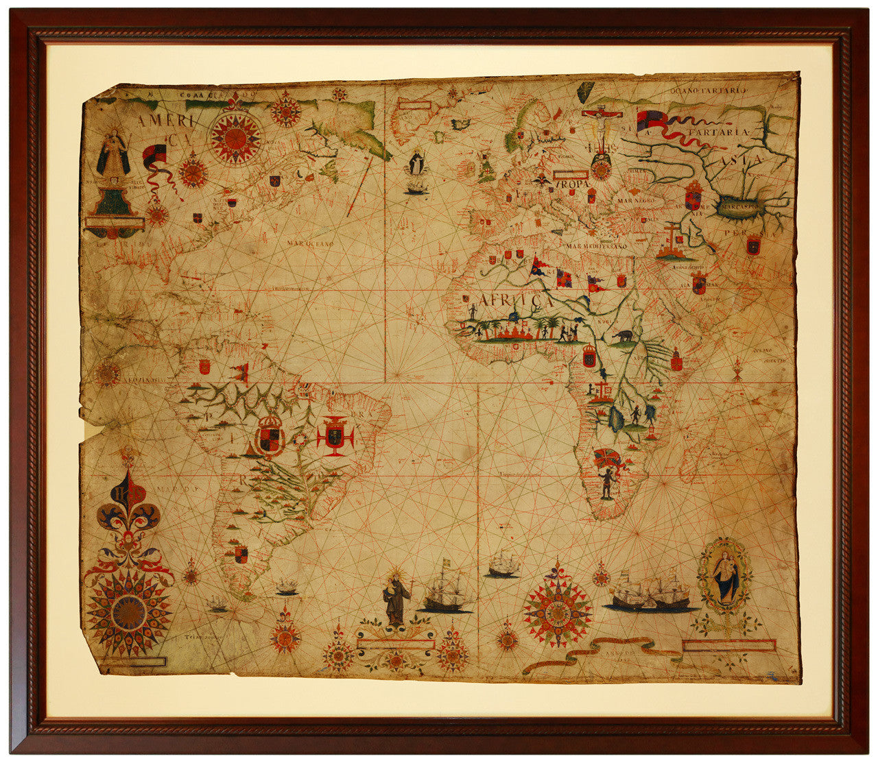
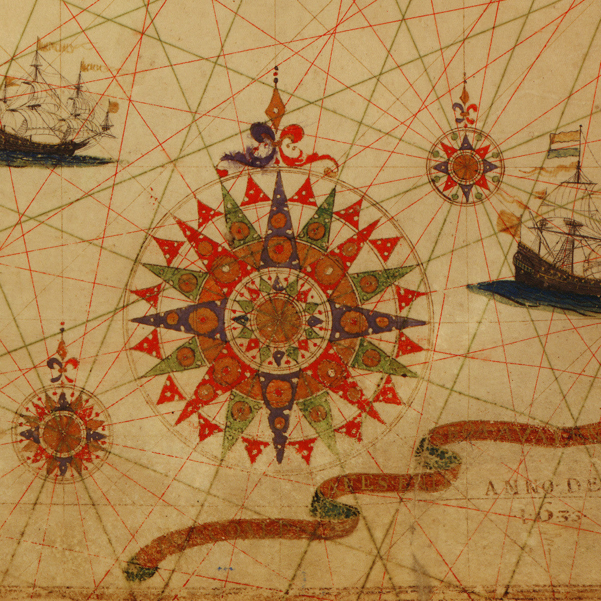
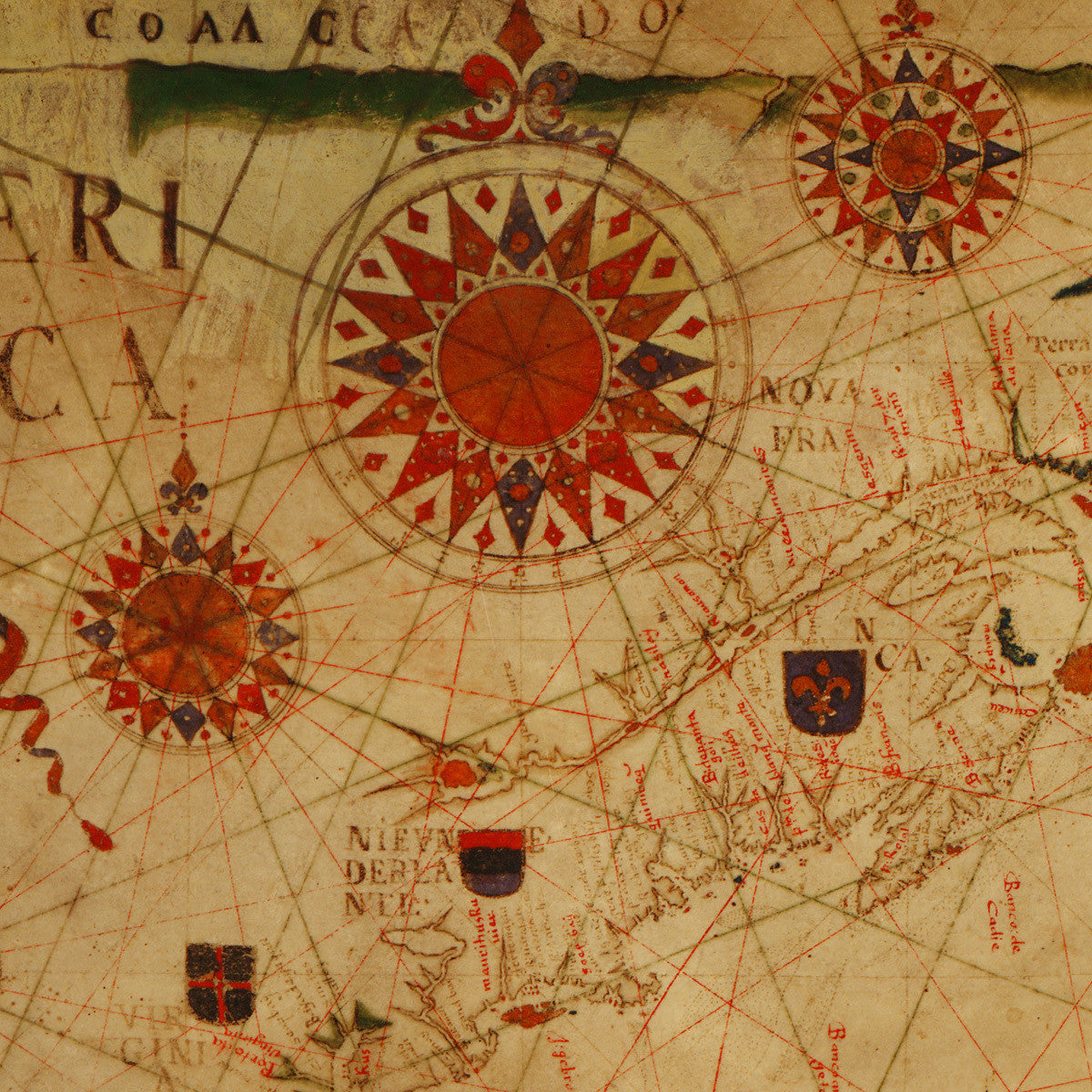
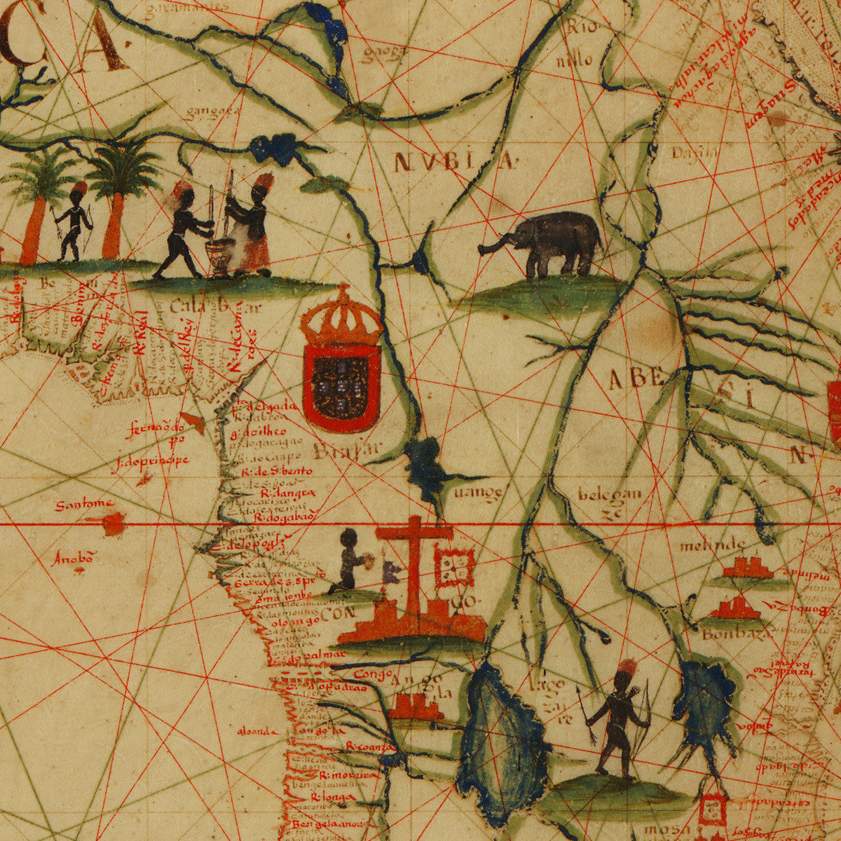
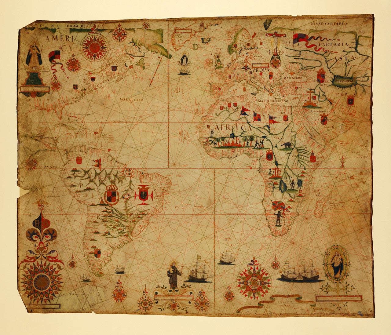

A spectacular portolan chart of the Atlantic Ocean, including North and South America, Africa, Europe, and part of the Indian Ocean, drawn on vellum in 1633. The author, Pascoal (Pascual) Roiz, was a Portuguese cartographer and portolan maker from Lisbon, who was active in the 17th century. The map contains beautiful illustrations and numerous elaborate compass roses. It also features a crucifix towering between Poland and Russia, a floating ‘Corpo Santo’ in the North Atlantic, Santo Antonio (Saint Anthony of Padua) holding the infant Jesus, and two separate vignettes of the Virgin Mary. The first one is in North America with an inscription “N S DA NATEVIDADE”, which stands for Nossa Senhora da Natevidade/Natividade (Our Lady of the Nativity). The second one is in the opposite corner of the map with the Blessed Virgin seemingly watching over Cabo da Boa Esperança (Cape Good Hope) — a crucial point for Portuguese navigation. A motto banner in the bottom right corner envelops the year “Anno de 1633”. The banner itself has a faded gold-leaf inscription, which possibly reads: “PASCOAL ROIZ A FES EN LISBOA A VALENTIN DE REVOADE…”. The original chart is kept at the Library of Congress in Washington, D.C. (Shown frame is not included.)
• Antique portolan chart of the Atlantic Ocean with the adjacent continents, 1633, Pascoal Roiz
• Fine Art Premium Giclée (Gouttelette) Print (100% cotton 340 gsm fine art paper)
• Made in USA