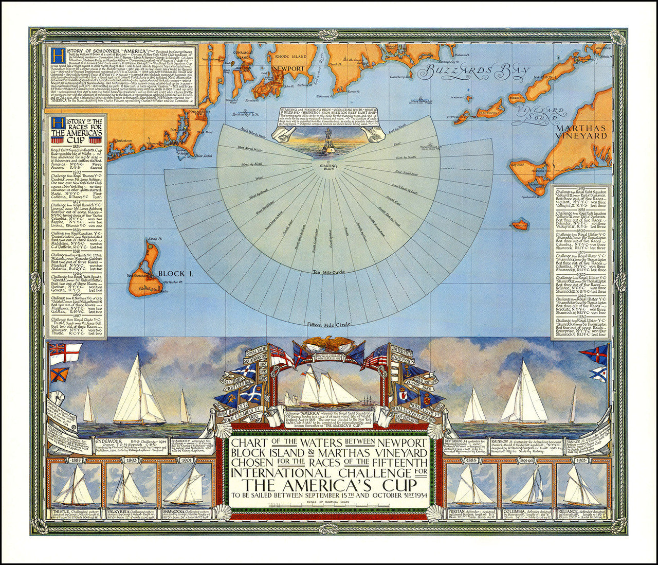

Pictorial chart of the America’s Cup from its Fifteenth International Sailing Challenge held in 1934 in New England, between Martha’s Vineyard, Massachusetts, and Block Island, Rhode Island. The map contains insets with history of the races and winning vessels since 1851. It was designed and drawn by Earnest Clegg. Full title reads: Chart of the Waters between Newport Block Island & Marthas Vineyard Chosen for the Races of the Fifteenth International Challenge for the America’s Cup to be Sailed between September 15th and October 31st 1934.
• Pre-WWII vintage chart of the America’s Cup sailing races held off Martha’s Vineyard in 1934
• Fine Art Premium Giclée (Gouttelette) Print (100% cotton 340 gsm textured fine art paper)
• Made in USA
Customer Reviews
No reviews yet
Write a review