

Tripoli, 1804, Battle of Tripoli Harbor, Barbary Wars, US Navy, USMC, Plan & View
Brand: Battlemaps.us

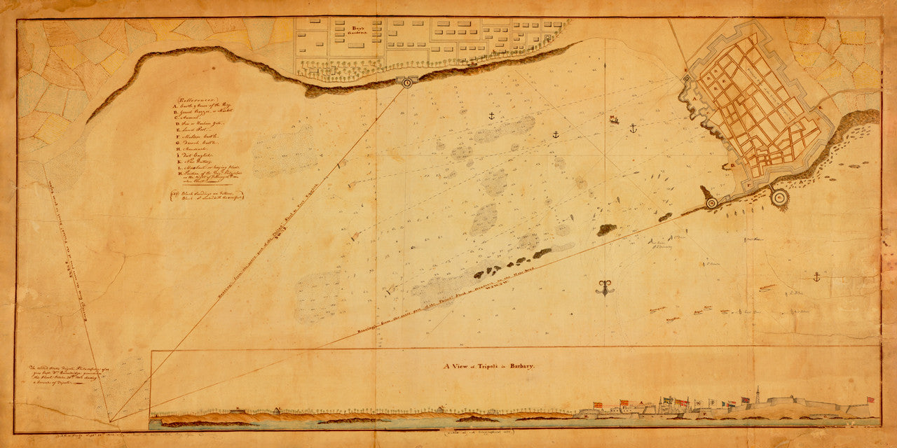
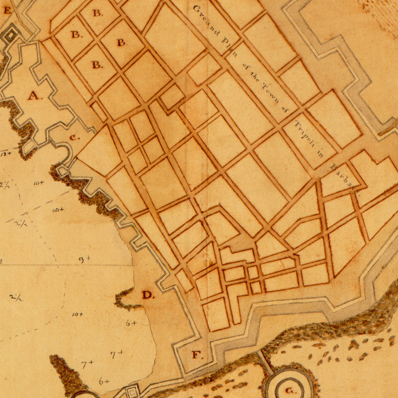
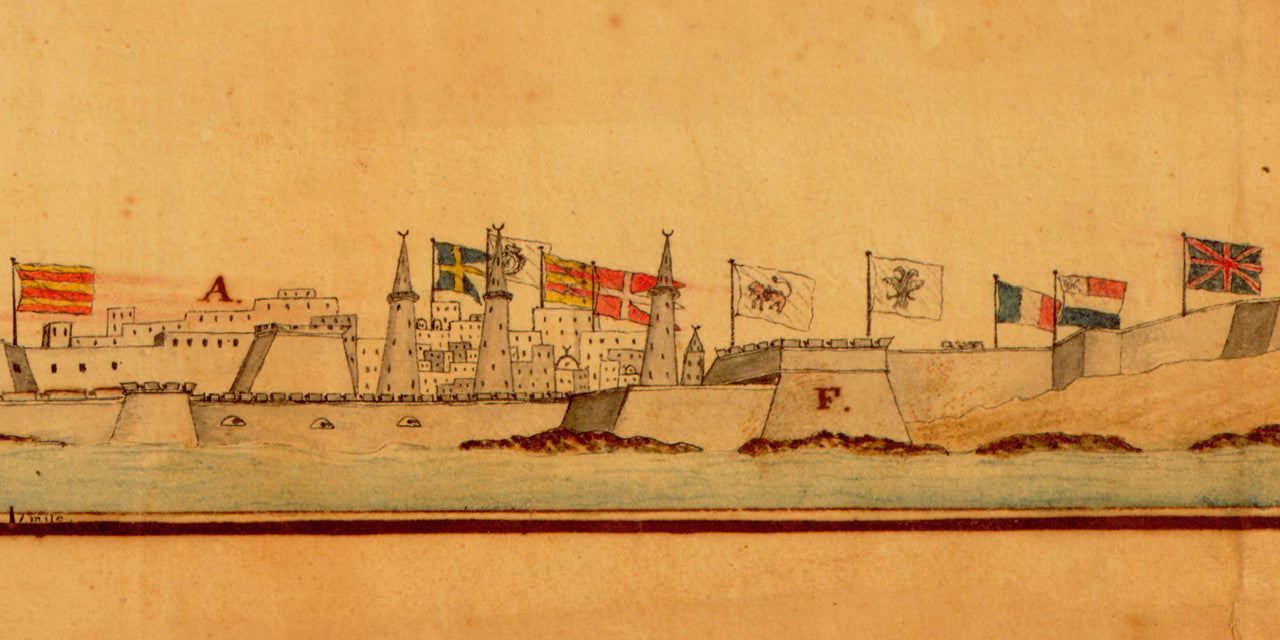
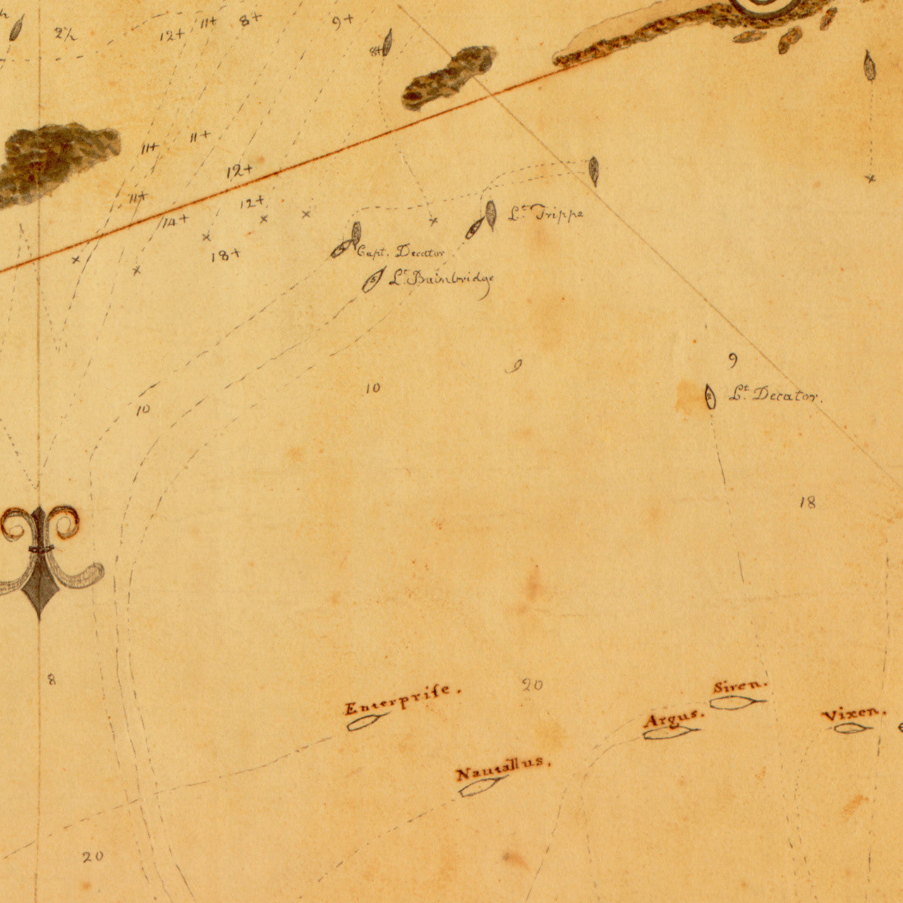
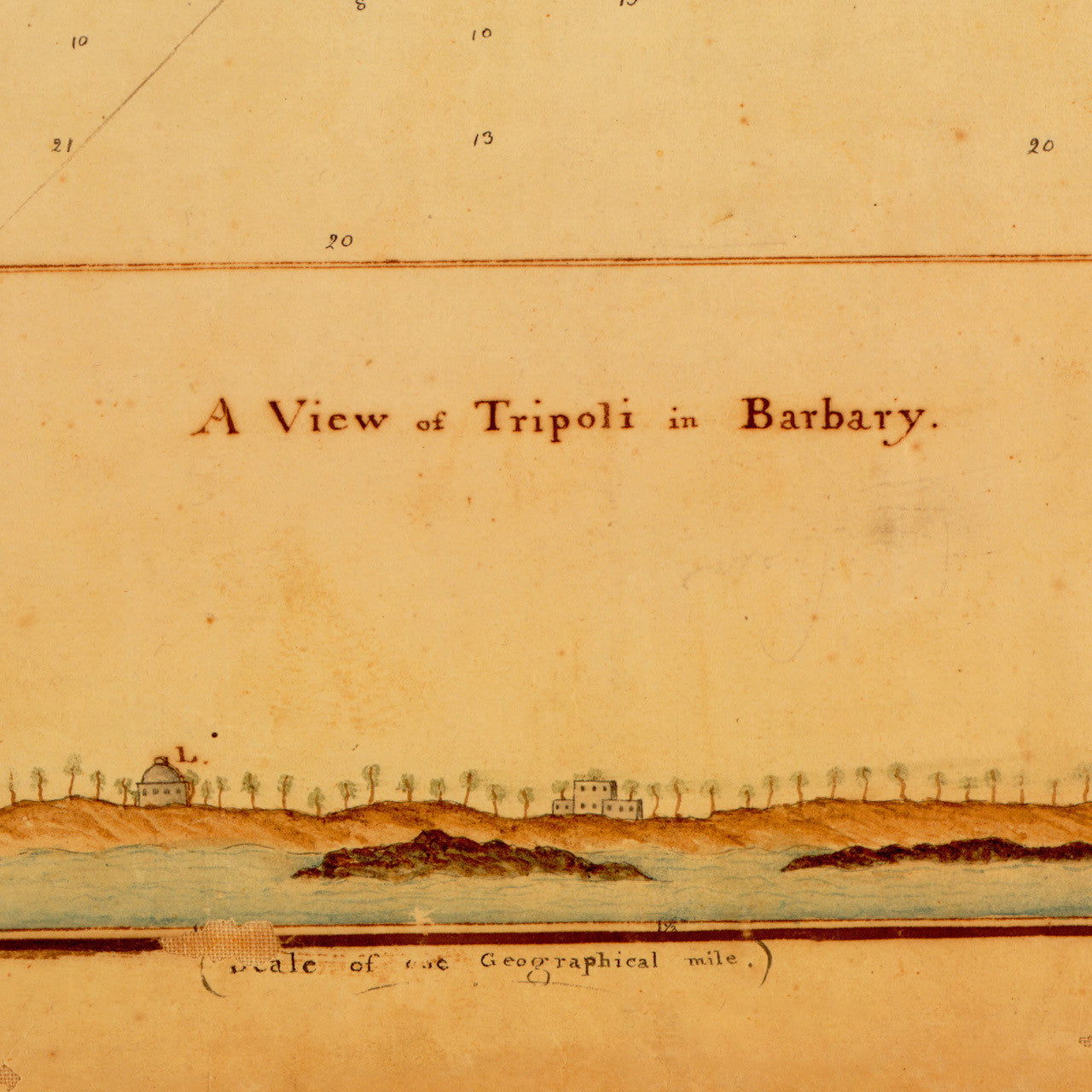
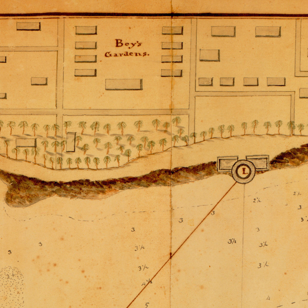
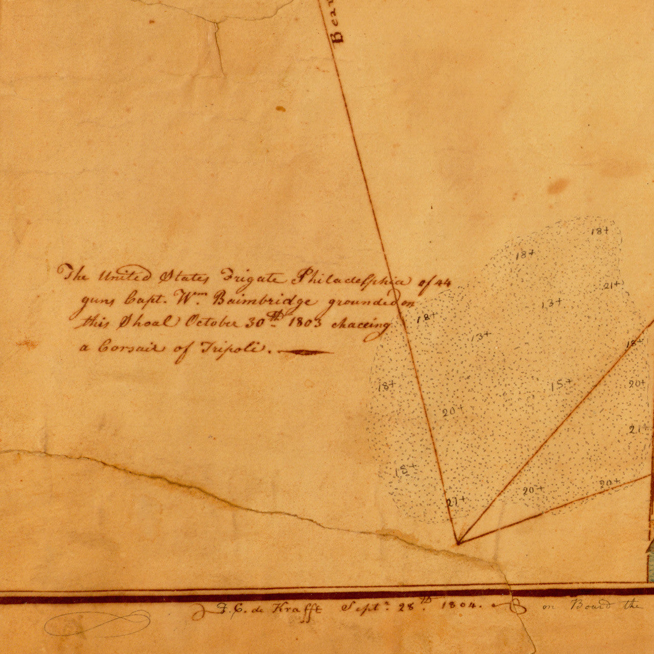
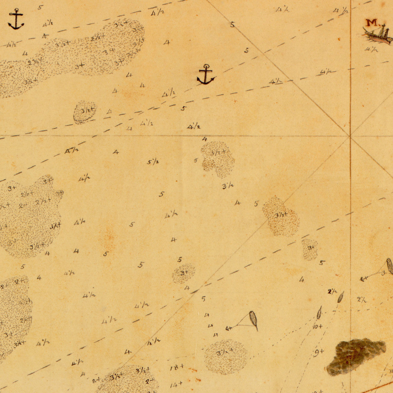
A very detailed, large manuscript map, containing a plan of the town and harbor of Tripoli, Libya (then Ottoman Tripolitania), in 1804. The map depicts the Second Battle of Tripoli Harbor during the Barbary Wars. It shows fortifications, navigational markings, events, views, and positions of vessels and maneuvers of the American naval blockade. The United States government had dispatched its Naval Mediterranean Squadron with a contingent of U.S. Marines, to deal with the Barbary piracy issue, pestering its merchant ships in the region. The map was hand drawn and signed by, “F. C. de Krafft, Sept. 28th 1804, on Board the United States Brig Syren”. Other inscriptions include: “A View of Tripoli in Barbary”; “The United States Frigate Philadelphia of 44 guns Capt. Wm. Baimbridge [Bainbridge] grounded on this Shoal October 30th 1803 chaceing a Corsair of Tripoli”; a map key with references, etc.
• Plan & View of the Town and Harbor of Tripoli, 1804, Battle of Tripoli Harbor, First Barbary War
• Fine Art Premium Giclée (Gouttelette) Print (100% cotton 340 gsm textured fine art paper)
• Made in USA