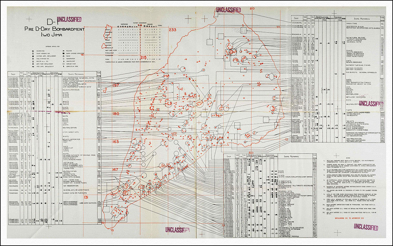
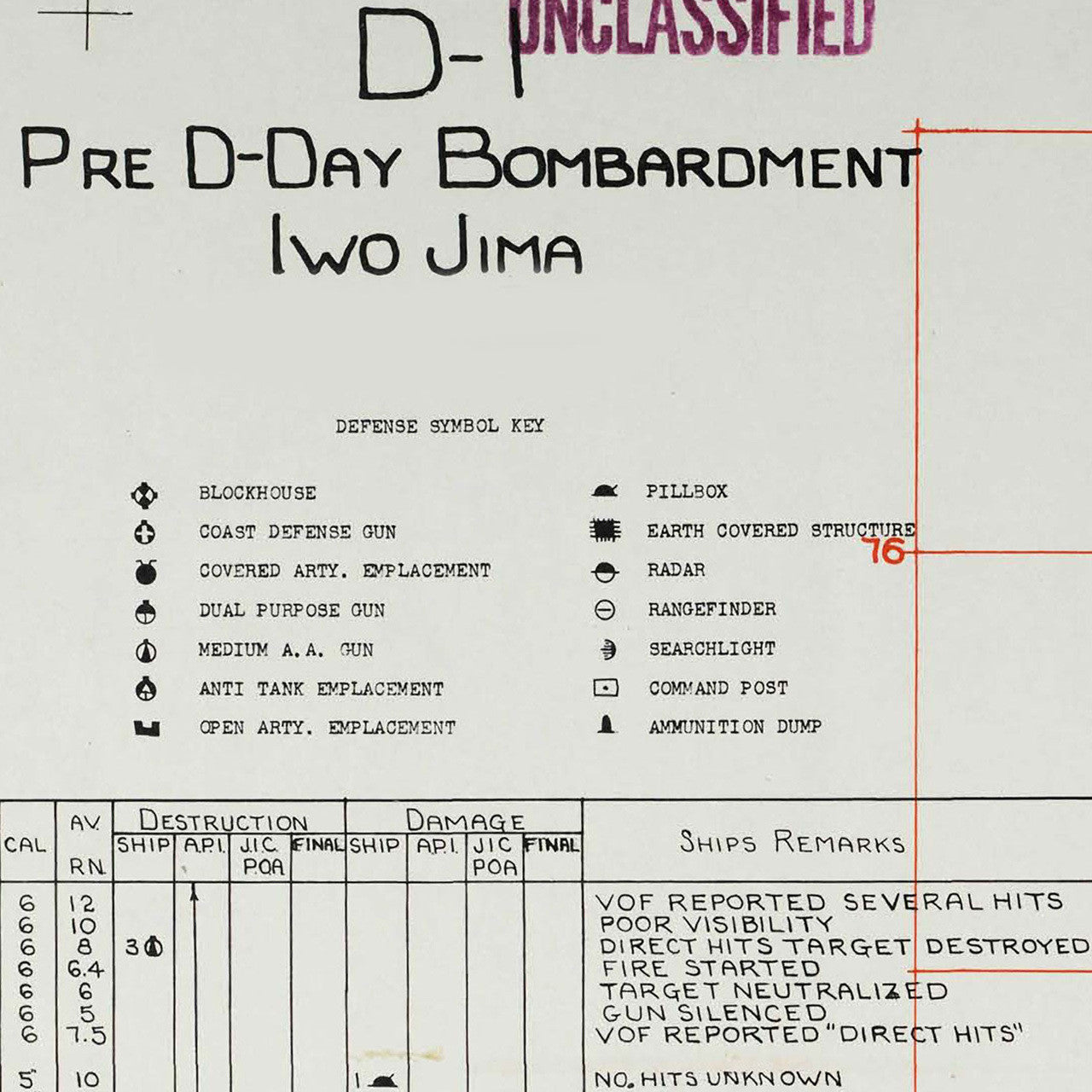
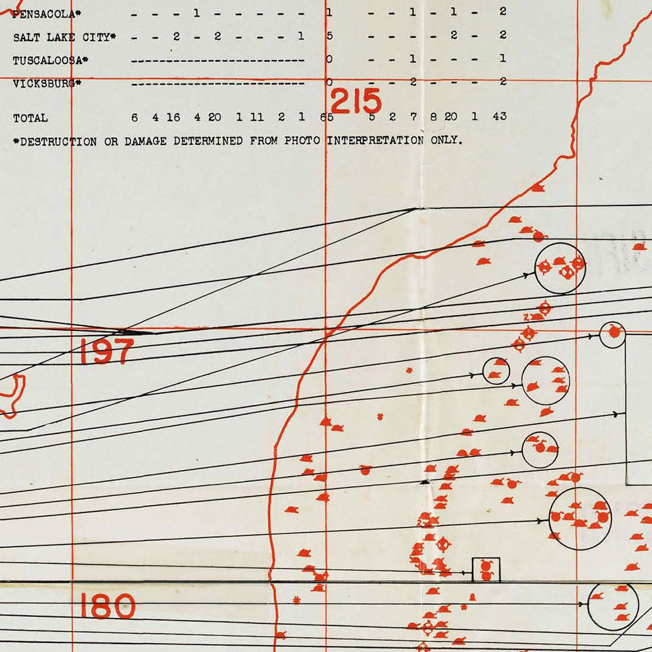
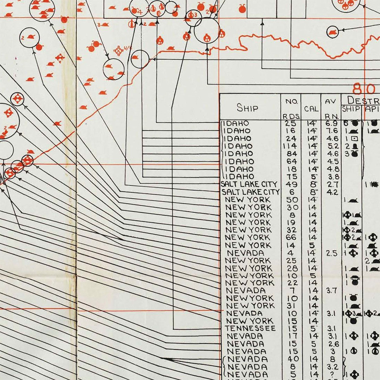
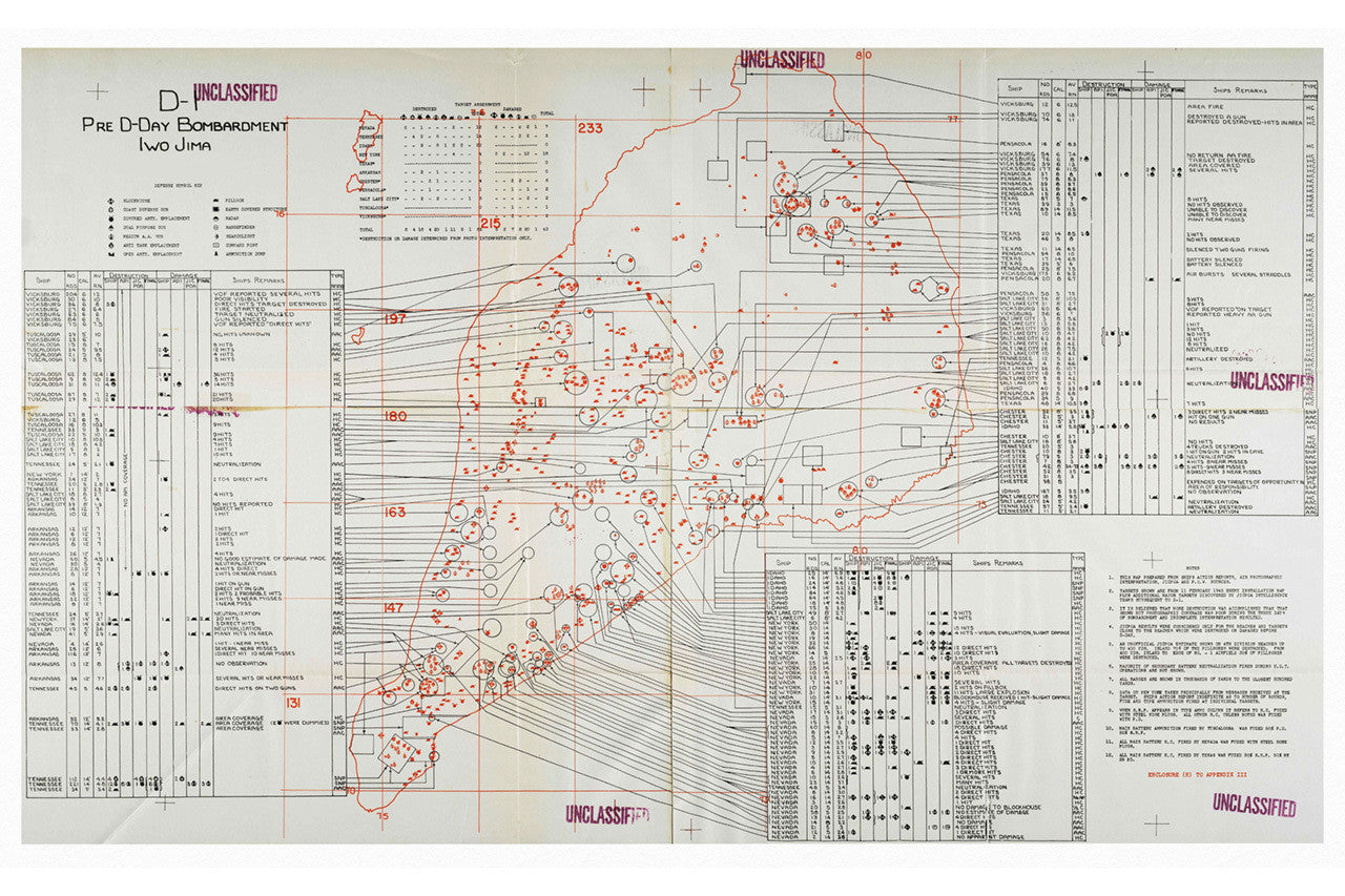

A bombardment force consisting of six battleships, four heavy cruisers and one light cruiser shelled Iwo Jima for three days straight, on February 16 — 18, 1945. This map depicts the gunnery plan on D-1 with effects of the naval gunfire annotated. Concerned that the preceding bombardments were not reducing the Japanese defenses, the Commander of Amphibious Group One approved a new plan, focusing on the landing beaches. The commander directed the ships delivering the fire to close the range as early as practicable, and to execute maximum destruction. On the map, Iwo Jima is annotated with Japanese fortifications and the ships assigned to service them. Tables list ship, caliber of weapons, range to target, target destroyed or damaged, remarks, and type of ammo used. From the ‘Notes’ section of the map: “…The map was prepared from ship action reports, air photographic interpretation, JICPOA (Joint Intelligence Center Pacific Ocean Area) and P.O.W. sources…” This map is a must-have for any student of naval support to amphibious landings.
• WWII Naval Gunnery Plan of Iwo Jima, Japan, prepared for the U.S. Pacific Command in 1945
• Premium Giclée Print (Ultra Premium Presentation Enhanced Matte Paper)
• Made in USA