Chesapeake Bay, 1778, Virginia, Maryland, French Navy Revolutionary War Chart
Brand: Battlemaps.us

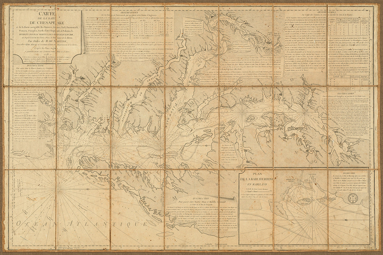
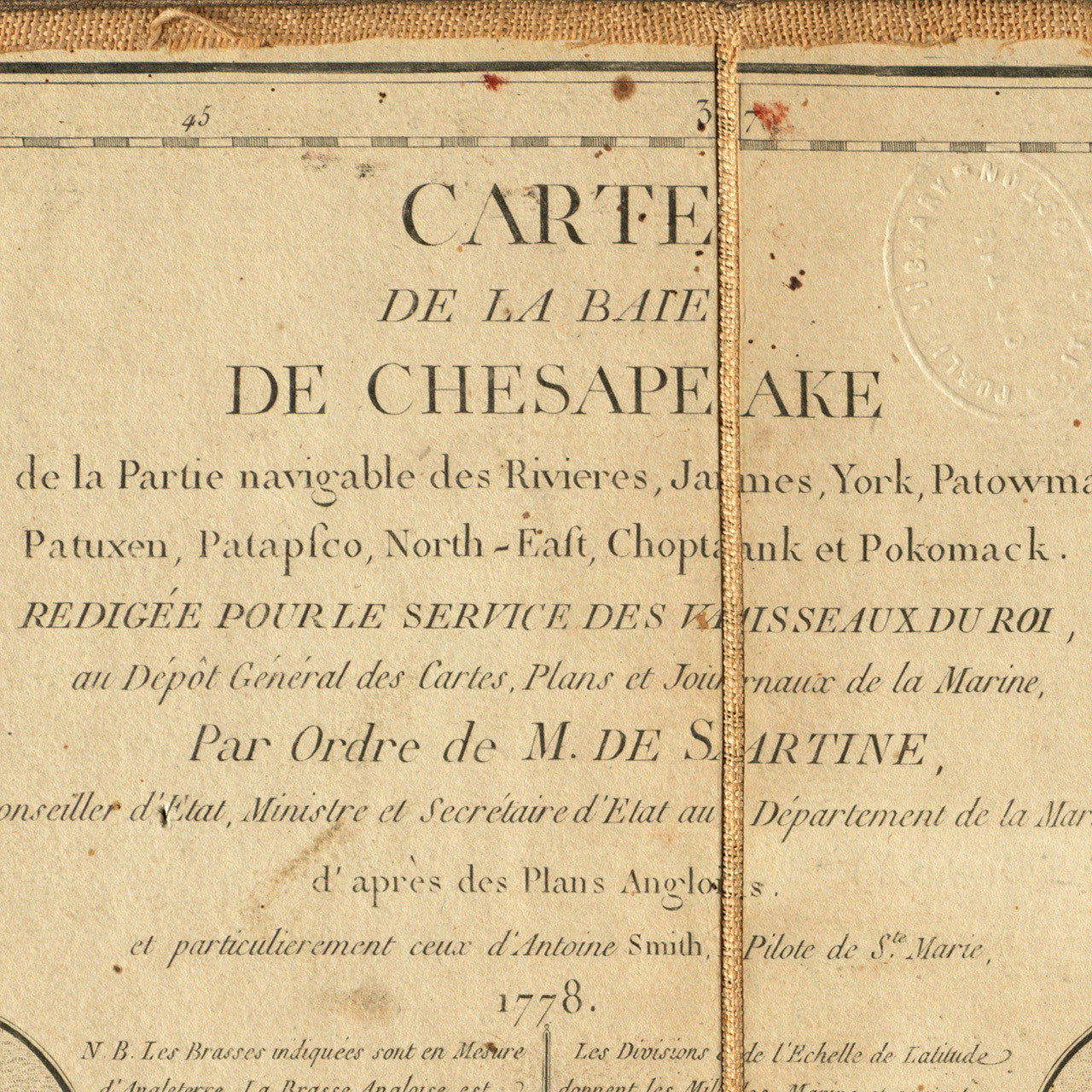
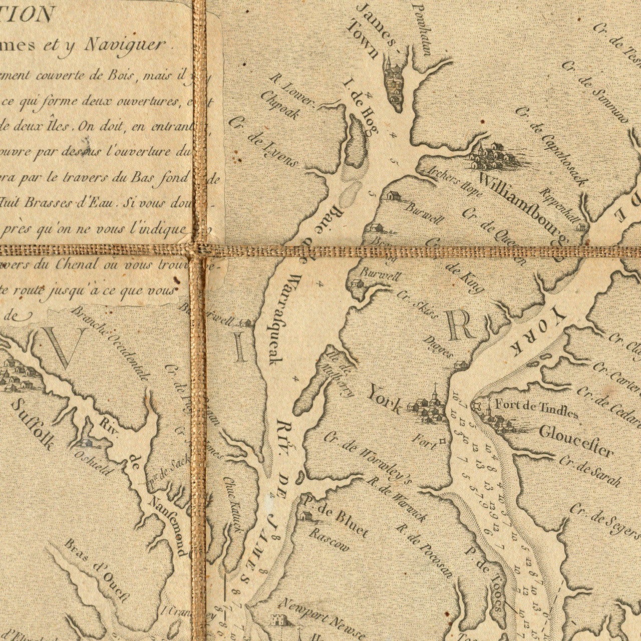
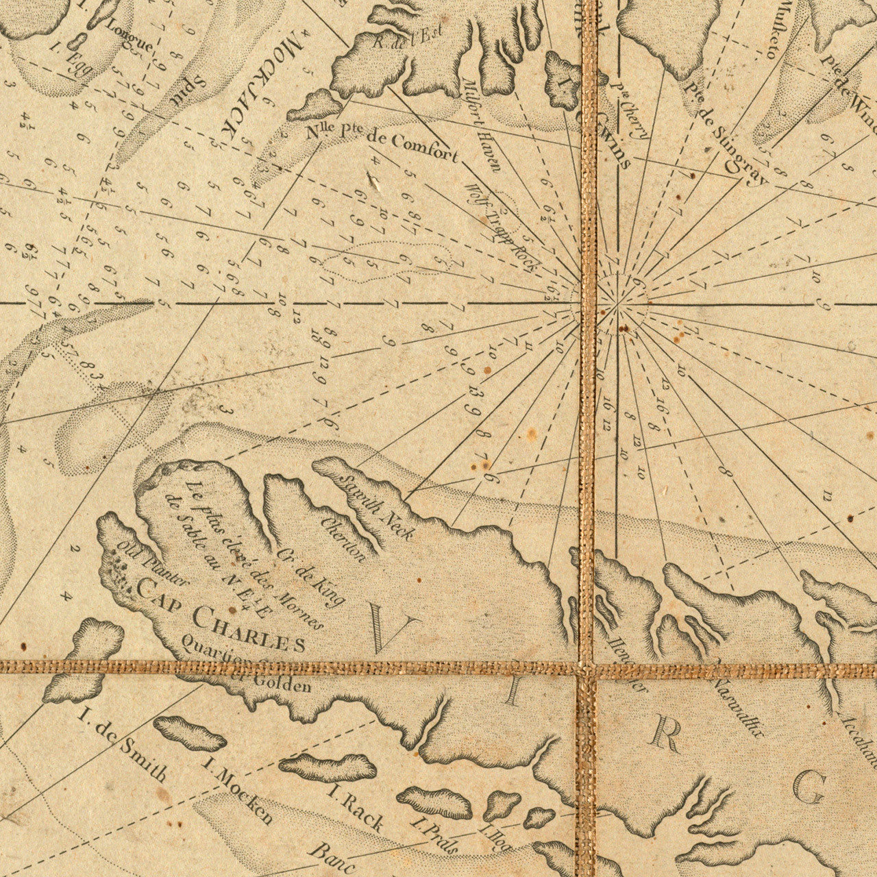
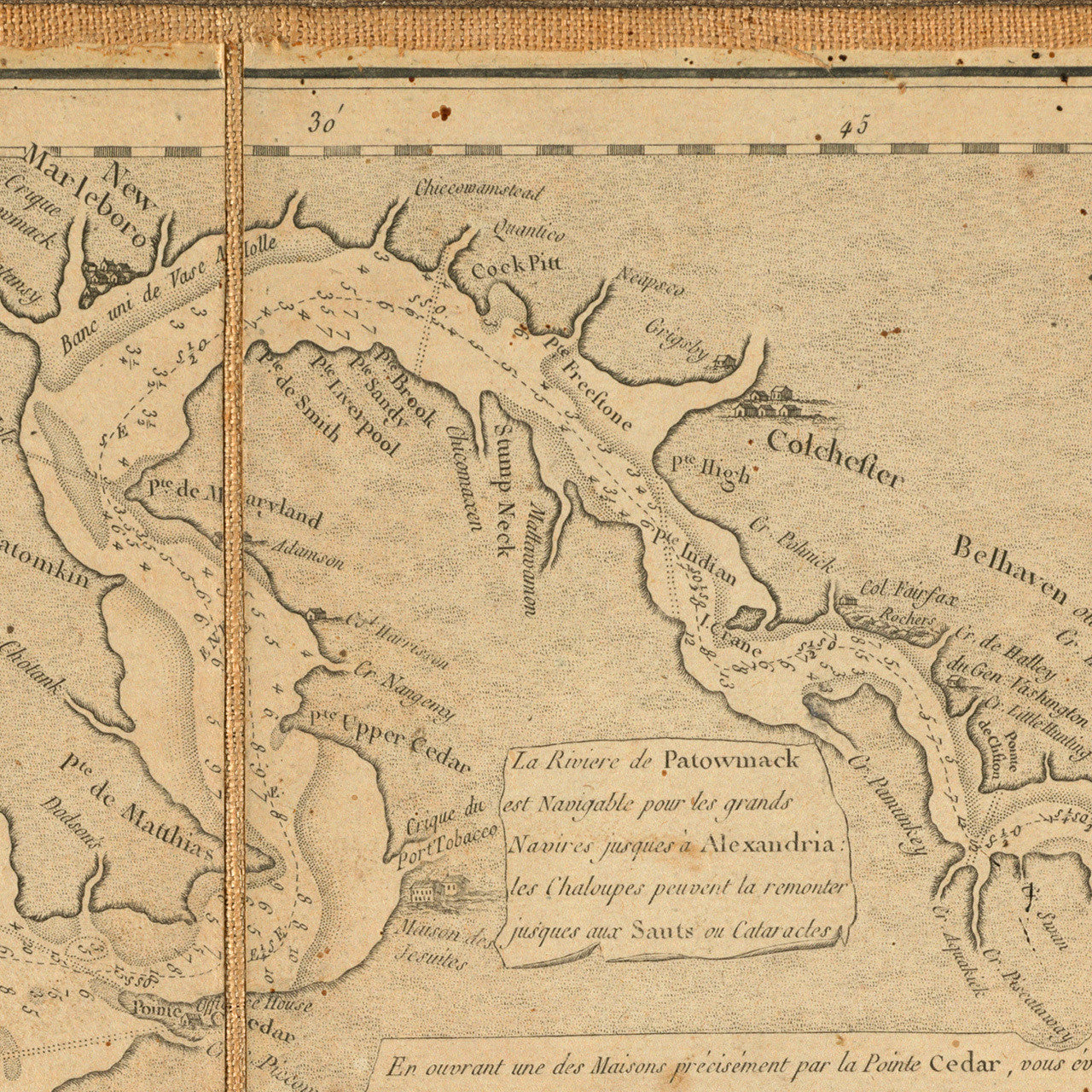
French naval chart of the Chesapeake Bay, designed specifically for use by the French Navy during the American Revolution. The map was published in Paris by Georges Louis Le Rouge for Depôt de la Marine, after Anthony Smith’s extremely accurate and important 1776 chart of the Chesapeake. Anthony Smith was a pilot based out of St. Mary’s, Maryland. The French edition contains additions relevant to the war.
Title EN: A New and Accurate Chart of the Bay of Chesapeake, with all the Shoals, Channels, Islands, Entrances, Soundings and Sailing-marks, as far as the Navigable Part of the Rivers Patowmack, Patapsco and North-east. Drawn from Several Draughts Made by the Most Experienced Navigators, Chiefly from those of Anthony Smith, Pilot of St. Marys and compared with the Modern Survey of Virginia and Maryland.
Title FR: Carte de la Baie de Chesapeake et de la partie navigable des rivières James, York, Patowmack, Patuxen, Patapsco, North-East, Choptank et Pokomack… Redigée pour le Service des Vaisseaux du Roi au Dépot Général des Cartes, Plans et Journaux de la Marine, d aprés des Plans Anglois, et particulierment ceux d'Antoine Smith, Pilote de Ste. Marie, 1778.
• French updated edition of Anthony Smith’s 1776 chart of the Chesapeake, Depot Générale de la Marine, 1778, Paris
• Fine Art Premium Giclée (Gouttelette) Print (100% cotton 340 gsm textured fine art paper)
• Made in USA