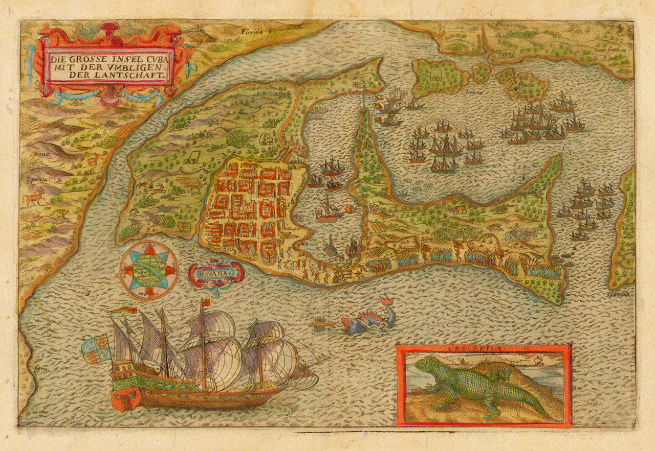

A late 16th-century manuscript map of Cuba, recounting Sir Francis Drake’s voyage to the island in April of 1586, on his way back to England and shortly before he reached the Roanoke colony. The map was printed in the book Franciscus Dracus Redivivus, published in Augsburg ca. 1596, and is reminiscent of Baptista Boazio’s (Giovanni Battista Boazio) 1589 view of Cartagena, Colombia, which details Drake’s 1585-86 expedition and subsequent raid of the city. The hand-drawn bird’s-eye view map is greatly distorted, with Peru, Florida, and the Carolinas practically surrounding Cuba. The map shows fleets and deployed battle troops, as well as sea monsters and even a crocodile (crocodilae) inset in the foreground. Translated in English the title of the map reads: The Great Island of Cuba with the Surrounding Areas, or, The Great Island of Cuba and Neighbouring Territories.
• 1596 map of Cuba with the oldest surviving view of Havana (depicts 1586 voyage of Francis Drake)
• Title: Die Grosse Insel Cvba (Cuba) mit der Vmbligen (Umbligen) der Lantschaft
• Fine Art Premium Giclée (Gouttelette) Print (100% cotton 340 gsm fine art paper)
• Made in USA