, Florida, John White Map "Pin It")
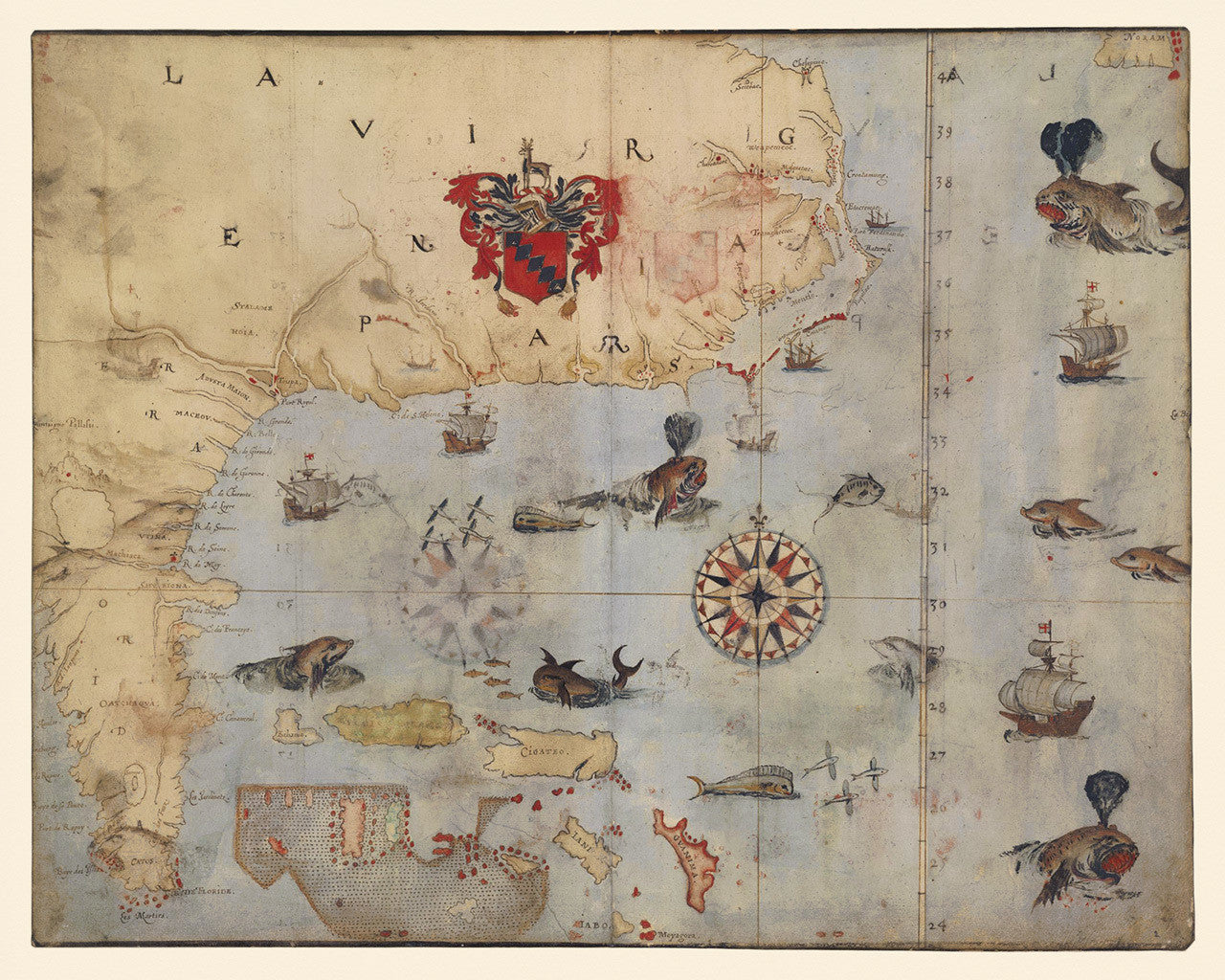
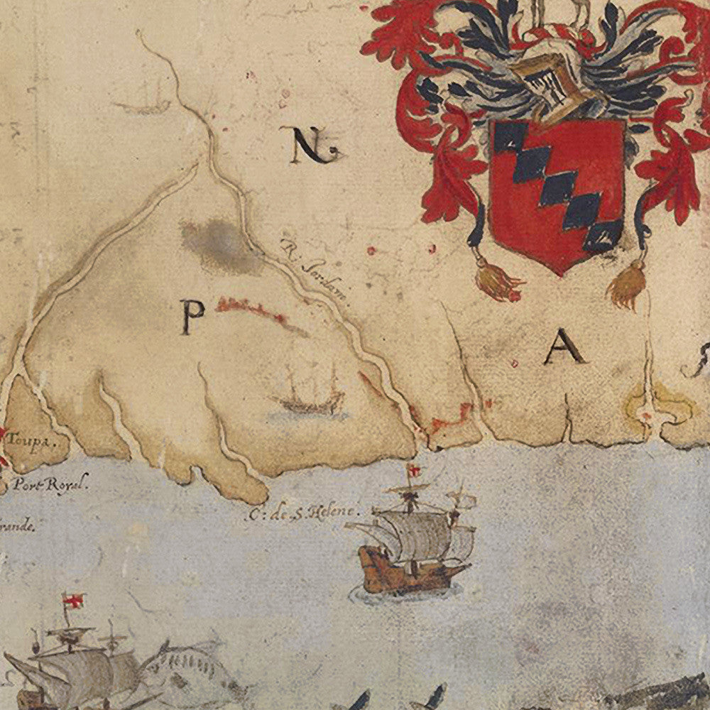
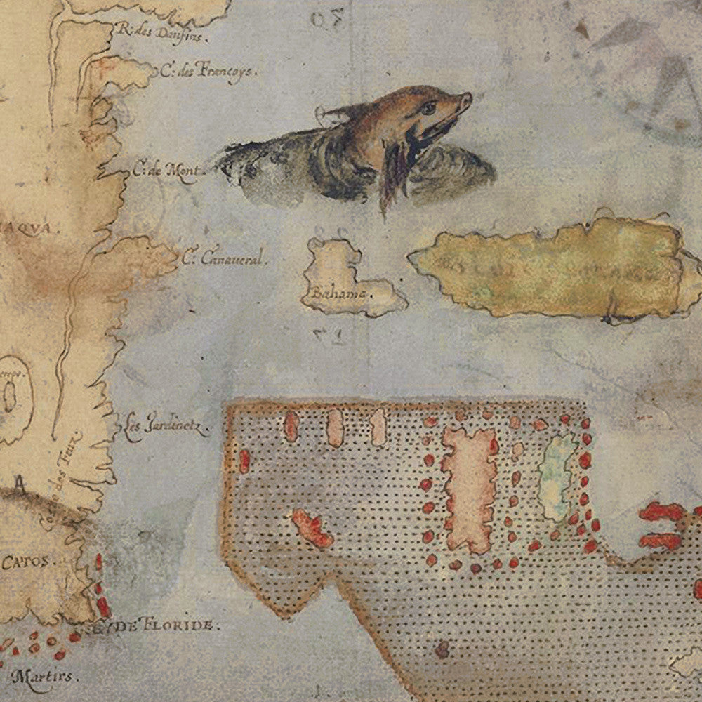
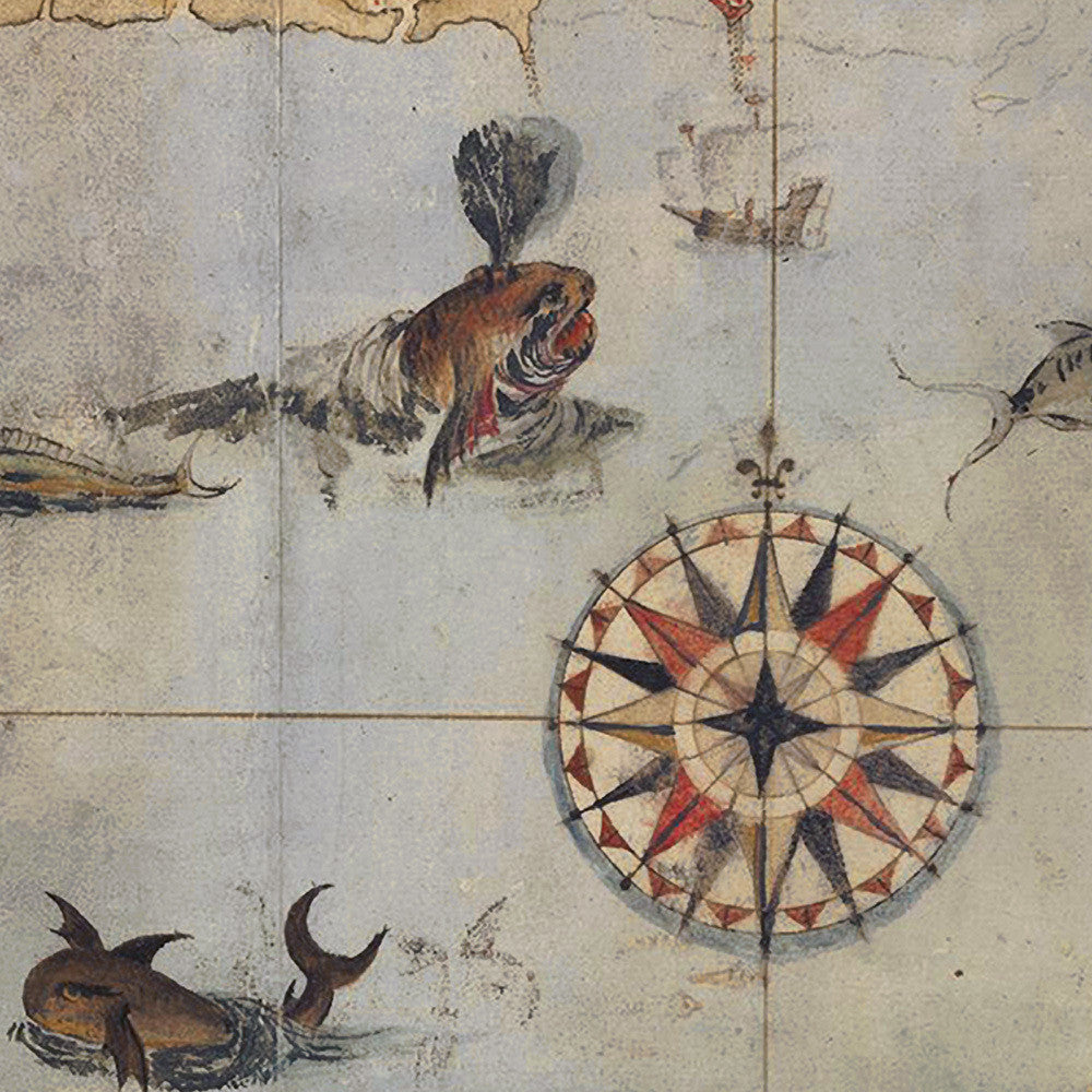
The second part of John White’s map set La Virginea Pars, depicting the coastline of SE North America in 1585. The chart stretches from Chesapeake Bay to the Florida Keys. It features an abundance of sea monsters, giant fish, dolphins, whales and English sailing vessels. The entire coastline is peppered with names of rivers and Native American settlements, as well as Spanish and French forts. Centrally at the top is displayed Sir Walter Raleigh’s coat of arms, as the patron of the colonization mission and holder of the charter. The creator of “La Virginea Pars” John White was a member of Sir Walter Raleigh’s expedition to America in 1585. White was later appointed by Raleigh governor of the Roanoke (Roanoac) Colony. He was also the grandfather of Virginia Dare — the first English child born in the New World. The original map was drawn in charcoal and overlayed with watercolor and inks. Our copy is reproduced on watercolor textured fine art paper.
• 1585 manuscript map of Virginia (Chesapeake Bay to Florida), John White, with Thomas Harriot
• Fine Art Premium Giclée (Gouttelette) Print (100% cotton 340 gsm textured fine art paper)
• Made in USA