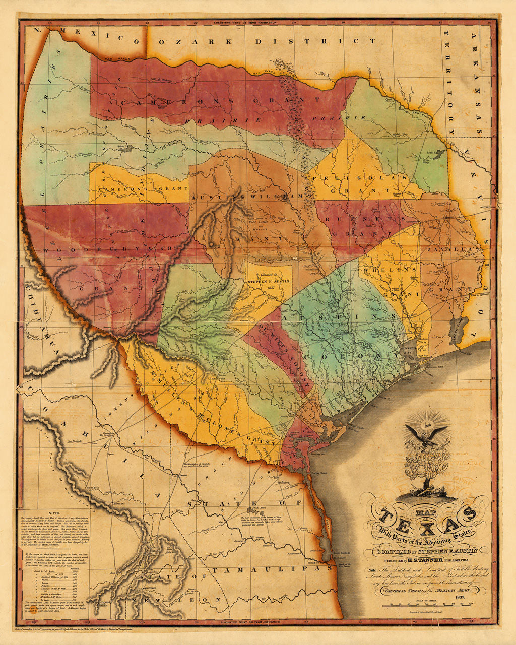

The Birth Certificate of Texas drawn by the Father of Texas
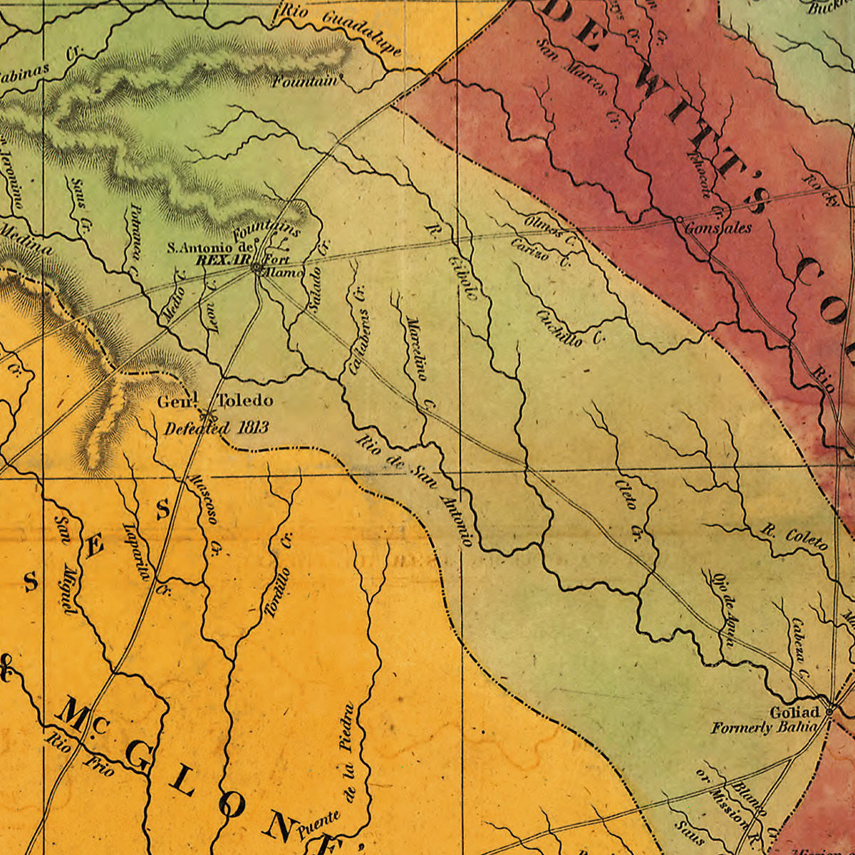
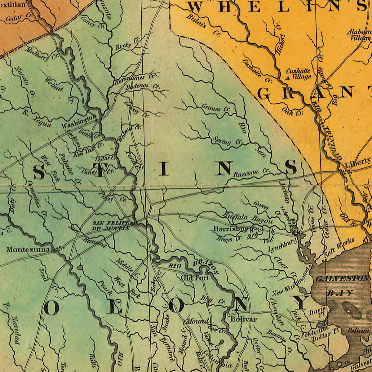
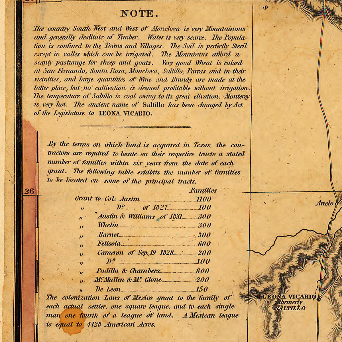
The 1837 edition of Stephen F. Austin’s 1830 map of Texas, the first printed map to show on a large scale the early stages of immigration into Texas, Mexico, from the United States. Austin had been compiling data and surveys for seven years prior to 1829, and in the process authored several manuscript maps of the region. The 1830 map contains a great deal of detail and full record on the land grants and early colonies. The Alamo’s location is marked on the map as Fort Alamo, next to San Antonio de Béxar. Austin’s Map of Texas is widely regarded as one of the most important documents in the history of Texas, as well as a milestone in the Westward Expansion period of American History.
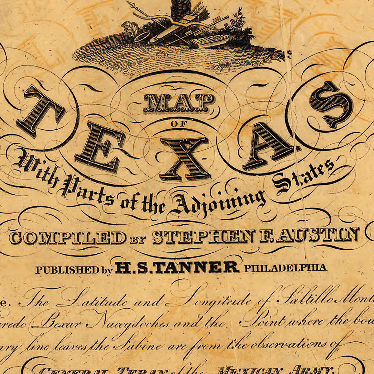
Title: Map of Texas with Parts of the Adjoining States, Completed by Stephen F. Austin, Published by H. S. Tanner Philadelphia
• Map of Texas, (1830, 1833, 1835) 1837, Stephen Fuller Austin / Henry Schenck Tanner
• Fine Art Premium Giclée (Gouttelette) Print (100% cotton 340 gsm fine art paper)
• Made in USA