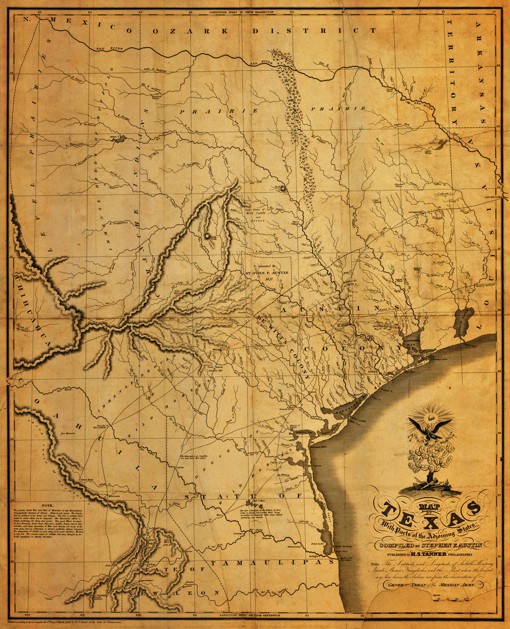
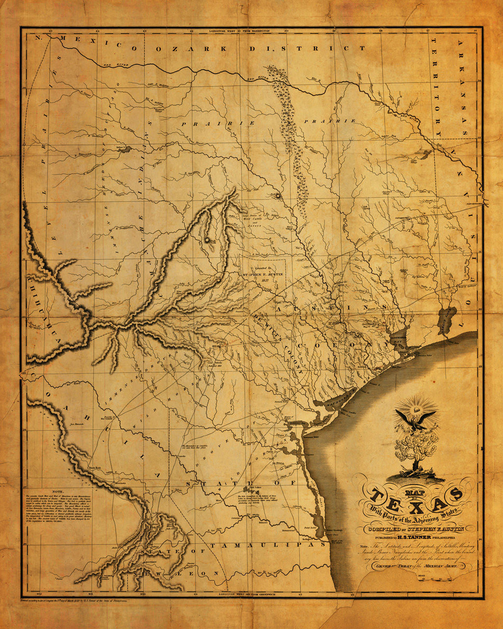
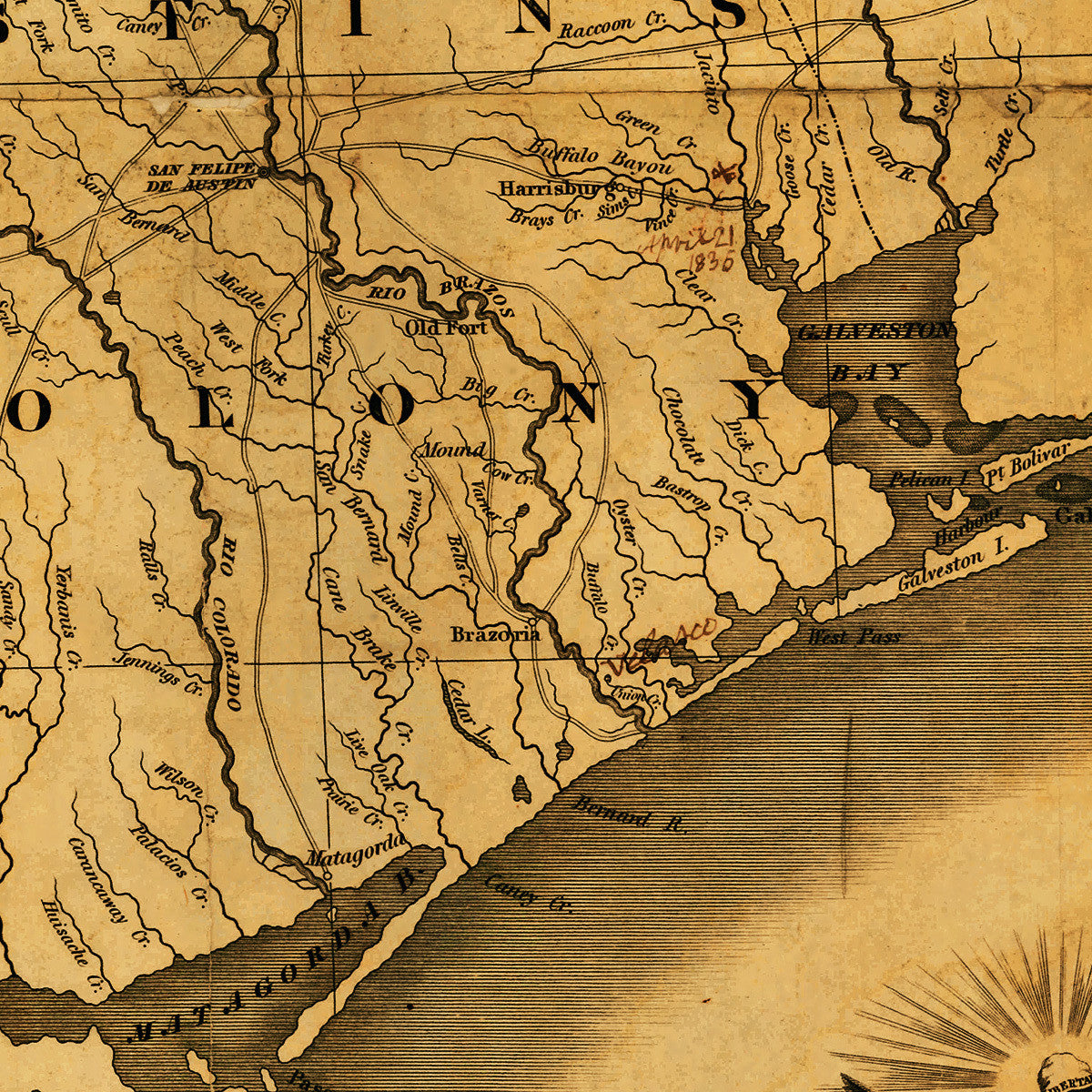

Stephen F. Austin’s Very First Printed Map of Texas &First Ever Map of Texas Published in the United States
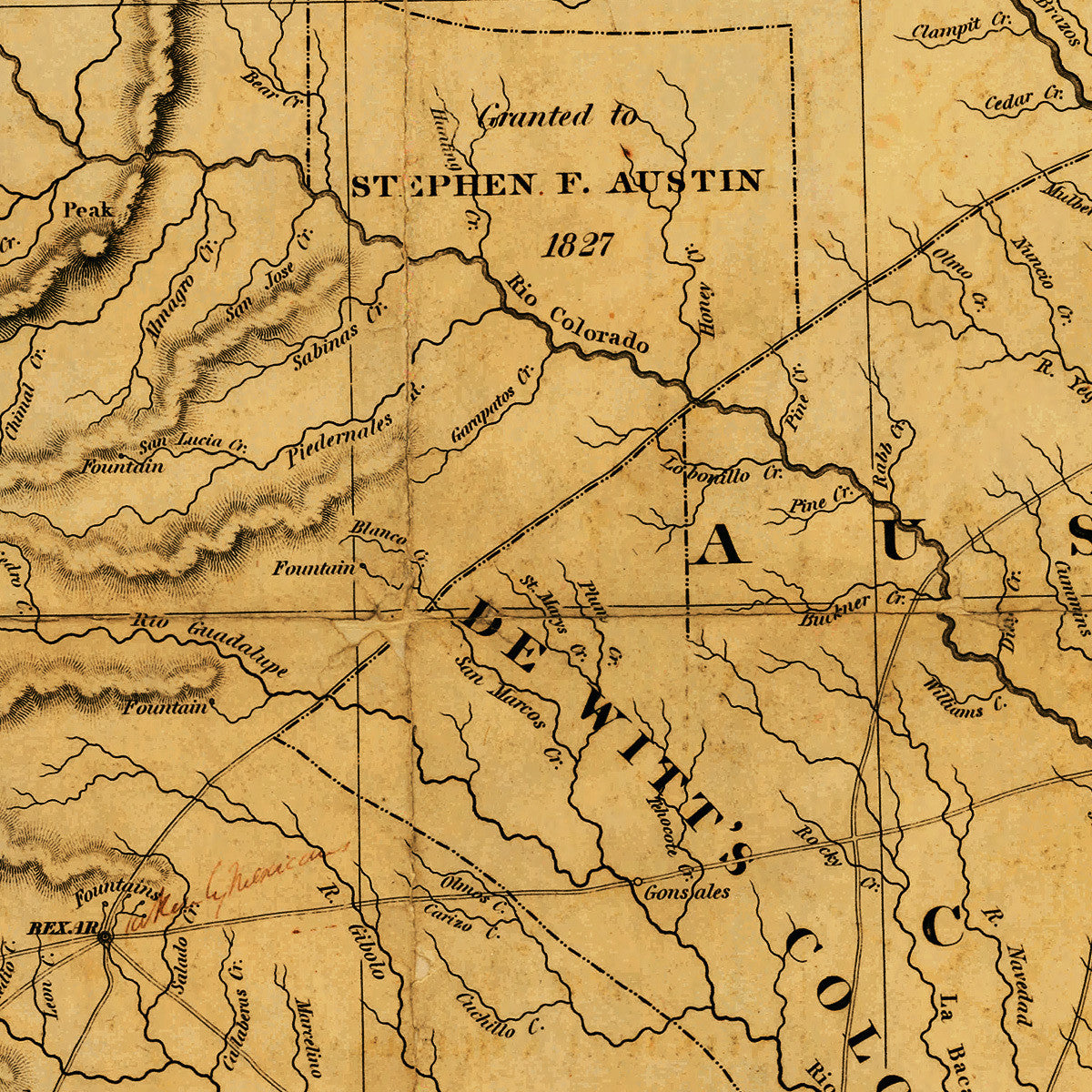
Stephen F. Austin, known as the “Father of Modern Texas”, spent almost seven years traveling and gathering information around the territory in the 1820s. He drew several manuscript maps of Texas in the process, which culminated in his 1829 “Mapa original de Texas Por El Ciudadano Estevan F. Austin Presentado al Exmo. Sor. Presidente por su autor 1829”. Combined with the surveys of General Téran, the 1829 manuscript became the basis of Austin’s first printed map. Austin contracted the very reputable firm of Henry Schenck Tanner of Philadelphia to engrave and print the map. First issued in March, 1830, it was also the first map of Texas to be published in the United States. Being the most accurate and detailed record of Texas at the time, the map remained a standard of cartography of the region for contemporary mapmakers, surveyors and officials, including the U.S. Government, until late nineteenth century. Austin’s map saw nine more issues in 1833, 1834, 1835, 1836, 1837, 1839, 1840, 1845 and 1846, and became one of the most widely used maps of Texas of all time.
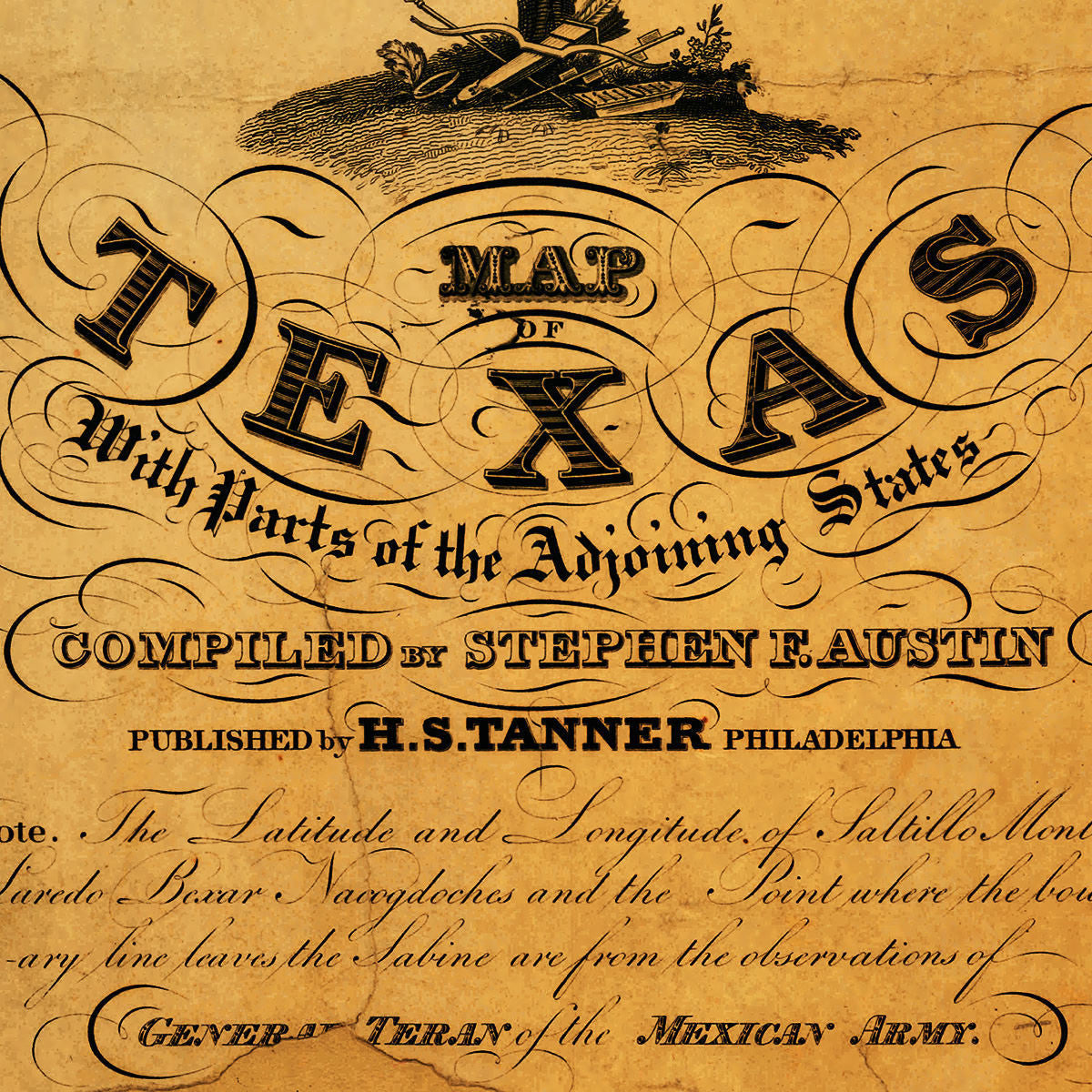
Map title: Map of Texas with Parts of the Adjoining States Compiled by Stephen F. Austin Published by H. S. Tanner Philadelphia / Note. The Latitude and Longitude of Saltillo Monterey Laredo Bexar Nacogdoches and the Point where the boundary line leaves the Sabine are from the observations of General Teran of the Mexican Army. 1830… Printed accordingly to Act of Congress the 17th day of March 1830 by H. S. Tanner of the State of Pennsylvania. (Please, choose the larger of the two available sizes, if you need a replica with the map’s original dimensions.)
• Map of Texas with Parts of the Adjoining States, 1830, Stephen F. Austin, H. S. Tanner
• Fine Art Premium Giclée (Gouttelette) Print (100% cotton 340 gsm fine art paper)
• Made in USA