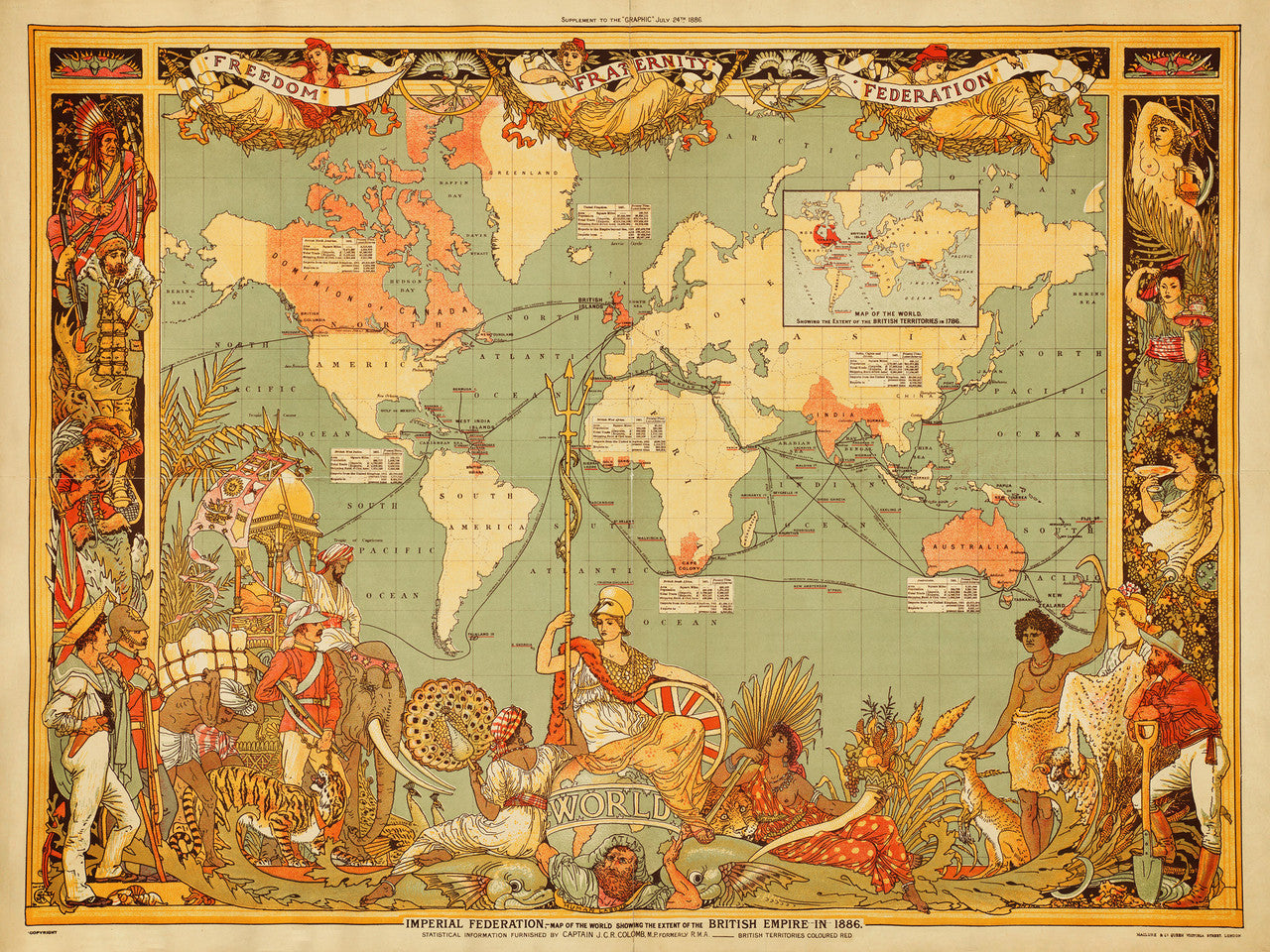
World, 1886, British Empire, Imperial Federation, Walter Crane, Vintage Map
Brand: Battlemaps.us

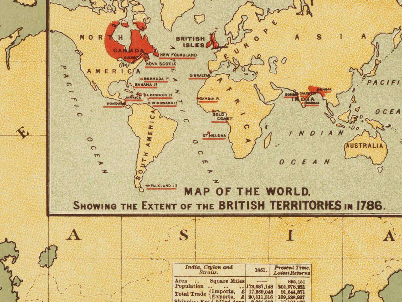
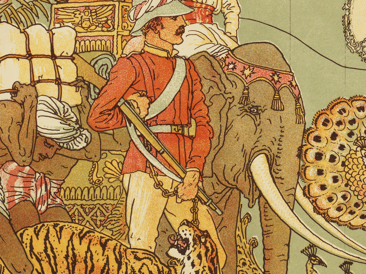
Vintage style world map showing the extent of the British Empire in 1886 and 1786 (inset). Designed and illustrated by the great Walter Crane, the map is a striking example of the Arts and Crafts Movement style, and a monument to 19th century colonialism. All the British colonies, from Canada and the Caribbean, to India and Australia, are personified with elaborate illustrations alongside the richly decorated margins. The British Isles are highlighted in red, and all the British territorial possessions overseas — with lighter red. In the lower center, Britannia is seated on top of the world, ruling over all her subjects.
• Map of the World showing the extent of the British Empire in 1886 and 1786
• Illustrator/Designer: Walter Crane (Arts and Crafts Movement)
• Fine Art Premium Giclée (Gouttelette) Print (100% cotton 340 gsm fine art paper)
• Made in USA